


View Information About HSR Ratings
This bridge is one of two similar truss bridges in the area. The other is the Beaverdams Road Bridge, which has one pony truss spans instead of two.
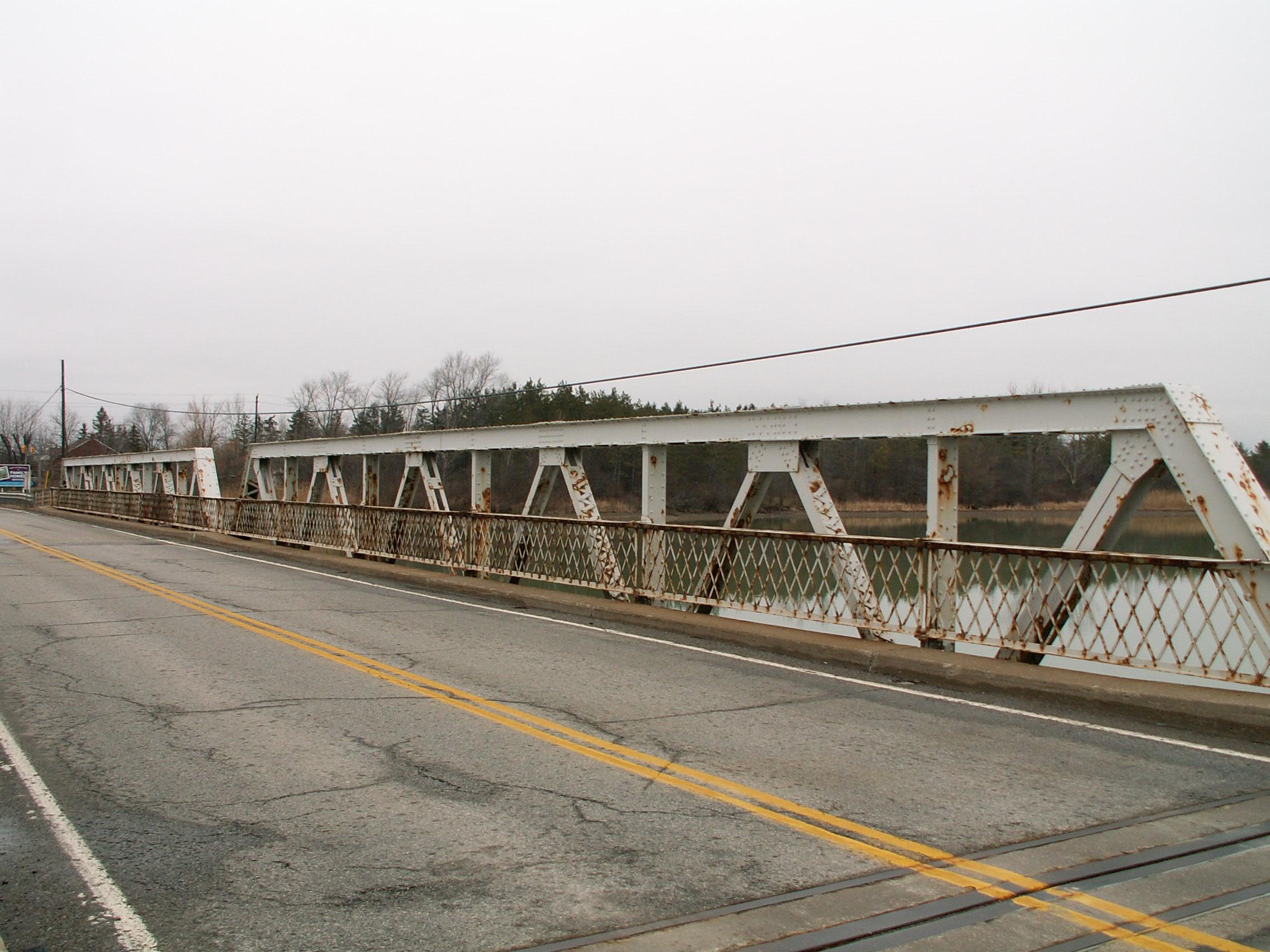
Supports for the bridge appear to be an unusual combination of concrete and steel caisson. Original lattice railings are present on the bridge. There is a concrete slab approach span at each end of the bridge. A collapsed concrete road that appears to have led to a preceding bridge remains just west of the bridge. A person can walk out on this road and get nice views of the bridge. There is a sign on this old road alignment that warns people that the sediment in Lake Gibson is polluted and toxic.
This bridge retains good historic integrity with no significant alterations to its original materials and design. Its trusses offer a geometric beauty not found in modern bridges. The trusses are composed of built-up beams that are riveted and include v-lacing and battens, which only adds to the geometric art of the bridge. There is v-lacing on the diagonals and under the top chord and end post.
This bridge has been owned by Ontario Power Generation. After this bridge was demolished and replaced, following that project, the bridge is owned by Niagara Region. It would have been nice instead to see the bridge rehabilitated. The number of riveted truss bridges in the Niagara Region has been dropping rapidly, and there are plans for demolition of a number of bridges.
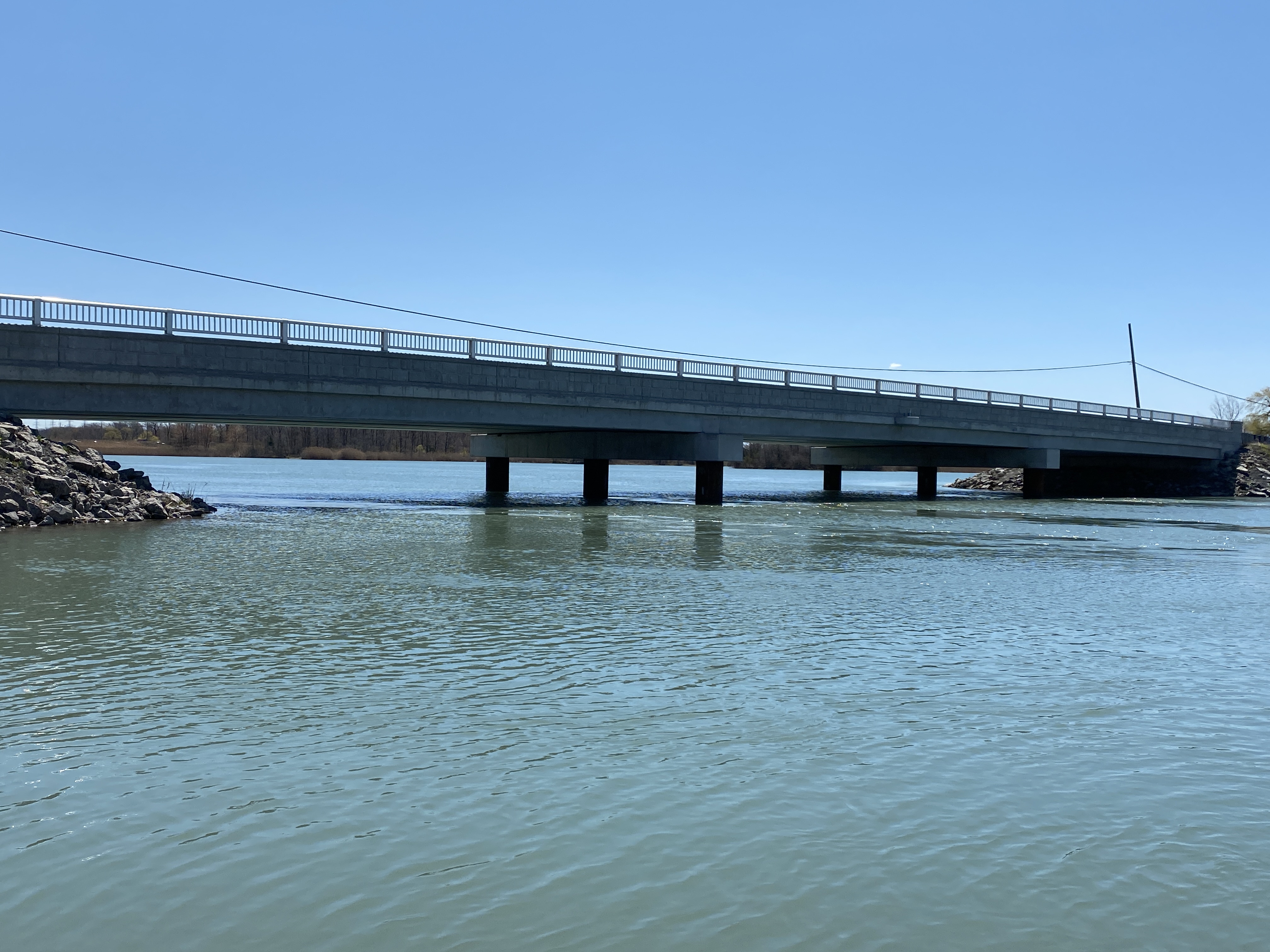
Above: Replacement bridge. Photo Credit: Ed Blasinski
![]()
![]()
![]()
![]()
This historic bridge has been demolished. This map is shown for reference purposes only.
Coordinates (Latitude, Longitude):
Search For Additional Bridge Listings:
Additional Maps:
Google Streetview (If Available)
GeoHack (Additional Links and Coordinates)
Apple Maps (Via DuckDuckGo Search)
Apple Maps (Apple devices only)
Android: Open Location In Your Map or GPS App
Flickr Gallery (Find Nearby Photos)
Wikimedia Commons (Find Nearby Photos)
Directions Via Sygic For Android
Directions Via Sygic For iOS and Android Dolphin Browser

© Copyright 2003-2024, HistoricBridges.org. All Rights Reserved. Disclaimer: HistoricBridges.org is a volunteer group of private citizens. HistoricBridges.org is NOT a government agency, does not represent or work with any governmental agencies, nor is it in any way associated with any government agency or any non-profit organization. While we strive for accuracy in our factual content, HistoricBridges.org offers no guarantee of accuracy. Information is provided "as is" without warranty of any kind, either expressed or implied. Information could include technical inaccuracies or errors of omission. Opinions and commentary are the opinions of the respective HistoricBridges.org member who made them and do not necessarily represent the views of anyone else, including any outside photographers whose images may appear on the page in which the commentary appears. HistoricBridges.org does not bear any responsibility for any consequences resulting from the use of this or any other HistoricBridges.org information. Owners and users of bridges have the responsibility of correctly following all applicable laws, rules, and regulations, regardless of any HistoricBridges.org information.
![]()