

View Information About HSR Ratings
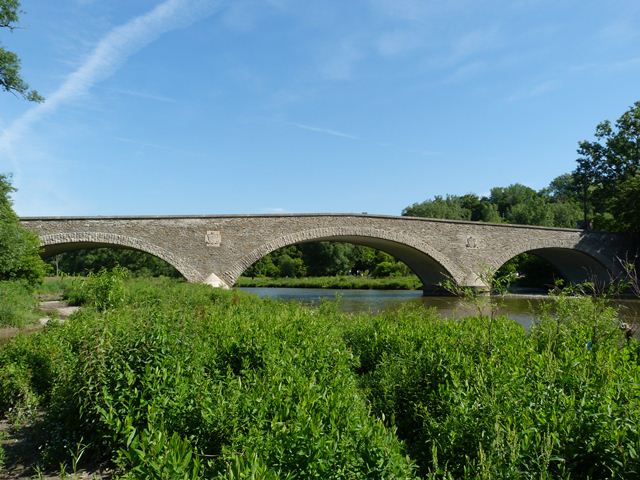
This bridge is both beautiful and historically significant. Built in 1916, it is a concrete arch bridge with a stone facing so that to a casual viewer it looks like a stone arch bridge. However, it is indeed a concrete arch bridge and looking underneath the bridge, the concrete of the arch ring can be seen. It was designed by Frank Barber who was also associated with the firm of Barber and Young. Barber was a leader in the introduction of concrete into bridge construction in Ontario. Read more about Frank Barber on the Middle Road Bridge page.
This bridge retains outstanding historic integrity. The concrete appears to be original and in good condition as does the stone facing and the stone railings. The bridge was designed with architectural assistance from Alfred Hirschfelder Chapman. Chapman was also associated with the firm of Chapman and Oxley, a Toronto-based firm that designed a number of buildings in the area.
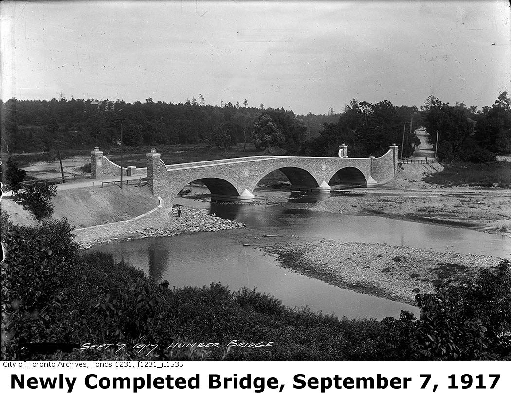
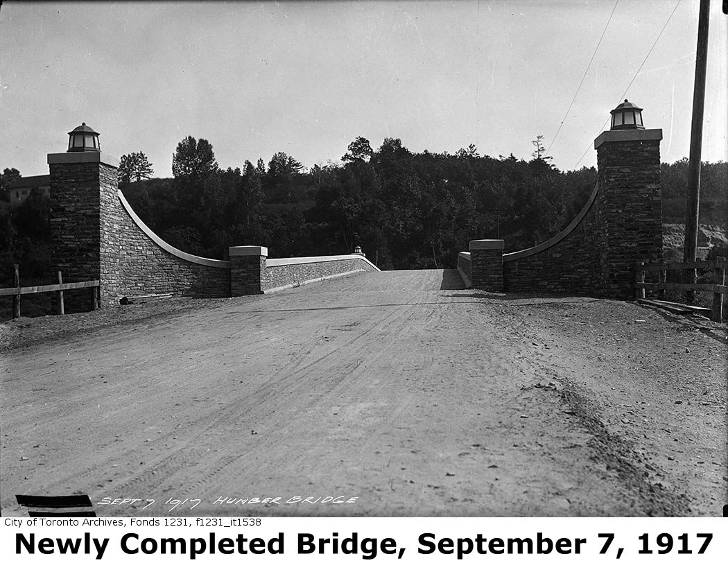
This bridge was a replacement for a multi-span Warren pony truss that was destroyed in an icy flood in March of 1914.
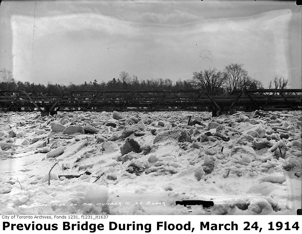

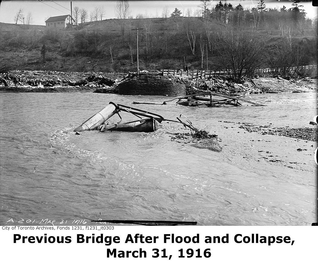
Above: The photo to the left shows the previous bridge at this location during the flood, and the right two photos show the bridge after the flood brought it down.

This bridge is tagged with the following special condition(s): Unorganized Photos
![]()
![]()
![]()

![]()
![]()
Coordinates (Latitude, Longitude):
Search For Additional Bridge Listings:
Additional Maps:
Google Streetview (If Available)
GeoHack (Additional Links and Coordinates)
Apple Maps (Via DuckDuckGo Search)
Apple Maps (Apple devices only)
Android: Open Location In Your Map or GPS App
Flickr Gallery (Find Nearby Photos)
Wikimedia Commons (Find Nearby Photos)
Directions Via Sygic For Android
Directions Via Sygic For iOS and Android Dolphin Browser

© Copyright 2003-2024, HistoricBridges.org. All Rights Reserved. Disclaimer: HistoricBridges.org is a volunteer group of private citizens. HistoricBridges.org is NOT a government agency, does not represent or work with any governmental agencies, nor is it in any way associated with any government agency or any non-profit organization. While we strive for accuracy in our factual content, HistoricBridges.org offers no guarantee of accuracy. Information is provided "as is" without warranty of any kind, either expressed or implied. Information could include technical inaccuracies or errors of omission. Opinions and commentary are the opinions of the respective HistoricBridges.org member who made them and do not necessarily represent the views of anyone else, including any outside photographers whose images may appear on the page in which the commentary appears. HistoricBridges.org does not bear any responsibility for any consequences resulting from the use of this or any other HistoricBridges.org information. Owners and users of bridges have the responsibility of correctly following all applicable laws, rules, and regulations, regardless of any HistoricBridges.org information.
![]()