

View Information About HSR Ratings

This bridge is a double-leaf bascule bridge that also includes a fixed deck truss approach span next to the bascule span. In addition there are many concrete approach spans. When this bridge was built, contractors were asked to bid two designs, one with concrete approach spans, and another with timber approach spans. The concrete alternate was chosen. The bascule span is a deck truss superstructure, and the bascule design is a Chicago type fixed trunnion with below-deck counterweight. The bridge provides a 140 clear channel for navigation, which is what the National Bridge Inventory decided to report as the span length. The actual span of trusses from face of abutment to face of abutment (16 panels) is 144 feet. The center-to-center span between trunnions (the typical measurement points for the structural span length of a bascule) is 165 feet.
When this bridge was built, newspapers reported the contractor as Liesch and Tofte of Marshfield, Oregon which refers to Coos Bay, Oregon. In 1944, citizens voted to change the name of the city from Marshfield to Coos Bay. The original overall length of the bridge is reported as 1,757.8 feet. The National Bridge Inventory reports a length of 1,691 feet.
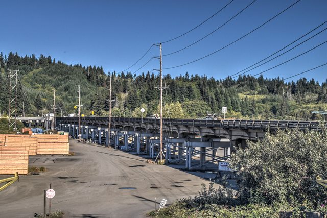
The trusses were being repainted and on top of this the sun position was not optimal at the time this bridge was visited. Photos are limited for this bridge.

Above: Plans for this bridge included this drawing of the previous bridge at this location, which was a swing bridge.

Above: A portion of an original plan sheet for this bridge's trusses showing the fixed trunnion design. Counterweight is attached to the left of the trusses in the above drawing. The trunnion is visible in the center, and to the left the rack and pinion operating system is shown.
![]()
![]()
![]()
Coordinates (Latitude, Longitude):
Search For Additional Bridge Listings:
Bridgehunter.com: View listed bridges within 0.5 miles (0.8 kilometers) of this bridge.
Bridgehunter.com: View listed bridges within 10 miles (16 kilometers) of this bridge.
Additional Maps:
Google Streetview (If Available)
GeoHack (Additional Links and Coordinates)
Apple Maps (Via DuckDuckGo Search)
Apple Maps (Apple devices only)
Android: Open Location In Your Map or GPS App
Flickr Gallery (Find Nearby Photos)
Wikimedia Commons (Find Nearby Photos)
Directions Via Sygic For Android
Directions Via Sygic For iOS and Android Dolphin Browser
USGS National Map (United States Only)
Historical USGS Topo Maps (United States Only)
Historic Aerials (United States Only)
CalTopo Maps (United States Only)

© Copyright 2003-2024, HistoricBridges.org. All Rights Reserved. Disclaimer: HistoricBridges.org is a volunteer group of private citizens. HistoricBridges.org is NOT a government agency, does not represent or work with any governmental agencies, nor is it in any way associated with any government agency or any non-profit organization. While we strive for accuracy in our factual content, HistoricBridges.org offers no guarantee of accuracy. Information is provided "as is" without warranty of any kind, either expressed or implied. Information could include technical inaccuracies or errors of omission. Opinions and commentary are the opinions of the respective HistoricBridges.org member who made them and do not necessarily represent the views of anyone else, including any outside photographers whose images may appear on the page in which the commentary appears. HistoricBridges.org does not bear any responsibility for any consequences resulting from the use of this or any other HistoricBridges.org information. Owners and users of bridges have the responsibility of correctly following all applicable laws, rules, and regulations, regardless of any HistoricBridges.org information.
![]()