

View Information About HSR Ratings
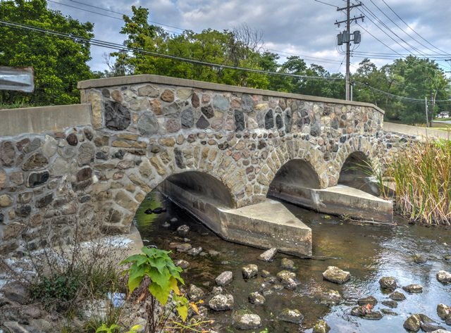
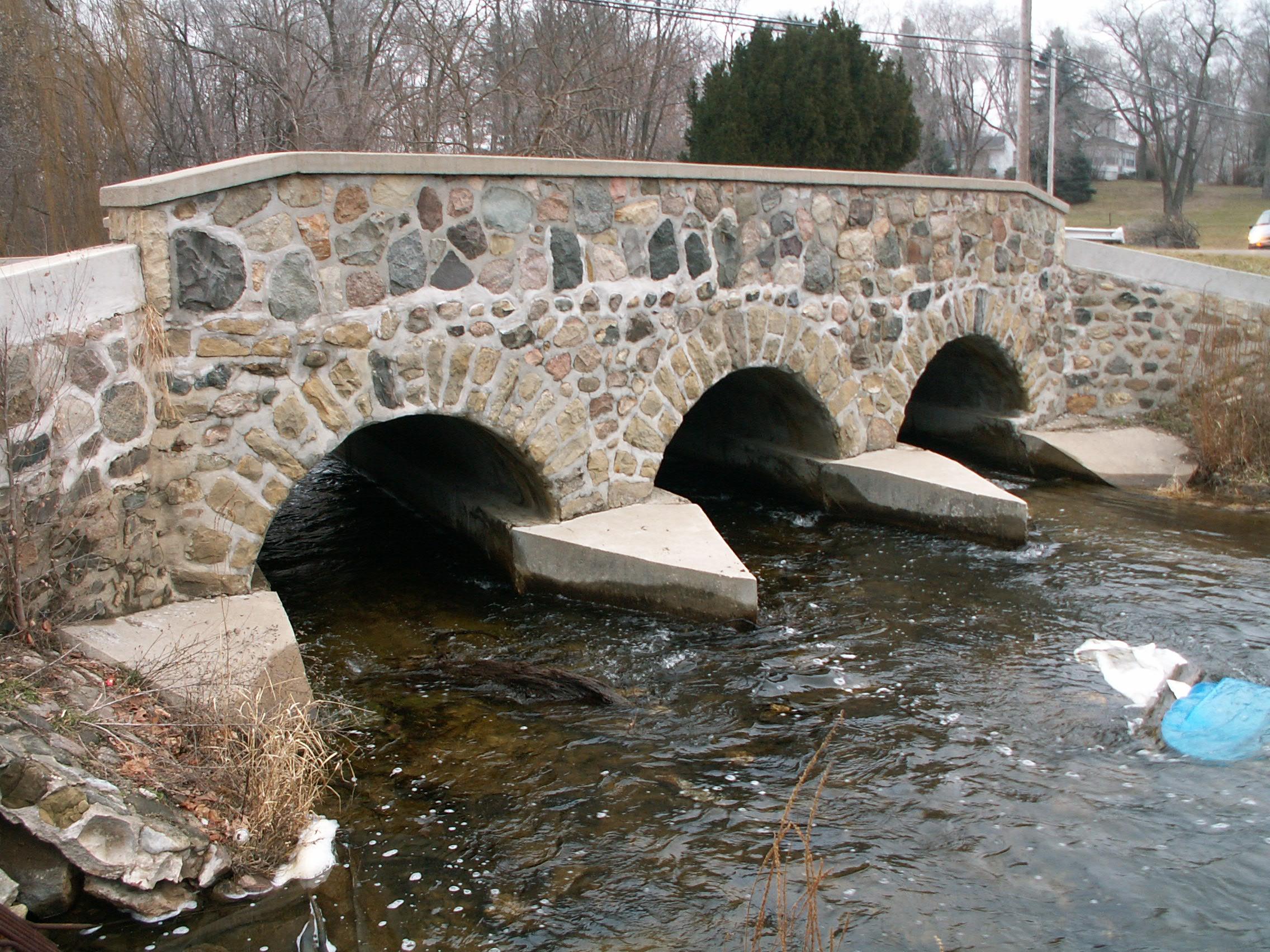
This bridge is an extremely tiny but excellent example of a stone faced concrete arch bridge. Although a mere 35 feet in length, it regardless is composed of three spans. Each span is only eight feet in length! The bridge has been rehabilitated and appears to be in good condition. It is listed on the National Register of Historic Places. The Michigan Historic Bridge Inventory stated that the previous bridge at this location was a three span stone arch bridge, and suggested that the stone on the current bridge may have been salvaged from this previous bridge. If so, this would be a rare reuse of materials from a previous bridge.
When concrete first started to be used in bridge design, there was sometimes an attempt to maintain the traditional appearance of a stone arch bridge, and so stones would be placed on the outside of the bridge as a decorative facing to make the concrete bridge look like a stone arch. This practice was used on rare occasions in the years following, but perhaps less so as engineers discovered that concrete itself could be beautiful and allowed them to do things architecturally and aesthetically that were not possible with stone. However, stone-faced arch bridges enjoyed a brief resurgence in the 1930s. In the 1930s, bridges were being built as part of Depression relief programs (like the Public Works Administration), and a notable number of these ended up as stone faced concrete bridges, or stone faced corrugated metal plate arch bridges. It is not known if this bridge was associated with Depression era relief programs, but it was built in that 1930s period.
Information and Findings From Michigan Historic Sites OnlineNarrative Description Located in the City of Brooklyn, this bridge carries Mill Street across the south branch of the Raisin River. A hydro-power dam spans the river south of the bridge, while a large associated industrial plant stands along the riverbank to the southeast. The bridge features flared concrete wingwalls with stone veneer, and upstream (south) cutwaters on both piers and at both abutment/wingwall junctions. A concrete apron slopes down to natural riverbed on north side. Solid parapet railings along each side of the bridge are faced with stone veneer and topped with concrete coping. The riverbanks on both sides of the crossing are lined with mortared stone several feet out from bridge. Statement of Significance In 1921, Henry Ford purchased Brooklyn's original mill site along the banks of the Raisin River. An industrial plant was constructed in 1937, with workers producing automobile horns, distributors, and starter switches. From 1954 to 1967, output shifted to plastic automobile interior parts and lamp lenses. A giant water wheel provided hydro-electric power for the manufacturing operation. If the 1925 construction date attributed to the present bridge is correct, it may have been built to accommodate anticipated traffic increases associated with Ford's property immediately to the south of the crossing, although the site was left vacant for several years. The attractive stone veneer that faces the concrete arch of the Mill Street Bridge qualifies this unique, aesthetically pleasing structure for the National Register. |
This bridge is tagged with the following special condition(s): Unorganized Photos
![]()
![]()
![]()
![]()
Coordinates (Latitude, Longitude):
Search For Additional Bridge Listings:
Bridgehunter.com: View listed bridges within 0.5 miles (0.8 kilometers) of this bridge.
Bridgehunter.com: View listed bridges within 10 miles (16 kilometers) of this bridge.
Additional Maps:
Google Streetview (If Available)
GeoHack (Additional Links and Coordinates)
Apple Maps (Via DuckDuckGo Search)
Apple Maps (Apple devices only)
Android: Open Location In Your Map or GPS App
Flickr Gallery (Find Nearby Photos)
Wikimedia Commons (Find Nearby Photos)
Directions Via Sygic For Android
Directions Via Sygic For iOS and Android Dolphin Browser
USGS National Map (United States Only)
Historical USGS Topo Maps (United States Only)
Historic Aerials (United States Only)
CalTopo Maps (United States Only)

© Copyright 2003-2024, HistoricBridges.org. All Rights Reserved. Disclaimer: HistoricBridges.org is a volunteer group of private citizens. HistoricBridges.org is NOT a government agency, does not represent or work with any governmental agencies, nor is it in any way associated with any government agency or any non-profit organization. While we strive for accuracy in our factual content, HistoricBridges.org offers no guarantee of accuracy. Information is provided "as is" without warranty of any kind, either expressed or implied. Information could include technical inaccuracies or errors of omission. Opinions and commentary are the opinions of the respective HistoricBridges.org member who made them and do not necessarily represent the views of anyone else, including any outside photographers whose images may appear on the page in which the commentary appears. HistoricBridges.org does not bear any responsibility for any consequences resulting from the use of this or any other HistoricBridges.org information. Owners and users of bridges have the responsibility of correctly following all applicable laws, rules, and regulations, regardless of any HistoricBridges.org information.
![]()