

View Information About HSR Ratings
This is an unusual highway plate girder bridge. Pennsylvania had a standard plate girder design that was used on highways, but this is not one of those bridges. It may be built from salvaged railroad plate girders, or if it is not, it must be something designed at the local level, not to a standard design. This being the case, the 1925 construction date might refer to a relocation and conversion to highway use for this bridge's girders which could be older.
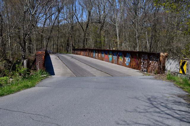
Information and Findings From Pennsylvania's Historic Bridge InventoryDiscussion of Bridge The 2 span, 142'-long built-up steel thru girder bridge is supported on a concrete substructure. The steel girder supports timber floorbeams and deck. Welded outriggers have been added. The ca. 1910 bridge is an example of a common bridge type that was developed and used by the railroads since the mid 19th century. Neither the bridge nor its setting are historically or technologically significant. Discussion of Surrounding Area The single lane bridge carries a township road over the Schuylkill River in a wooded area well south of the developed portion of the borough of Landingville. There is a brick, mid-19th century farmhouse beyond the northeast quadrant of the bridge. Bridge Considered Historic By Survey: No |
This bridge is tagged with the following special condition(s): Unorganized Photos
![]()
![]()
![]()
Coordinates (Latitude, Longitude):
Search For Additional Bridge Listings:
Bridgehunter.com: View listed bridges within 0.5 miles (0.8 kilometers) of this bridge.
Bridgehunter.com: View listed bridges within 10 miles (16 kilometers) of this bridge.
Additional Maps:
Google Streetview (If Available)
GeoHack (Additional Links and Coordinates)
Apple Maps (Via DuckDuckGo Search)
Apple Maps (Apple devices only)
Android: Open Location In Your Map or GPS App
Flickr Gallery (Find Nearby Photos)
Wikimedia Commons (Find Nearby Photos)
Directions Via Sygic For Android
Directions Via Sygic For iOS and Android Dolphin Browser
USGS National Map (United States Only)
Historical USGS Topo Maps (United States Only)
Historic Aerials (United States Only)
CalTopo Maps (United States Only)

© Copyright 2003-2026, HistoricBridges.org. All Rights Reserved. Disclaimer: HistoricBridges.org is a volunteer group of private citizens. HistoricBridges.org is NOT a government agency, does not represent or work with any governmental agencies, nor is it in any way associated with any government agency or any non-profit organization. While we strive for accuracy in our factual content, HistoricBridges.org offers no guarantee of accuracy. Information is provided "as is" without warranty of any kind, either expressed or implied. Information could include technical inaccuracies or errors of omission. Opinions and commentary are the opinions of the respective HistoricBridges.org member who made them and do not necessarily represent the views of anyone else, including any outside photographers whose images may appear on the page in which the commentary appears. HistoricBridges.org does not bear any responsibility for any consequences resulting from the use of this or any other HistoricBridges.org information. Owners and users of bridges have the responsibility of correctly following all applicable laws, rules, and regulations, regardless of any HistoricBridges.org information.
![]()