


View Information About HSR Ratings
This bridge is a great example of how railroads would alter bridges (both long ago and more recently) to accommodate increasing loads and increased deterioration. First, the original 1894 bridge was altered in 1907. This is discussed in the HAER documentation. More recently additional alterations and repairs have been made, and are easy to spot on the bridge as they have a brighter orange rust color in the photos.
In recent history historic railroad truss bridges have come under increasing risk for demolition and replacement after many decades of very few being replaced. This bridge with its original lightweight construction followed by numerous repairs might seem like a possible at-risk railroad bridge, considering the line would appear to be a direct route to New York City. However the current owner of the railroad line has another flatter and parallel railroad line so this line (and thus the bridge) are likely not considered major corridors. The line likely only sees one of two Susquehanna engines per day.
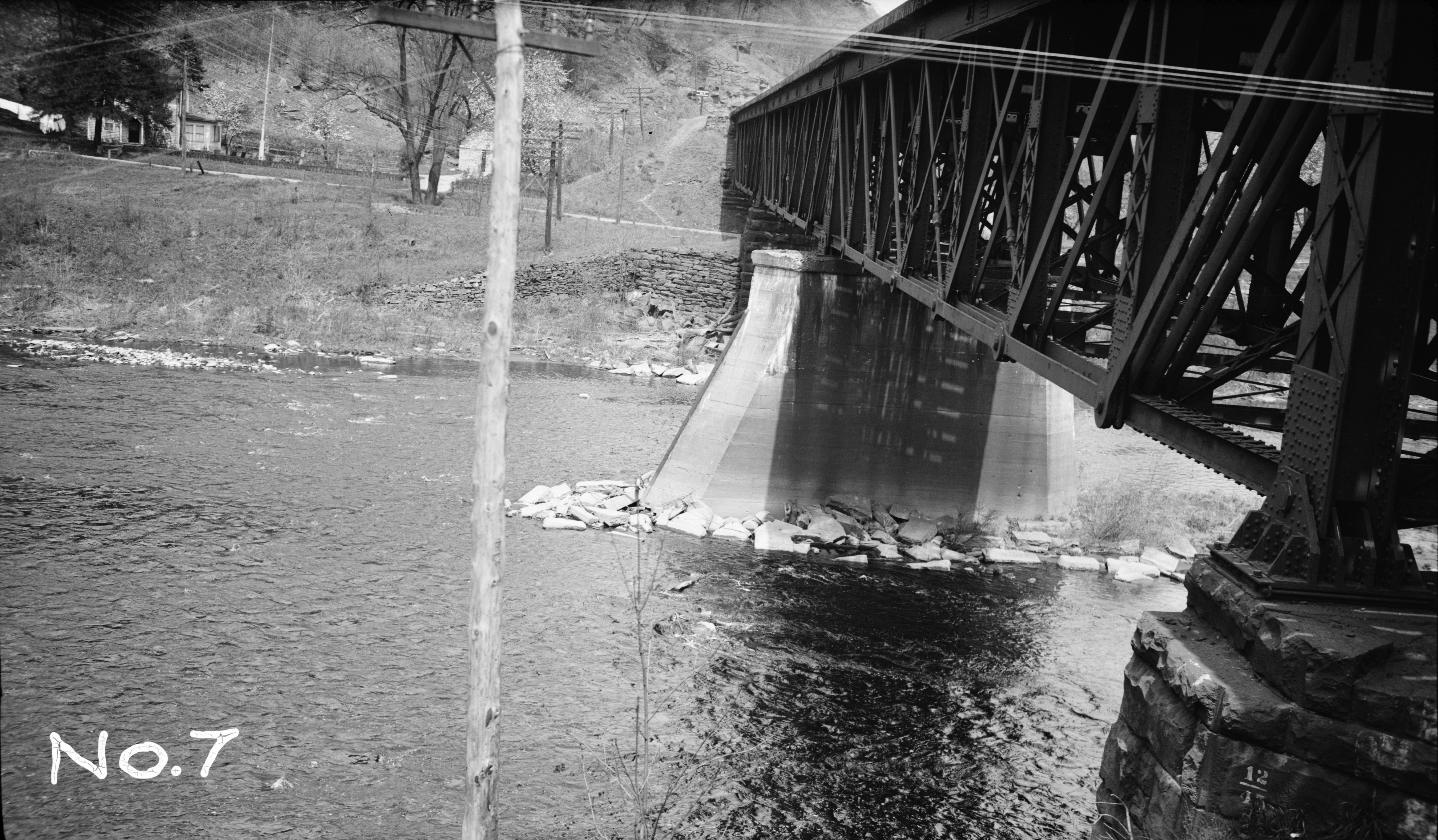
The 1907 photo below appears to show the repair work in progress.

Above: Photo from HAER showing bridge in 1907.
Above: Photo from HAER showing bridge in 1933.
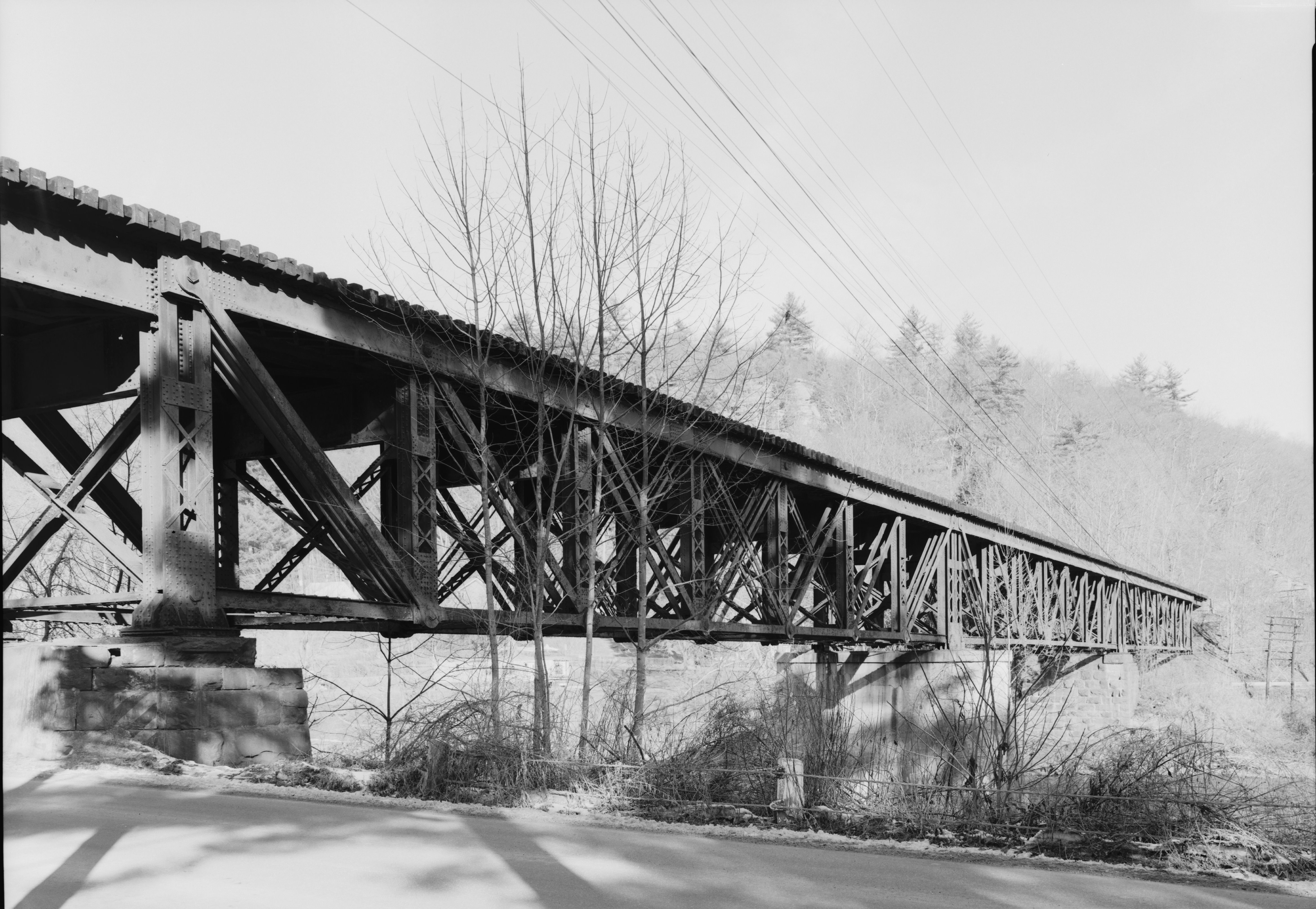
Above: Photo from HAER showing bridge in 1971.
This bridge is tagged with the following special condition(s): Unorganized Photos
![]()
![]()
![]()
Coordinates (Latitude, Longitude):
Search For Additional Bridge Listings:
Bridgehunter.com: View listed bridges within 0.5 miles (0.8 kilometers) of this bridge.
Bridgehunter.com: View listed bridges within 10 miles (16 kilometers) of this bridge.
Additional Maps:
Google Streetview (If Available)
GeoHack (Additional Links and Coordinates)
Apple Maps (Via DuckDuckGo Search)
Apple Maps (Apple devices only)
Android: Open Location In Your Map or GPS App
Flickr Gallery (Find Nearby Photos)
Wikimedia Commons (Find Nearby Photos)
Directions Via Sygic For Android
Directions Via Sygic For iOS and Android Dolphin Browser
USGS National Map (United States Only)
Historical USGS Topo Maps (United States Only)
Historic Aerials (United States Only)
CalTopo Maps (United States Only)

© Copyright 2003-2024, HistoricBridges.org. All Rights Reserved. Disclaimer: HistoricBridges.org is a volunteer group of private citizens. HistoricBridges.org is NOT a government agency, does not represent or work with any governmental agencies, nor is it in any way associated with any government agency or any non-profit organization. While we strive for accuracy in our factual content, HistoricBridges.org offers no guarantee of accuracy. Information is provided "as is" without warranty of any kind, either expressed or implied. Information could include technical inaccuracies or errors of omission. Opinions and commentary are the opinions of the respective HistoricBridges.org member who made them and do not necessarily represent the views of anyone else, including any outside photographers whose images may appear on the page in which the commentary appears. HistoricBridges.org does not bear any responsibility for any consequences resulting from the use of this or any other HistoricBridges.org information. Owners and users of bridges have the responsibility of correctly following all applicable laws, rules, and regulations, regardless of any HistoricBridges.org information.
![]()