

View Information About HSR Ratings
Located in a county and region with few surviving historic truss bridges, this bridge should perhaps get more recognition than it has in the past. The bridge appears to have once had a top chord mounted plaque. Companies that were prolific in this region that did this included Groton Bridge Company, Owego Bridge Company, Havena Bridge Company, and Climax Bridge Company.
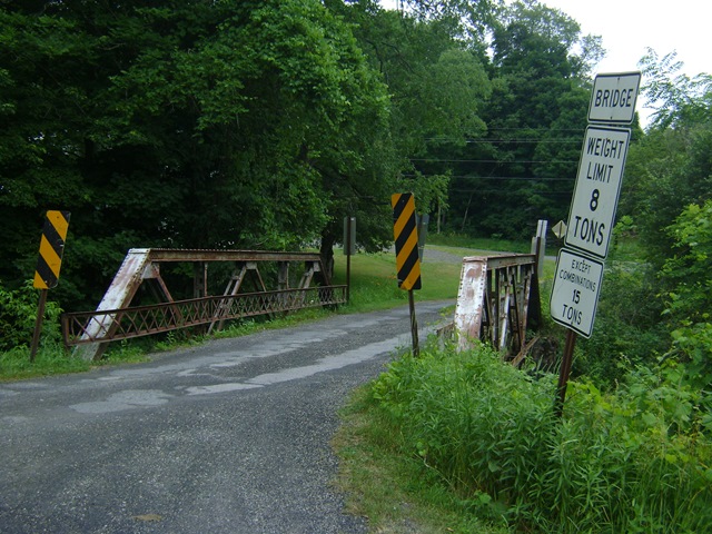
Information and Findings From Pennsylvania's Historic Bridge InventoryDiscussion of Bridge The one span, 42' long and 14' wide, riveted, Warren with verticals pony truss bridge was built in 1909. The verticals, diagonals, and lower chords are composed of angles with battens. The upper chords and inclined end posts are built up box sections. There are lattice railings inside the truss lines. The bridge is complete, but it does not have any innovative or distinctive details, and it is not an early example of its type and design. The bridge is not historically or technologically significant. Discussion of Surrounding Area The bridge carries one lane of a township road over a stream in a rural area of active farms and forests. The setting does not appear to have historic district potential. The building stock consists of primarily late-19th and early-20th century farm houses. Bridge Considered Historic By Survey: No |
This bridge is tagged with the following special condition(s): Unorganized Photos
![]()
![]()
![]()
Coordinates (Latitude, Longitude):
Search For Additional Bridge Listings:
Bridgehunter.com: View listed bridges within 0.5 miles (0.8 kilometers) of this bridge.
Bridgehunter.com: View listed bridges within 10 miles (16 kilometers) of this bridge.
Additional Maps:
Google Streetview (If Available)
GeoHack (Additional Links and Coordinates)
Apple Maps (Via DuckDuckGo Search)
Apple Maps (Apple devices only)
Android: Open Location In Your Map or GPS App
Flickr Gallery (Find Nearby Photos)
Wikimedia Commons (Find Nearby Photos)
Directions Via Sygic For Android
Directions Via Sygic For iOS and Android Dolphin Browser
USGS National Map (United States Only)
Historical USGS Topo Maps (United States Only)
Historic Aerials (United States Only)
CalTopo Maps (United States Only)

© Copyright 2003-2024, HistoricBridges.org. All Rights Reserved. Disclaimer: HistoricBridges.org is a volunteer group of private citizens. HistoricBridges.org is NOT a government agency, does not represent or work with any governmental agencies, nor is it in any way associated with any government agency or any non-profit organization. While we strive for accuracy in our factual content, HistoricBridges.org offers no guarantee of accuracy. Information is provided "as is" without warranty of any kind, either expressed or implied. Information could include technical inaccuracies or errors of omission. Opinions and commentary are the opinions of the respective HistoricBridges.org member who made them and do not necessarily represent the views of anyone else, including any outside photographers whose images may appear on the page in which the commentary appears. HistoricBridges.org does not bear any responsibility for any consequences resulting from the use of this or any other HistoricBridges.org information. Owners and users of bridges have the responsibility of correctly following all applicable laws, rules, and regulations, regardless of any HistoricBridges.org information.
![]()