

View Information About HSR Ratings

Above: Main cantilever truss spans, as shown in a bridge inspection report. This drawing also shows the suspended span of the bridge and its associated hinge pins.
Note: For this bridge, directions given assume an east-west orientation of bridge, despite the fact that north-south is often used to describe each side of the river in the city.
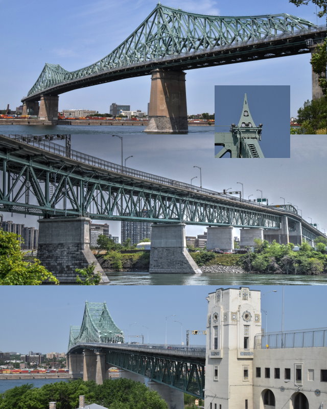
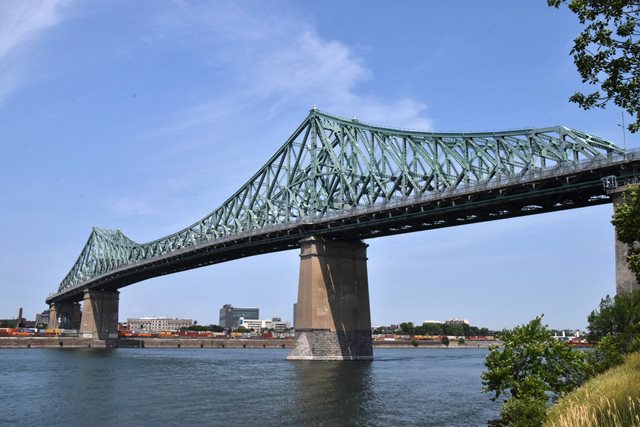
Pont Jacques-Cartier is one of the most complex and impressive bridges in all of Canada. The bridge is massive and large in ever sense: overall length, span length, and also roadway width, since it carries five lanes. Roadway width given is a rough estimate. There are two main parts of the bridge, the enormous cantilever truss over the river, and a smaller simple span through truss over the canal portion of the river that is used by ships. The portion of the bridge over the canal was raised an additional 80 feet (24.4 m) (to 120 feet or 36.6 metres) in 1957 and 1958 to accommodate the St. Lawrence Seaway. Bailey trusses were used to allow the operation to take place without closing the bridge to traffic. The main polygonal Warren through truss span over the canal dates to this period and is not original to the bridge.
The remainder of the bridge is composed of a variety of deck truss spans, girder spans, and rigid-frame spans. Details vary throughout the bridge, including depth of trusses, and whether concrete piers or steel bents were used.
The west approach of the bridge has a curve in it because when the bridge was built, it has to avoid the land of a soap factory owner who refused the amount the city wanted to give him for the land.
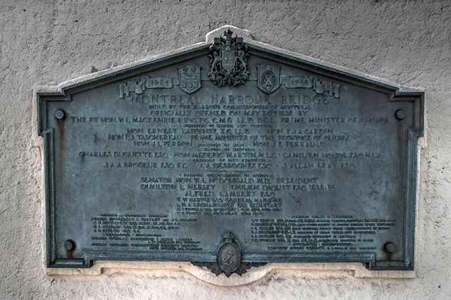
The bridge passes over Saint Helen's Island (Île Sainte-Hélène) and it is here some additional unique bridge features are found. Here, there is the Pavilion, a large Art Deco building structure featuring decorative towers. This building carries a portion of the deck on top, and is where the bridge plaques and a statue of Jacques Cartier can be found. At this point there are two ramps to the island. The "south" ramp is historic, consisting of riveted deck truss and riveted deck girder spans. It leads directly up to the south side of the deck. The newer, non-original modern "north" ramp passes under the deck trusses of the main bridge and curves around to access the north side of the bridge deck.
The noted firm of Monsarrat and Pratley of Montréal, Québec (run by engineers Charles Nicholas Monsarrat and Philip Louis Pratley) was the designer of the bridge. These men had no doubt learned much with their work on the 1917 Pont de Québec, and this may be the reason why this bridge's cantilever truss also uses the K-truss configuration that was invented for the bridge at Québec. Another fascinating discovery is that famous American engineer, Joseph Baermann Strauss appears on this bridge's plaque. Strauss's company, Strauss Bascule Bridge Company (later the Strauss Engineering Company) focused on the design of movable bascule bridges (including some in Canada), but he later developed an interest in long-span bridge construction as well. It is not known what exact role Strauss played in this bridge's design.
Overall, considering some sources state that this is the 3rd busiest bridge in all of Canada, the bridge retains relatively good historic integrity. A number of rivets have been replaced with bolts, and the addition of the north ramp changed the appearance of the bridge in that area notably. Perhaps the most visually distasteful alteration is the prison-like suicide barrier on the sidewalk. This barrier also make detail photography difficult. Original vehicular railings do not remain on the bridge.
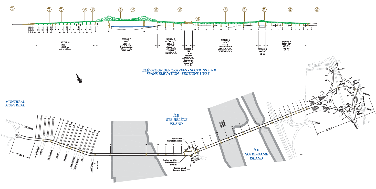
Above: This drawing from a bridge inspection shows the layout of this very complex bridge.
Scope of HistoricBridges.org Documentation
This is an enormous bridge, and HistoricBridges.org is proud to offer hundreds of photos of this bridge in the photo gallery, grouped into the various bridge sections. However there are a few limitations of the documentation, a result of time constraints. The western deck truss approach spans are not documented. These differ from the island spans documented by HistoricBridges.org because they have more shallow trusses and they are supported by steel bents rather than concrete piers, except for one span which is supported by stone pillars, perhaps for decorative reasons. Also, the very end of the bridge has a few concrete rigid-frame approach spans, which also were not documented. See below guest photos which illustrate these spans.

Above: Western deck truss approach spans. Photo Credit: Caribb, CC BY-NC-ND 2.0, https://flickr.com/photos/caribb/92277529/
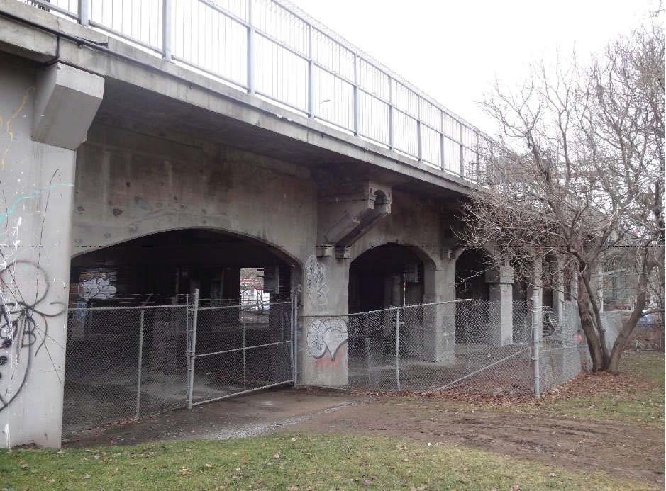
Above: Concrete rigid-frame spans. Source: Bridge Inspection Report.
![]()
![]()
![]()
![]()
![]()

![]()
Coordinates (Latitude, Longitude):
Search For Additional Bridge Listings:
Additional Maps:
Google Streetview (If Available)
GeoHack (Additional Links and Coordinates)
Apple Maps (Via DuckDuckGo Search)
Apple Maps (Apple devices only)
Android: Open Location In Your Map or GPS App
Flickr Gallery (Find Nearby Photos)
Wikimedia Commons (Find Nearby Photos)
Directions Via Sygic For Android
Directions Via Sygic For iOS and Android Dolphin Browser

© Copyright 2003-2024, HistoricBridges.org. All Rights Reserved. Disclaimer: HistoricBridges.org is a volunteer group of private citizens. HistoricBridges.org is NOT a government agency, does not represent or work with any governmental agencies, nor is it in any way associated with any government agency or any non-profit organization. While we strive for accuracy in our factual content, HistoricBridges.org offers no guarantee of accuracy. Information is provided "as is" without warranty of any kind, either expressed or implied. Information could include technical inaccuracies or errors of omission. Opinions and commentary are the opinions of the respective HistoricBridges.org member who made them and do not necessarily represent the views of anyone else, including any outside photographers whose images may appear on the page in which the commentary appears. HistoricBridges.org does not bear any responsibility for any consequences resulting from the use of this or any other HistoricBridges.org information. Owners and users of bridges have the responsibility of correctly following all applicable laws, rules, and regulations, regardless of any HistoricBridges.org information.
![]()