

View Information About HSR Ratings
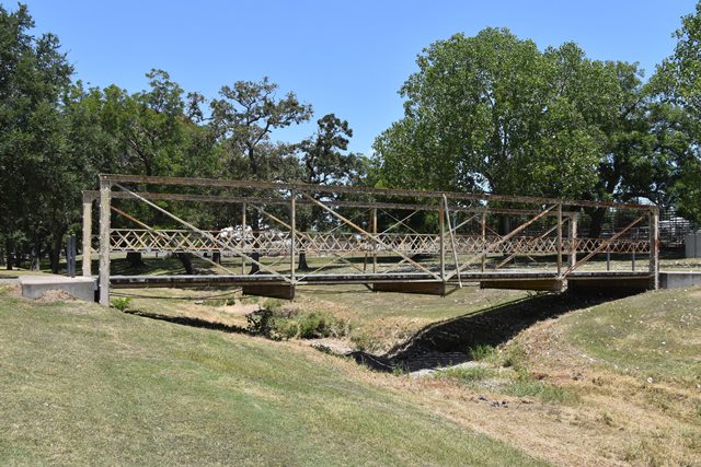
The nomination form has a detailed history of this bridge. This bridge has been relocated twice, once long ago in the 1920s-1930s, and more recent preservation-related ca. 2001 move to its existing location, following construction of a replacement bridge. The bedstead endposts of the bridge were cut when the bridge was moved; the original design would have had longer bedstead legs.
The bridge has rare star iron (cruciform) for its outriggers.
This bridge is an extremely early surviving example of a bedstead truss bridge. Most examples in the country date to after 1890. Bedstead truss bridges of any date are rare, particularly in Texas.
The bridge is noteworthy as an early product of the Missouri Valley Bridge and Iron Company of Leavenworth, Kansas, so old in fact that the plaques do not yet display that name, instead naming the company "A. J. Tullock and Company of Leavenworth, Kansas" although periodicals published in this same year name the company Missouri Valley Bridge and Iron Works, which itself was a name used for some years before the name became Missouri Valley Bridge and Iron Company. Reportedly, A. J. Tullock was a subcontractor for this bridge, with the truss being fabricated by the King Bridge Company of Cleveland, Ohio.
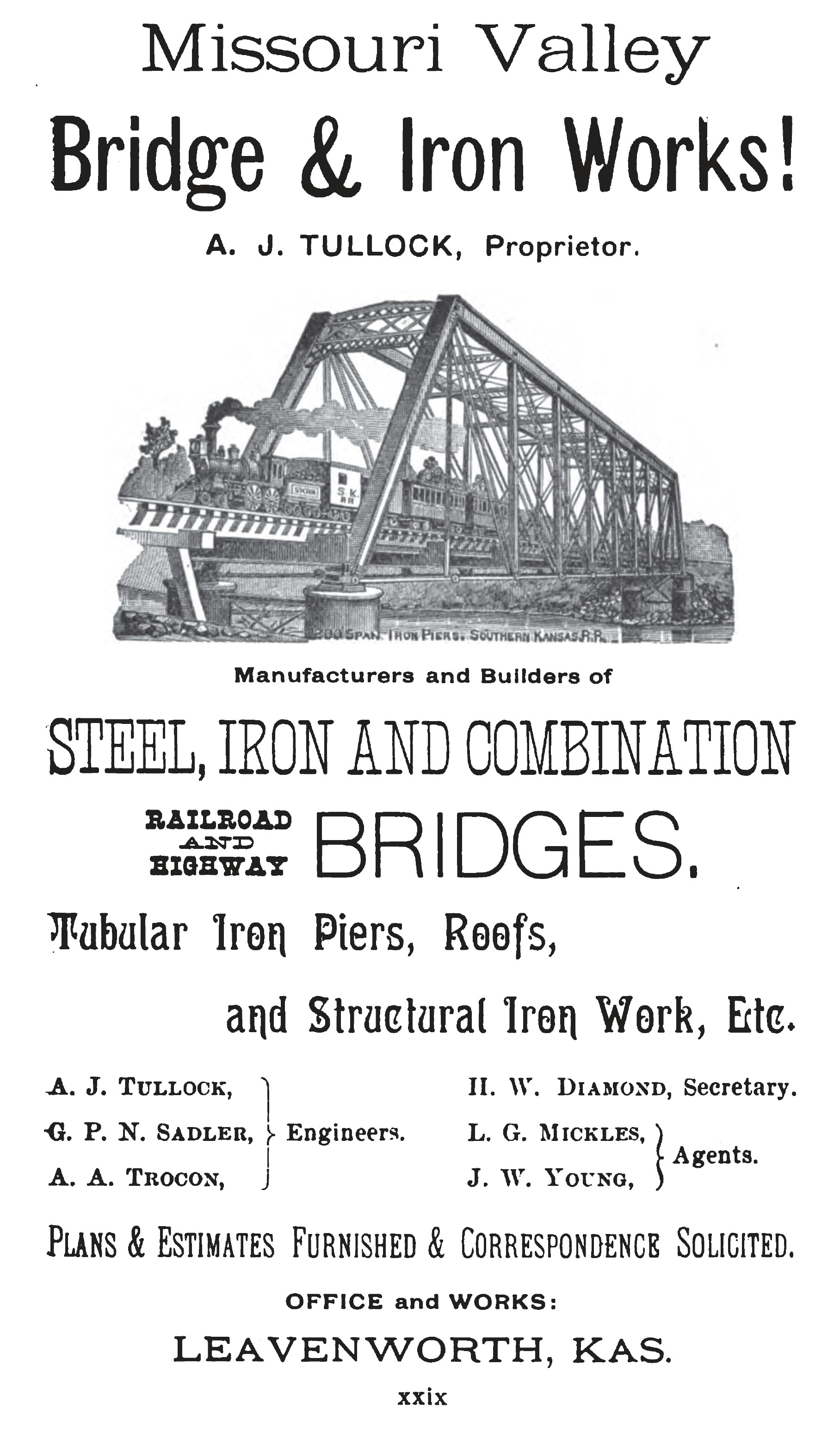
Above: 1888 Advertisement for the builder of this bridge.
Text From Bridge Interpretive PlaqueBuilt in 1888 by the King Iron Bridge Company of Cleveland, Ohio, and its sub-contractor, A. J. Tullock and Company of Leavenworth, Kansas, this bridge provided easy access to the developing community of Schulenburg. Located on the Old Praha Road, it was part of a major travel route during the late 19th and early 20th centuries. The 60-foot iron structure, described as a single span, box-chord, pin-connected modified Pratt low truss bridge with counters, cost $1,422 at the time of its construction. It is one of the few bridges of this style still standing. Recorded Texas Historic Landmark - 1990 |
![]()
![]()
![]()
Coordinates (Latitude, Longitude):
Search For Additional Bridge Listings:
Bridgehunter.com: View listed bridges within 0.5 miles (0.8 kilometers) of this bridge.
Bridgehunter.com: View listed bridges within 10 miles (16 kilometers) of this bridge.
Additional Maps:
Google Streetview (If Available)
GeoHack (Additional Links and Coordinates)
Apple Maps (Via DuckDuckGo Search)
Apple Maps (Apple devices only)
Android: Open Location In Your Map or GPS App
Flickr Gallery (Find Nearby Photos)
Wikimedia Commons (Find Nearby Photos)
Directions Via Sygic For Android
Directions Via Sygic For iOS and Android Dolphin Browser
USGS National Map (United States Only)
Historical USGS Topo Maps (United States Only)
Historic Aerials (United States Only)
CalTopo Maps (United States Only)

© Copyright 2003-2024, HistoricBridges.org. All Rights Reserved. Disclaimer: HistoricBridges.org is a volunteer group of private citizens. HistoricBridges.org is NOT a government agency, does not represent or work with any governmental agencies, nor is it in any way associated with any government agency or any non-profit organization. While we strive for accuracy in our factual content, HistoricBridges.org offers no guarantee of accuracy. Information is provided "as is" without warranty of any kind, either expressed or implied. Information could include technical inaccuracies or errors of omission. Opinions and commentary are the opinions of the respective HistoricBridges.org member who made them and do not necessarily represent the views of anyone else, including any outside photographers whose images may appear on the page in which the commentary appears. HistoricBridges.org does not bear any responsibility for any consequences resulting from the use of this or any other HistoricBridges.org information. Owners and users of bridges have the responsibility of correctly following all applicable laws, rules, and regulations, regardless of any HistoricBridges.org information.
![]()