We Recommend:
Bach Steel - Experts at historic truss bridge restoration.
BridgeHunter.com Phase 1 is released to the public! - Visit Now
Indian Trail Bridge
Radike Mills Bridge
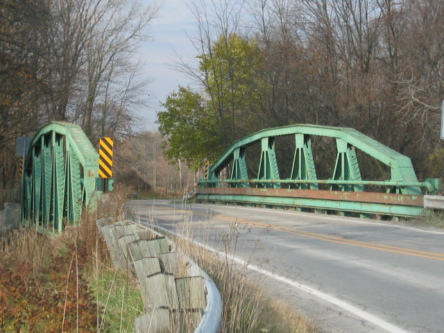
Primary Photographer(s): Nathan Holth
Bridge Documented: June 17, 2003 - July 10, 2006
Rural: St. Clair County, Michigan: United States
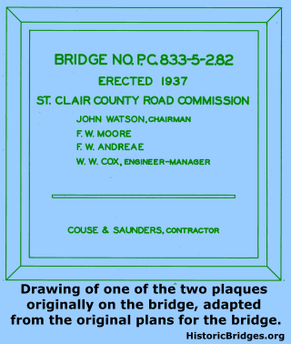
1937 By Builder/Contractor: Couse and Saunders of Detroit, Michigan
Not Available or Not Applicable
88.0 Feet (26.8 Meters)
93.8 Feet (28.6 Meters)
24 Feet (7.32 Meters)
1 Main Span(s)
77200066000B010

View Information About HSR Ratings
Bridge Documentation
This bridge is in storage!
Bridge Status: This bridge has been replaced but the trusses were put on display at Purdue University for the training of bridge engineers.View Archived National Bridge Inventory Report - Has Additional Details and Evaluation
View The Original Plans For This Historic Bridge
Researching Bridges
HistoricBridges.org has a paper that provides a look at historic bridge development, particularly metal truss bridges in Michigan, and also contains a discussion of this bridge and its history. The essay is part of the Introduction to Truss Bridges part of this website, and you can access the essay from there.
About the Bridge
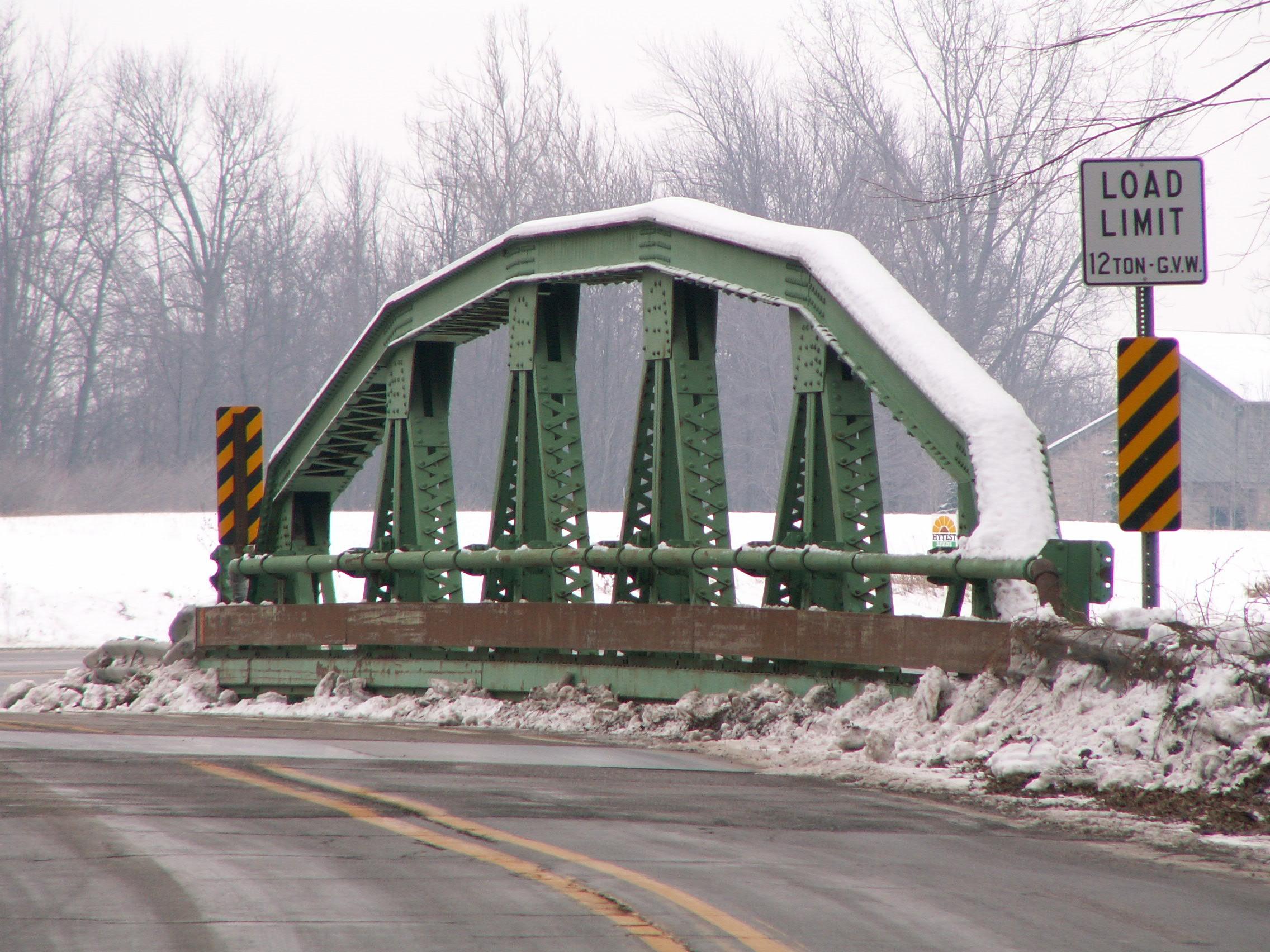
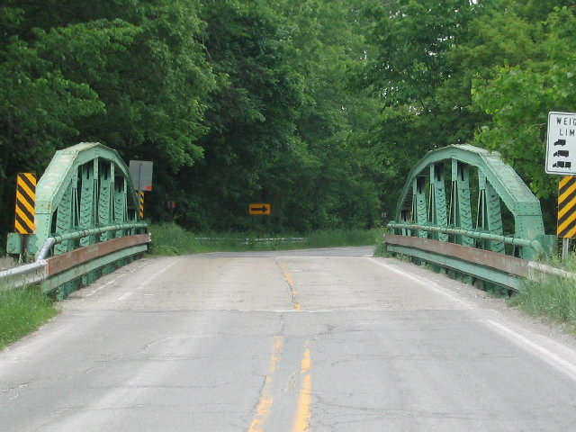
This is St. Clair County's newest truss bridge, with a construction date of 1937. The Indian Trail Bridge crosses the Belle River. It is a pony truss in a warren configuration. Like many pony truss bridges, the bridge is a camelback. The bridge was built by Couse and Saunders of Detroit. The bridge originally had a concrete curb, which is gone now, due to salt damage. There are three parts to the guardrail, a metal pole, a large channel and a small channel. The largest channel was added during a 1985 repair. The other two parts are original. The bridge was last painted during these 1985 repairs as well. The analysis of the structure's integrity suggests that the greatest loss of integrity is in the flooring system for the bridge. The trusses are in excellent condition. The deck on this bridge is 25 feet wide. The length of the truss span is 88 feet.
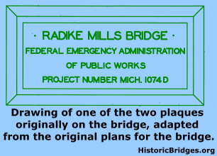
For some reason, someone took the time to photograph the previous bridge, which was also a truss bridge, before it was demolished. This is unusual to document a truss bridge back in the thirties, when they were still common technology. Anyhow, the former bridge was a one span Pratt through truss bridge. The bridge had six panels. It had lattice guardrails. Plaques were mounted on the portal bracing. It sat on masonry abutment, the remains of which are still visible today. The bridge was 96 feet long, and 14 feet wide.
Unlike some other states which built massive-membered through truss bridges into the thirties, Michigan built very few truss bridges after the 1910s. The Indian Trail Bridge is distinguished as a good example of late truss bridge construction in Michigan. Truss bridges from the thirties have a totally different appearance and feeling to them than to turn of the century truss bridges. They have a more massive feeling to them, but still retain a great deal of aesthetics, often in the form of extensive v-lacing and latticework. It is just as important to preserve these bridges as it is older truss bridges. They both have something special to offer today's roadways.
Observations Prior To Replacement
This bridge, compared to the other two truss bridges in St. Clair county, is in good condition. Even so, the bridge is listed as a critical bridge. Usually this translates to the bridge being torn down as soon as the money is available. Although not as old as the other St. Clair truss bridges, the bridge is definitely the most restorable. Although in need of a preventative paint job, the bridge has not yet rusted severely. The northern abutment appears to be slowly being washed away and should perhaps be patched or redone. Also, since the bridge is newer, the bridge is more massive than older truss bridges, and is capable of supporting more weight. The current 15 ton weight limit on the bridge should be more than enough for a paved country road, especially when there are other larger north-south truck routes nearby. King Road is two miles away and M-29 is four miles away. These are both truck routes, and run a more direct and faster route. It is likely many of the residents in the area also would not like the idea of having those trucks on this road if the bridge were replaced with a slab with unlimited weight limit. This is a truss bridge with two lanes, so it is unclear how width could be a problem.


Photo Credit: St. Clair County Road Commission
Information and Findings From Michigan Historic Bridge InventoryNarrative Description The Indian Trail Road Bridge is eligible for the National Register as a representative product of the PWA program. The polygonal-truss bridge is also eligible as an example of late pony-truss design. Pony-truss
bridges were rarely built after the late 1930s. |
This bridge is tagged with the following special condition(s): Unorganized Photos
![]()
Photo Galleries and Videos: Indian Trail Bridge
Original / Full Size Gallery
Original / Full Size PhotosFor the best visual immersion and full detail, or for use as a desktop background, this gallery presents selected overview and detail photos for this bridge in the original digital camera resolution. This gallery offers photos in the highest available resolution and file size in a touch-friendly popup viewer.
Alternatively, Browse Without Using Viewer
![]()
Structure Overview
Mobile Optimized PhotosA collection of overview photos that show the bridge as a whole and general areas of the bridge. This gallery features data-friendly, fast-loading photos in a touch-friendly popup viewer.
Alternatively, Browse Without Using Viewer
![]()
Structure Details
Mobile Optimized PhotosA collection of detail photos that document the parts, construction, and condition of the bridge. This gallery features data-friendly, fast-loading photos in a touch-friendly popup viewer.
Alternatively, Browse Without Using Viewer
![]()
Additional Unorganized Photos
Original / Full Size PhotosThis photo gallery features older ca. 2003-2006 photos taken when the website only included a few photos in original size on the website, and a smaller quantity of reduced size photos as well. This unorganized gallery may partially duplicate photos in other galleries on this bridge's page, however all photos here are available in the Original / Full Size. This gallery offers photos in the highest available resolution and file size in a touch-friendly popup viewer.
Alternatively, Browse Without Using Viewer
![]()
Additional Unorganized Photos
Mobile Optimized PhotosThis photo gallery features older ca. 2003-2006 photos taken when the website only included a few photos in original size on the website, and a smaller quantity of reduced size photos as well. This unorganized gallery may partially duplicate photos in other galleries on this bridge's page, however all photos here are available in the Original / Full Size. This gallery features data-friendly, fast-loading photos in a touch-friendly popup viewer.
Alternatively, Browse Without Using Viewer
![]()
Maps and Links: Indian Trail Bridge
Coordinates (Latitude, Longitude):
Search For Additional Bridge Listings:
Bridgehunter.com: View listed bridges within 0.5 miles (0.8 kilometers) of this bridge.
Bridgehunter.com: View listed bridges within 10 miles (16 kilometers) of this bridge.
Additional Maps:
Google Streetview (If Available)
GeoHack (Additional Links and Coordinates)
Apple Maps (Via DuckDuckGo Search)
Apple Maps (Apple devices only)
Android: Open Location In Your Map or GPS App
Flickr Gallery (Find Nearby Photos)
Wikimedia Commons (Find Nearby Photos)
Directions Via Sygic For Android
Directions Via Sygic For iOS and Android Dolphin Browser
USGS National Map (United States Only)
Historical USGS Topo Maps (United States Only)
Historic Aerials (United States Only)
CalTopo Maps (United States Only)


