We Recommend:
Bach Steel - Experts at historic truss bridge restoration.
4 3/4 Mile Road Bridge

Primary Photographer(s): Nathan Holth
Bridge Documented: 2006 and November 13, 2021
Rural: Midland County, Michigan: United States
1903 By Builder/Contractor: Tunnel City Bridge and Iron Works of Port Huron, Michigan
Not Available or Not Applicable
116.0 Feet (35.4 Meters)
120.0 Feet (36.6 Meters)
15 Feet (4.57 Meters)
1 Main Span(s)
56314H00009B010

View Information About HSR Ratings
Bridge Documentation
View Archived National Bridge Inventory Report - Has Additional Details and Evaluation
This bridge is the only known bridge in existence built by the Tunnel City Bridge and Iron Works of Port Huron, Michigan. It is thus extremely important as what may be the last physical remnant of a little-known Michigan bridge company. In case you are curious why the company named themselves "Tunnel City" consider Port Huron's history during the period the bridge company was in operation. In 1891s, the first full-size sub-aqueous tunnel in North America was completed, running from Port Huron, MI and Sarnia, ON to serve trains. In 1903 when the 4 3/4 Mile Road Bridge was built, this key international tunnel would have been a major source of fame for Port Huron. Engineers would have possibly nicknamed Port Huron "Tunnel City" back then. Click here to visit HAER's page for this historic tunnel.
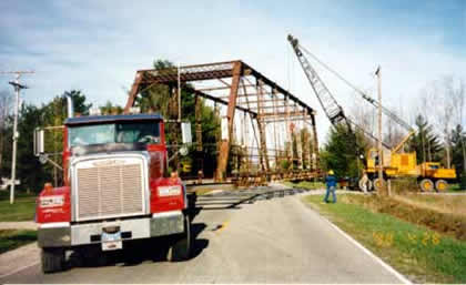
This bridge has been moved for a number of years, as MDOT's website mentions, and it took some searching to find who moved the bridge and where it moved. It turns out that a nearby resident, Jim Hyatt, moved the bridge to a nearby private drive and restored it. HistoricBridges.org is appreciative that this beautiful piece of Port Huron heritage was saved from the dumpster, which is where the Midland County Road Commission was going to put it.
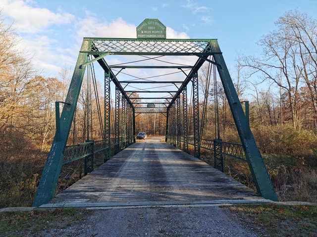
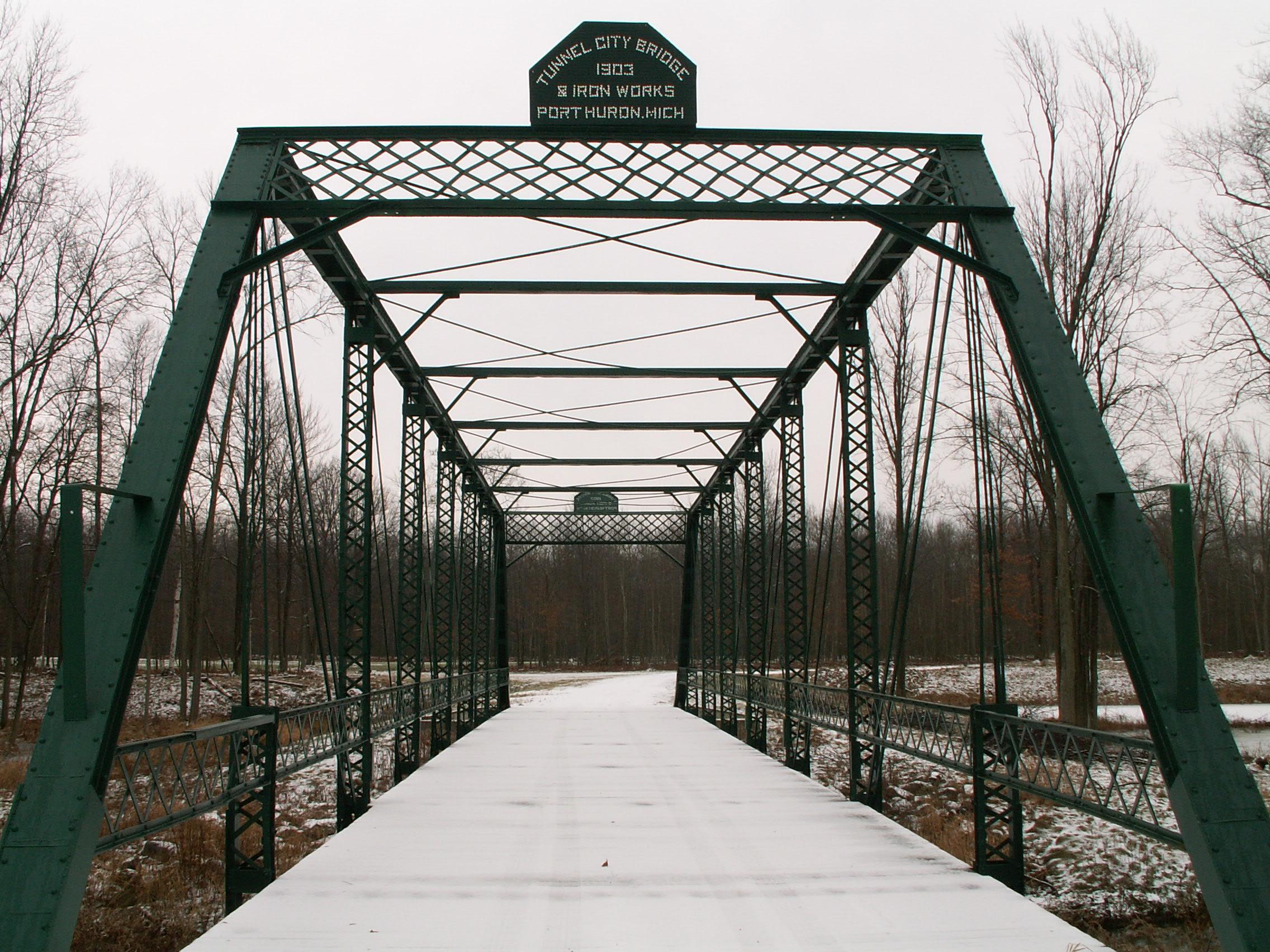
Constructed in 1903, this bridge is a classic example of a pin connected Pratt through truss. The bridge is composed of eight panels yielding a 120 foot span. V-lacing is present on the vertical members, and lattice is present on the portal bracing. The original railings on the bridge are also lattice.
The bridge has been altered, most notably with extensive plate steel welded to bottom chord elements. In addition, the flooring system was also replaced, but with a wooden deck. Although MDOT's website mentions that the deck of the bridge was originally concrete, wood was a common surface for pin connected through truss bridges.
The unusual, simple plaque on the bridge which is composed of a thin plate with punched holes spelling out the bridge builder and date might at first glance appear to be not original. However there are a couple other bridge companies who created plaques of this type. After careful consideration, HistoricBridges.org believes the plaque to be original.
HistoricBridges.org thanks Jim Hyatt for allowing a visit and and photo-documentation of this important bridge, and also for choosing to save this historic bridge from certain doom!
Information and Findings From Michigan Historic Bridge InventoryNarrative Description
Located
over the Pine River about a mile east of Gordonville, this medium-span
truss crosses the Pine River on the Gordonville Road. This pin-connected
Pratt through truss, extending 120 feet, is supported by concrete
abutments with angled wingwalls. The web members are built up from
rolled steel sections from the Cambria mills of Pennsylvania. They are
comprised as follows: upper chord and sloped end posts - two channels
with cover and batten plates; lower chord - 2 looped rectangular eyebars;
vertical - two channels with lacing (with two looped rectangular eyebars
at the hip); and diagonal - two rectangular eyebars. The guardrails are
lattice; The 12-foot-wide asphalt-covered concrete deck is supported by
I-beam stringers and floor beams, which are field-bolted to the
verticals. Other than the relatively recent installation of Armco
guardrails and turnbuckled tension rods at the hip verticals, the bridge
is unaltered. It is presently cloes to vehicular traffic. |
This bridge is tagged with the following special condition(s): Unorganized Photos
![]()
Photo Galleries and Videos: 4 3/4 Mile Road Bridge
2006 Bridge Photo-Documentation
A collection of overview and detail photos. This photo gallery contains a combination of Original Size photos and Mobile Optimized photos in a touch-friendly popup viewer.Alternatively, Browse Without Using Viewer
![]()
Additional Unorganized Photos
Original / Full Size PhotosA supplemental collection of photos that are from additional visit(s) to the bridge and have not been organized or captioned. This gallery offers photos in the highest available resolution and file size in a touch-friendly popup viewer.
Alternatively, Browse Without Using Viewer
![]()
Additional Unorganized Photos
Mobile Optimized PhotosA supplemental collection of photos that are from additional visit(s) to the bridge and have not been organized or captioned. This gallery features data-friendly, fast-loading photos in a touch-friendly popup viewer.
Alternatively, Browse Without Using Viewer
![]()
Maps and Links: 4 3/4 Mile Road Bridge
Coordinates (Latitude, Longitude):
Search For Additional Bridge Listings:
Bridgehunter.com: View listed bridges within 0.5 miles (0.8 kilometers) of this bridge.
Bridgehunter.com: View listed bridges within 10 miles (16 kilometers) of this bridge.
Additional Maps:
Google Streetview (If Available)
GeoHack (Additional Links and Coordinates)
Apple Maps (Via DuckDuckGo Search)
Apple Maps (Apple devices only)
Android: Open Location In Your Map or GPS App
Flickr Gallery (Find Nearby Photos)
Wikimedia Commons (Find Nearby Photos)
Directions Via Sygic For Android
Directions Via Sygic For iOS and Android Dolphin Browser
USGS National Map (United States Only)
Historical USGS Topo Maps (United States Only)
Historic Aerials (United States Only)
CalTopo Maps (United States Only)


