

View Information About HSR Ratings
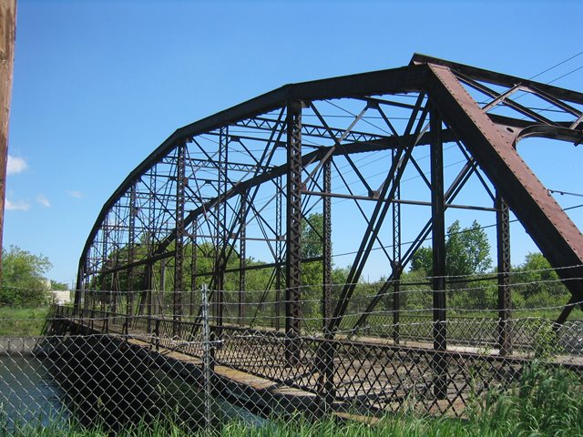
This is an extremely rare pinned Pennsylvania highway truss bridge and was listed on the National Register of Historic Places. There is only one other Pennsylvania truss bridge in Michigan, the CR-510 bridge. Pennsylvania truss bridges are generally quite stunning, due to the complex arrangement of members. This Fort Street bridge is no exception. In its original location, original lattice guardrails were present on the bridge, and a wooden deck was present. Extensive V-lacing on many parts of the bridge add to the visual qualities of the structure.
This bridge was replaced in 2005, but the historic bridge was carefully match-marked, dismantled, and placed into storage in a secure location. The plan was to quickly get the bridge restored and moved to a new location in the city. The place being considered was a park called Ashmun Bay Park as shown in this diagram. Unfortunately, this has not yet panned out and as of 2014, no restoration has occurred. It was originally planned to be completed between 2010 and 2014. As long as the parts of the bridge remain in storage, there is no reason why the bridge could not still be restored either now or in the future. Given the great beauty and high significance of this bridge it is hoped that this bridge will eventually be restored and re-erected. Wherever it is placed it would be a positive asset and area attraction.
![]()
![]()
![]()
Coordinates (Latitude, Longitude):
Search For Additional Bridge Listings:
Bridgehunter.com: View listed bridges within 0.5 miles (0.8 kilometers) of this bridge.
Bridgehunter.com: View listed bridges within 10 miles (16 kilometers) of this bridge.
Additional Maps:
Google Streetview (If Available)
GeoHack (Additional Links and Coordinates)
Apple Maps (Via DuckDuckGo Search)
Apple Maps (Apple devices only)
Android: Open Location In Your Map or GPS App
Flickr Gallery (Find Nearby Photos)
Wikimedia Commons (Find Nearby Photos)
Directions Via Sygic For Android
Directions Via Sygic For iOS and Android Dolphin Browser
USGS National Map (United States Only)
Historical USGS Topo Maps (United States Only)
Historic Aerials (United States Only)
CalTopo Maps (United States Only)

© Copyright 2003-2025, HistoricBridges.org. All Rights Reserved. Disclaimer: HistoricBridges.org is a volunteer group of private citizens. HistoricBridges.org is NOT a government agency, does not represent or work with any governmental agencies, nor is it in any way associated with any government agency or any non-profit organization. While we strive for accuracy in our factual content, HistoricBridges.org offers no guarantee of accuracy. Information is provided "as is" without warranty of any kind, either expressed or implied. Information could include technical inaccuracies or errors of omission. Opinions and commentary are the opinions of the respective HistoricBridges.org member who made them and do not necessarily represent the views of anyone else, including any outside photographers whose images may appear on the page in which the commentary appears. HistoricBridges.org does not bear any responsibility for any consequences resulting from the use of this or any other HistoricBridges.org information. Owners and users of bridges have the responsibility of correctly following all applicable laws, rules, and regulations, regardless of any HistoricBridges.org information.
![]()