

View Information About HSR Ratings
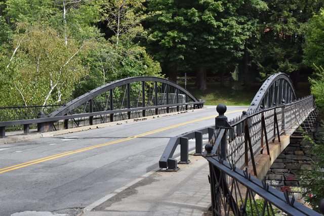
This is a large, impressive, and extremely rare Parker patent pony truss bridge. As originally designed, this bridge had two overhead portal braces. Those no longer remain on the bridge, effectively turning the bridge into a pony truss. In 1900, this bridge had a riveted deck truss added to help support loads. Perhaps at this time as well, the original railing was replaced with a new, ornamental railing. In 1980, the deck truss was removed, and load-bearing steel stringers were installed, rendering the bowstring trusses non-structural and decorative only. Despite alteration, this bridge remains highly significiant as an example of the original patented design of Parker truss that inspired decades of Parker truss construction into the 20th century.

Above: Historical photo showing bridge as originally designed with overhead portal bracing.
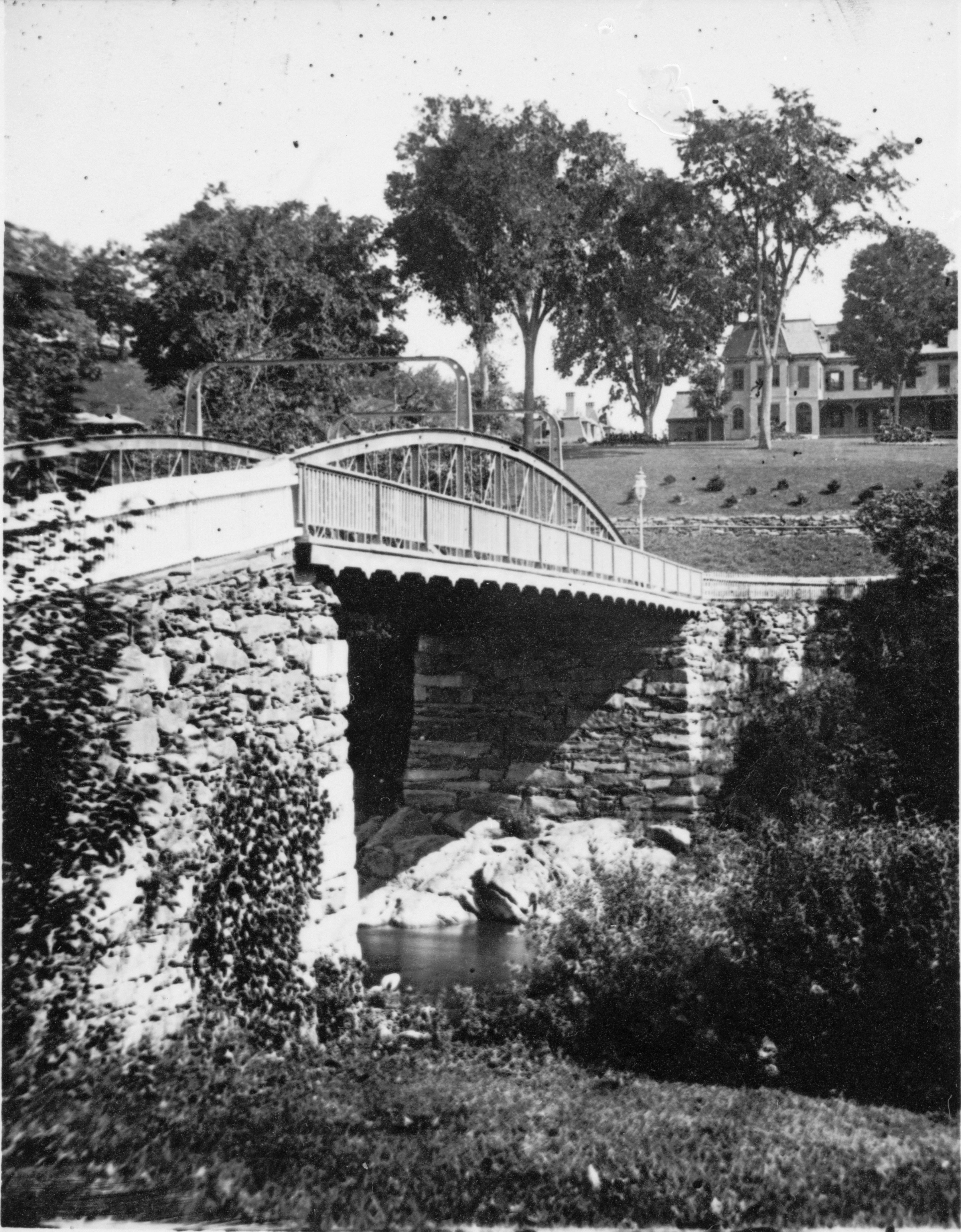
Above: Historical photo showing bridge as originally designed with overhead portal bracing.

Above: Historical photo showing bridge as originally designed with overhead portal bracing.

Above: Historical photo showing bridge as originally designed with overhead portal bracing.
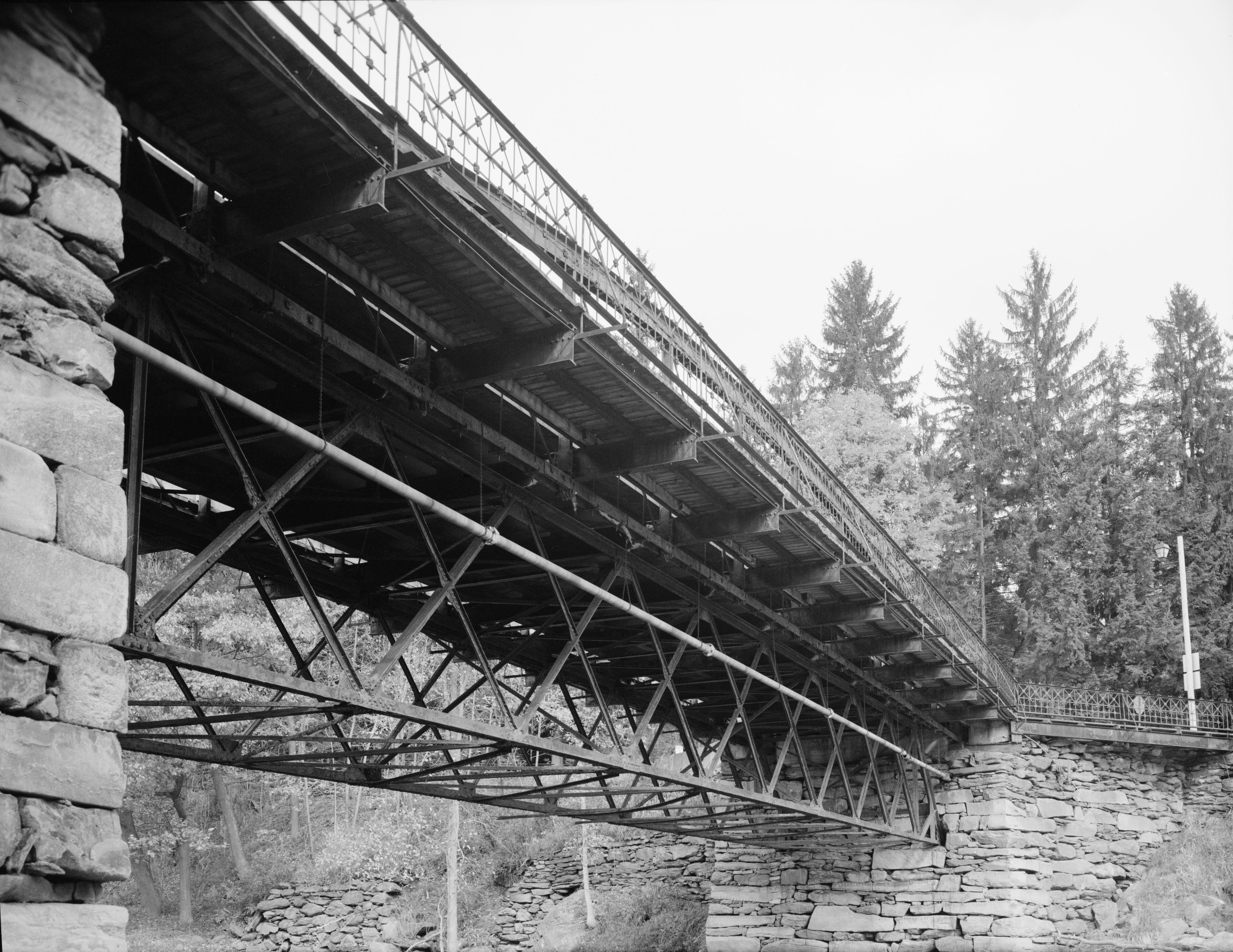
Above: Photo showing the 1900 deck truss prior to removal. Photo Credit: Historic American Engineering Record.

Above: Historical advertisement for Parker patent truss bridge.

Above: Historical advertisement for Parker patent truss bridge.

Above: Historical advertisement for Parker patent truss bridge.
This bridge is tagged with the following special condition(s): Trusses Converted To Decorative
![]()
![]()
![]()
Coordinates (Latitude, Longitude):
Search For Additional Bridge Listings:
Bridgehunter.com: View listed bridges within 0.5 miles (0.8 kilometers) of this bridge.
Bridgehunter.com: View listed bridges within 10 miles (16 kilometers) of this bridge.
Additional Maps:
Google Streetview (If Available)
GeoHack (Additional Links and Coordinates)
Apple Maps (Via DuckDuckGo Search)
Apple Maps (Apple devices only)
Android: Open Location In Your Map or GPS App
Flickr Gallery (Find Nearby Photos)
Wikimedia Commons (Find Nearby Photos)
Directions Via Sygic For Android
Directions Via Sygic For iOS and Android Dolphin Browser
USGS National Map (United States Only)
Historical USGS Topo Maps (United States Only)
Historic Aerials (United States Only)
CalTopo Maps (United States Only)

© Copyright 2003-2026, HistoricBridges.org. All Rights Reserved. Disclaimer: HistoricBridges.org is a volunteer group of private citizens. HistoricBridges.org is NOT a government agency, does not represent or work with any governmental agencies, nor is it in any way associated with any government agency or any non-profit organization. While we strive for accuracy in our factual content, HistoricBridges.org offers no guarantee of accuracy. Information is provided "as is" without warranty of any kind, either expressed or implied. Information could include technical inaccuracies or errors of omission. Opinions and commentary are the opinions of the respective HistoricBridges.org member who made them and do not necessarily represent the views of anyone else, including any outside photographers whose images may appear on the page in which the commentary appears. HistoricBridges.org does not bear any responsibility for any consequences resulting from the use of this or any other HistoricBridges.org information. Owners and users of bridges have the responsibility of correctly following all applicable laws, rules, and regulations, regardless of any HistoricBridges.org information.
![]()