

View Information About HSR Ratings
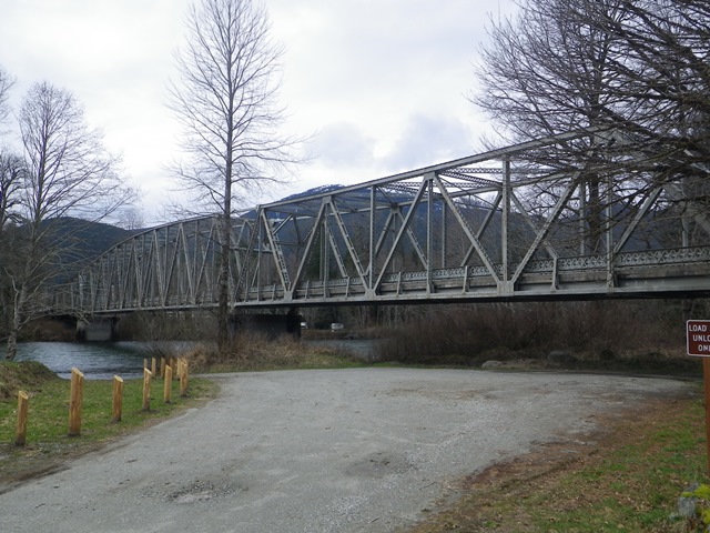
This is an unusual bridge, with its continuous through truss design, and is dissimilar to the simple span and cantilever trusses found elsewhere in the state. The approach spans appear to have been replaced and reconfigured from the original design. The three span continuous unit is 600 feet in length with a 280 foot center span and end spans of 160 feet.
Mark Bozanich provided the following information:
The Cascade Wagon Road was the first state road designated by the Washington legislature in 1893. This bridge was built in 1930 as part of the Cascade Wagon Road, numbered Primary State Highway 17 in 1937. The highway was intended to cross Cascade Pass and Twisp Pass with a spur heading south to the unincorporated community of Stehekin. Part of this proposed route was never built. In the later 1940s, a route via Washington and Rainy Passes was surveyed that eventually became State Route 20, the North Cascades Highway. The final link was opened to traffic in September 1972.
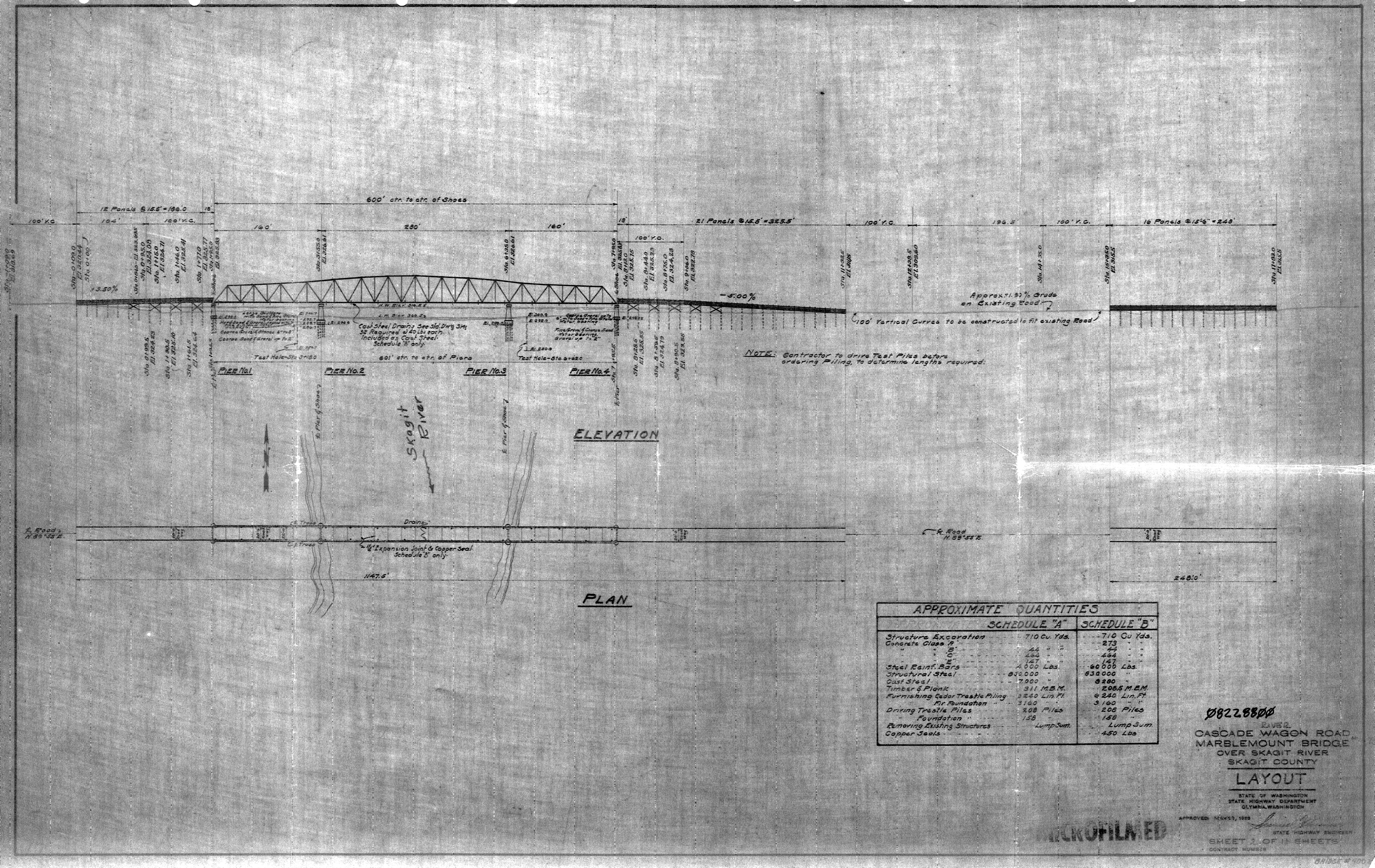
Above: Original plan sheet from bridge.
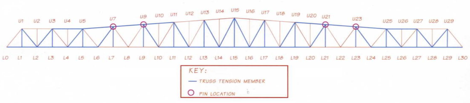
Above: Inspection sketch that shows the connections that have a pin.

Above: Historical ca. 1940s photo of bridge.
This bridge is tagged with the following special condition(s): Unorganized Photos
![]()
![]()
![]()
Coordinates (Latitude, Longitude):
Search For Additional Bridge Listings:
Bridgehunter.com: View listed bridges within 0.5 miles (0.8 kilometers) of this bridge.
Bridgehunter.com: View listed bridges within 10 miles (16 kilometers) of this bridge.
Additional Maps:
Google Streetview (If Available)
GeoHack (Additional Links and Coordinates)
Apple Maps (Via DuckDuckGo Search)
Apple Maps (Apple devices only)
Android: Open Location In Your Map or GPS App
Flickr Gallery (Find Nearby Photos)
Wikimedia Commons (Find Nearby Photos)
Directions Via Sygic For Android
Directions Via Sygic For iOS and Android Dolphin Browser
USGS National Map (United States Only)
Historical USGS Topo Maps (United States Only)
Historic Aerials (United States Only)
CalTopo Maps (United States Only)

© Copyright 2003-2026, HistoricBridges.org. All Rights Reserved. Disclaimer: HistoricBridges.org is a volunteer group of private citizens. HistoricBridges.org is NOT a government agency, does not represent or work with any governmental agencies, nor is it in any way associated with any government agency or any non-profit organization. While we strive for accuracy in our factual content, HistoricBridges.org offers no guarantee of accuracy. Information is provided "as is" without warranty of any kind, either expressed or implied. Information could include technical inaccuracies or errors of omission. Opinions and commentary are the opinions of the respective HistoricBridges.org member who made them and do not necessarily represent the views of anyone else, including any outside photographers whose images may appear on the page in which the commentary appears. HistoricBridges.org does not bear any responsibility for any consequences resulting from the use of this or any other HistoricBridges.org information. Owners and users of bridges have the responsibility of correctly following all applicable laws, rules, and regulations, regardless of any HistoricBridges.org information.
![]()