We Recommend:
Bach Steel - Experts at historic truss bridge restoration.
BridgeHunter.com Phase 1 is released to the public! - Visit Now
Lyons Ferry Bridge
Primary Photographer(s): Nathan Holth
Bridge Documented: August 21, 2014
Rural: Columbia County, Washington and Franklin County, Washington: United States
Metal Cantilever 26 Panel Multiple-Type-Connected Baltimore Through Truss, Fixed and Approach Spans: Metal 9 Panel Rivet-Connected Pratt Deck Truss, Fixed
1927 By Builder/Contractor: Kuckenberg and Wittman of Portland, Oregon and Engineer/Design: Washington Department of Highways
1968
520.0 Feet (158.5 Meters)
2,040.0 Feet (621.8 Meters)
20 Feet (6.1 Meters)
3 Main Span(s) and 8 Approach Span(s)
0008390A0000000

View Information About HSR Ratings
Bridge Documentation
View Archived National Bridge Inventory Report - Has Additional Details and Evaluation
View Historic American Engineering Record (HAER) Documentation For This Bridge
HAER Data Pages, PDF
HAER Documentation, Washington Cantilever Bridges - Data Pages - Drawings
View Historic Structure Reports For This Bridge

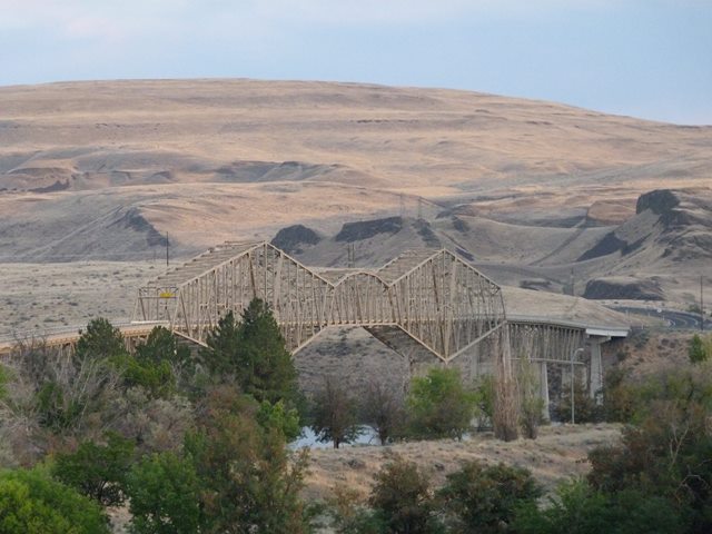
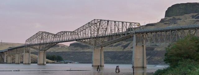
This bridge is one of the most fascinating bridges in Washington State. The bridge was originally located at Vantage, Washington where it was built in 1927 to cross the Columbia River. In the early 1960s, the construction of the Wanapam Dam was going to raise the water levels and a higher bridge was needed. The bridge was therefore replaced, however the 1927 bridge was dismantled and placed into storage. In 1968 it was erected here in its current location at Lyons Ferry. Some additional concrete approach spans were built to accommodate the crossing in addition to the 1927 truss spans. Truss bridges were historically relocated and reused in this manner, but the practice was more common in the late 1800s and early 20th Century. Additionally, it was usually done with smaller simple span truss bridges, not enormous cantilever truss bridges. This is one of the largest known truss bridges to have been relocated in this manner.
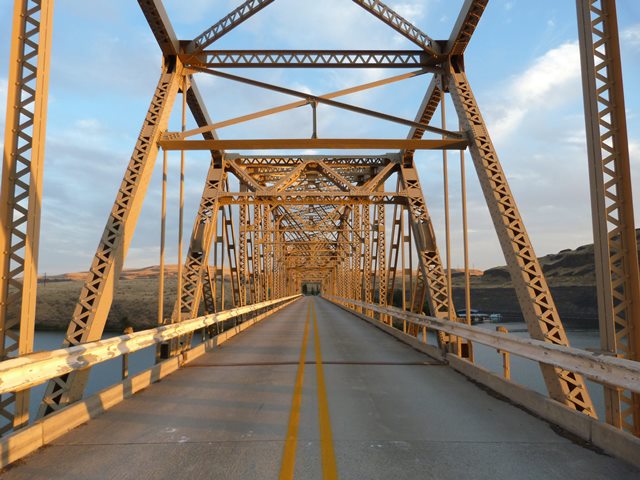
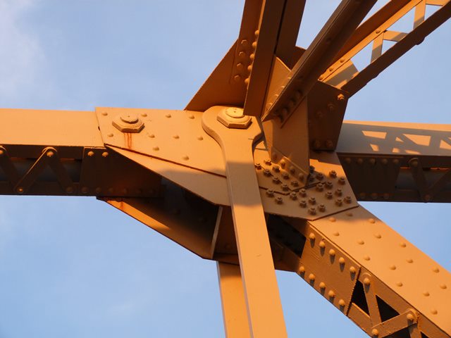
As the bridge was relocated in the late 1960s when bolts were replacing rivets as the preferred fastener, all connections on this bridge are bolted. They would originally have been riveted however, which is why this is listed as a rivet-connected truss bridge on this website. The use of bolts instead of rivets is the only major alteration to the original truss materials and design. Brackets are still welded on the end posts of the suspended span which were used to lift the pre-assembled suspended span into place when it was moved here. Before the bridge was erected here, a ferry served the needs of highway traffic.

Built in 1927, this is not an early example of a cantilever truss bridge, but it is an early surviving cantilever truss, especially among highway bridges, since many of the earlier highway cantilever truss bridges have been demolished and replaced. It stands out as particularly early among cantilever truss bridges in Washington State, since the state has a number of cantilever trusses dating to after 1930, but few dating to before 1930.
The shape of this cantilever truss is very unusual and distinctive. It is strikingly similar in shape to the Quebec Bridge in Canada, perhaps the only bridge in the United States (or Canada) to so closely resemble that famous bridge in shape. The triangular shape formed by both the top and bottom chords at each end of the bridge combined with the polygonal top chord of the suspended span are the features that make this bridge look like the Quebec Bridge. In the details however, the Lyons Ferry Bridge is very different, since its anchor and cantilever arms do not follow the K-truss configuration of the Quebec Bridge and instead a Baltimore truss configuration is used. The Lyons Ferry Bridge is also much smaller in terms of main span length.
To describe this bridge's current location as unique and beautiful is an understatement. Firstly, the location is very rural, and because of this, traffic is fairly light on this bridge, which is unusual for a bridge of this size since bridges crossing large rivers are spaced far apart which generally results in high traffic counts. Its nice to be able to enjoy a bridge of this type without nonstop trucks crossing the bridge. Second, the natural scenery of the location is absolutely incredible. The historic structure reports describe the rocky, arid landscape of steep volcanic rock that was exposed by ancient floods as otherworldly and this is a great description. Its a unique landscape for a unique bridge.
This bridge is next to the Joso High Bridge, a spectacular bridge in its own right.
![]()
Photo Galleries and Videos: Lyons Ferry Bridge
Structure Overview
Original / Full Size PhotosA collection of overview photos that show the bridge as a whole and general areas of the bridge. This gallery offers photos in the highest available resolution and file size in a touch-friendly popup viewer.
Alternatively, Browse Without Using Viewer
![]()
Structure Details
Original / Full Size PhotosA collection of detail photos that document the parts, construction, and condition of the bridge. This gallery offers photos in the highest available resolution and file size in a touch-friendly popup viewer.
Alternatively, Browse Without Using Viewer
![]()
Structure Overview
Mobile Optimized PhotosA collection of overview photos that show the bridge as a whole and general areas of the bridge. This gallery features data-friendly, fast-loading photos in a touch-friendly popup viewer.
Alternatively, Browse Without Using Viewer
![]()
Structure Details
Mobile Optimized PhotosA collection of detail photos that document the parts, construction, and condition of the bridge. This gallery features data-friendly, fast-loading photos in a touch-friendly popup viewer.
Alternatively, Browse Without Using Viewer
![]()
Maps and Links: Lyons Ferry Bridge
Coordinates (Latitude, Longitude):
Search For Additional Bridge Listings:
Bridgehunter.com: View listed bridges within 0.5 miles (0.8 kilometers) of this bridge.
Bridgehunter.com: View listed bridges within 10 miles (16 kilometers) of this bridge.
Additional Maps:
Google Streetview (If Available)
GeoHack (Additional Links and Coordinates)
Apple Maps (Via DuckDuckGo Search)
Apple Maps (Apple devices only)
Android: Open Location In Your Map or GPS App
Flickr Gallery (Find Nearby Photos)
Wikimedia Commons (Find Nearby Photos)
Directions Via Sygic For Android
Directions Via Sygic For iOS and Android Dolphin Browser
USGS National Map (United States Only)
Historical USGS Topo Maps (United States Only)
Historic Aerials (United States Only)
CalTopo Maps (United States Only)


