We Recommend:
Bach Steel - Experts at historic truss bridge restoration.
BridgeHunter.com Phase 1 is released to the public! - Visit Now
Jim Falls Bridge

Primary Photographer(s): Nathan Holth
Bridge Documented: October 17, 2021
Jim Falls: Chippewa County, Wisconsin: United States
By Builder/Contractor: Unknown
Not Available or Not Applicable
130.0 Feet (39.6 Meters)
260.0 Feet (79.2 Meters)
Not Available
2 Main Span(s)
Not Applicable

View Information About HSR Ratings
Bridge Documentation
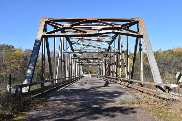
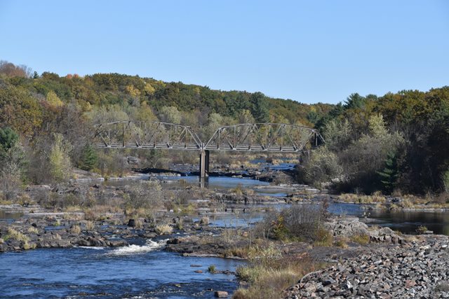
This abandoned state standard through truss bridge is situated in a stunningly beautiful setting. It crosses the rocky Chippewa River. This section of the river is special today because it only carries some of the river's water, acting as a sort of spillway for a nearby dam. The rest of the water flows through the Jim Falls Dam. East of this bridge is a section of land that separates the old riverbed from the start of the Old Abe Lake reservoir. The dam itself is southeast of the bridge. The bridge is a two lane state standard truss so it would appear this bridge originally provided the highway crossing in this area (rather then being a purpose-built dam service/access bridge), which is today served by the CR-Y Bridge immediately south of the dam. It is not clear if this bridge's service was ended by the construction of this dam (if the bridge is older than the dam). Or perhaps the old road once crossed the dam itself east of this bridge to get to the eastern bank of this pair of waterways.
Lengths given are estimates.

![]()
Photo Galleries and Videos: Jim Falls Bridge
Bridge Photo-Documentation
Original / Full Size PhotosA collection of overview and detail photos. This gallery offers photos in the highest available resolution and file size in a touch-friendly popup viewer.
Alternatively, Browse Without Using Viewer
![]()
Bridge Photo-Documentation
Mobile Optimized PhotosA collection of overview and detail photos. This gallery features data-friendly, fast-loading photos in a touch-friendly popup viewer.
Alternatively, Browse Without Using Viewer
![]()
Maps and Links: Jim Falls Bridge
Coordinates (Latitude, Longitude):
Search For Additional Bridge Listings:
Bridgehunter.com: View listed bridges within 0.5 miles (0.8 kilometers) of this bridge.
Bridgehunter.com: View listed bridges within 10 miles (16 kilometers) of this bridge.
Additional Maps:
Google Streetview (If Available)
GeoHack (Additional Links and Coordinates)
Apple Maps (Via DuckDuckGo Search)
Apple Maps (Apple devices only)
Android: Open Location In Your Map or GPS App
Flickr Gallery (Find Nearby Photos)
Wikimedia Commons (Find Nearby Photos)
Directions Via Sygic For Android
Directions Via Sygic For iOS and Android Dolphin Browser
USGS National Map (United States Only)
Historical USGS Topo Maps (United States Only)
Historic Aerials (United States Only)
CalTopo Maps (United States Only)

