We Recommend:
Bach Steel - Experts at historic truss bridge restoration.
Barker-Stewart Island Railroad Bridge West

Primary Photographer(s): Nathan Holth
Bridge Documented: July 14, 2007, August 15, 2020, and October 17, 2021
Railroad (Wisconsin Central) Over Wisconsin River (West Channel)
Wausau: Marathon County, Wisconsin: United States
Metal 13 Panel Rivet-Connected Lattice (Quadruple Warren) Through Truss, Fixed and Approach Spans: Metal Through Girder, Fixed
1888 By Builder/Contractor: Lassig Bridge and Iron Works of Chicago, Illinois
Not Available or Not Applicable
158.0 Feet (48.2 Meters)
380.0 Feet (115.8 Meters)
Not Available
2 Main Span(s) and 1 Approach Span(s)
Not Applicable

View Information About HSR Ratings
Bridge Documentation
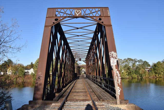
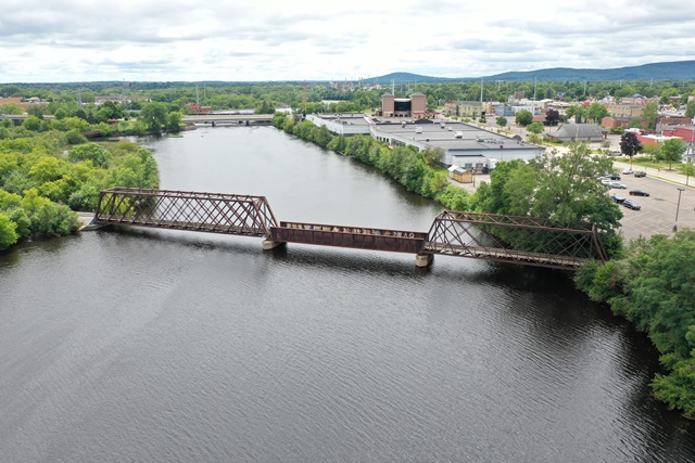
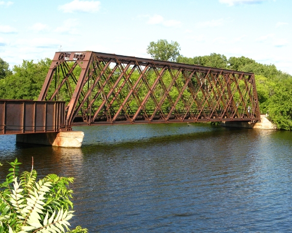
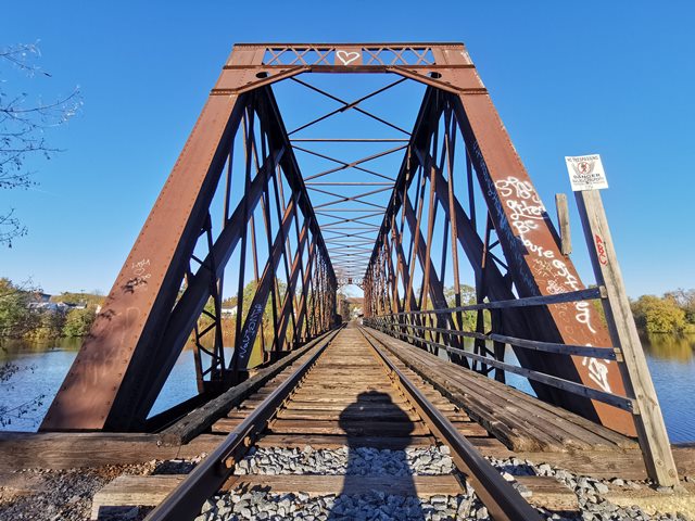
This is a multi-span example of a nationally uncommon truss type, with a variety of span designs. The bridge is unusual because it has a truss span at each end and a plate girder in the middle. The western truss span is wider than the eastern truss span, to allow for a slight curving of the track over the bridge at the western end. A truss span was clearly reused and widened through alteration for this part of the bridge. Evidence comes in the form of altered portal bracing, where it is apparant that steel was added to widen the original portal bracing. John Marvig provided research indicating that the girder span was added in 1913 when a flood destroyed the previous span at this portion of the bridge.
Thanks to Chicago NorthWestern Railroad's preference for lattice truss bridges, Wisconsin has a disproportionate number of remaining historic lattice truss bridges (sometimes called Warren Quadrangular trusses), which are on a national range somewhere between uncommon and rare. This is an excellent multi-span example. Apparently once a three-span bridge, the center span is now a through plate girder.
This bridge is one of three impressive railroad bridges that jump islands to cross the Wisconsin River at this location. Southeast of this bridge there is another two-span Lattice truss (Big Bull Falls Park and the east side of the river), and also a single span pony truss (Big Bull Falls Park and Stewart Island). All these bridges are historic.
Above: Aerial view. Photo Credit: Mark Boettcher
Above: Aerial view. Photo Credit: Mark Boettcher
This bridge is tagged with the following special condition(s): Unorganized Photos
![]()
Photo Galleries and Videos: Barker-Stewart Island Railroad Bridge West
2007-2020 Bridge Photo-Documentation
Original / Full Size PhotosA collection of overview and detail photos. This gallery offers photos in the highest available resolution and file size in a touch-friendly popup viewer.
Alternatively, Browse Without Using Viewer
![]()
2007-2020 Bridge Photo-Documentation
Mobile Optimized PhotosA collection of overview and detail photos. This gallery features data-friendly, fast-loading photos in a touch-friendly popup viewer.
Alternatively, Browse Without Using Viewer
![]()
2021 Additional Unorganized Photos
Original / Full Size PhotosA supplemental collection of photos that are from additional visit(s) to the bridge and have not been organized or captioned. This gallery offers photos in the highest available resolution and file size in a touch-friendly popup viewer.
Alternatively, Browse Without Using Viewer
![]()
2021 Additional Unorganized Photos
Mobile Optimized PhotosA supplemental collection of photos that are from additional visit(s) to the bridge and have not been organized or captioned. This gallery features data-friendly, fast-loading photos in a touch-friendly popup viewer.
Alternatively, Browse Without Using Viewer
![]()
Maps and Links: Barker-Stewart Island Railroad Bridge West
Coordinates (Latitude, Longitude):
Search For Additional Bridge Listings:
Bridgehunter.com: View listed bridges within 0.5 miles (0.8 kilometers) of this bridge.
Bridgehunter.com: View listed bridges within 10 miles (16 kilometers) of this bridge.
Additional Maps:
Google Streetview (If Available)
GeoHack (Additional Links and Coordinates)
Apple Maps (Via DuckDuckGo Search)
Apple Maps (Apple devices only)
Android: Open Location In Your Map or GPS App
Flickr Gallery (Find Nearby Photos)
Wikimedia Commons (Find Nearby Photos)
Directions Via Sygic For Android
Directions Via Sygic For iOS and Android Dolphin Browser
USGS National Map (United States Only)
Historical USGS Topo Maps (United States Only)
Historic Aerials (United States Only)
CalTopo Maps (United States Only)


