We Recommend:
Bach Steel - Experts at historic truss bridge restoration.
Pope Street Bridge

Primary Photographer(s): Nathan Holth
Bridge Documented: April 8, 2013
Rural: Napa County, California: United States
1894 By Builder/Contractor: R. H. Pithie of St. Helena, California
Not Available or Not Applicable
50.0 Feet (15.2 Meters)
176.8 Feet (53.9 Meters)
18.4 Feet (5.61 Meters)
3 Main Span(s)
21C0109

View Information About HSR Ratings
Bridge Documentation
View Archived National Bridge Inventory Report - Has Additional Details and Evaluation
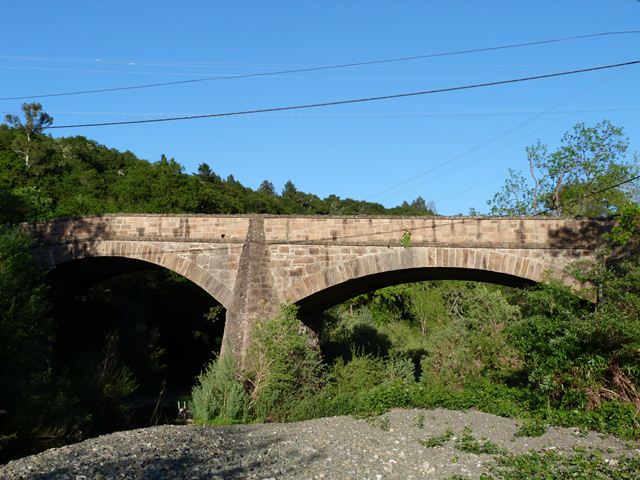
Among California counties, Napa County stands out for its unusually large collection of beautiful historic stone arch bridges. However, many of them have fairly small spans and are usually two or less spans in total. Most also date to after 1900. As such, this 1894 three span stone arch bridge with a comparatively tall 50 foot span stands out among the collection as one of the most significant. The bridge retains excellent historic integrity with one exception. Layers of asphalt have been applied to the deck. When this was done, no attention was paid to the location of the builder plaque on the bridge. The asphalt today extends to above the bottom of the plaque. Worse, the asphalt was poured right up against the plaque, sealing away an unknown amount of the plaque. One of the most important pieces of information on the plaque was half covered up by this careless and insensitive action, which is the name of the contractor. This whole issue could have at minimum been avoided by simply leaving a small gap between the plaque and the asphalt so at least people could read what the plaque said. This would also avoid the potentially irreversible damage possibly caused by jamming a bunch of hot tar up against the plaque. It is sad to see that something as simple as keeping the asphalt away from the plaque was not a priority for one of the finest stone bridges in Napa County.
![]()
Photo Galleries and Videos: Pope Street Bridge
Bridge Photo-Documentation
Original / Full Size PhotosA collection of overview and detail photos. This gallery offers photos in the highest available resolution and file size in a touch-friendly popup viewer.
Alternatively, Browse Without Using Viewer
![]()
Bridge Photo-Documentation
Mobile Optimized PhotosA collection of overview and detail photos. This gallery features data-friendly, fast-loading photos in a touch-friendly popup viewer.
Alternatively, Browse Without Using Viewer
![]()
Maps and Links: Pope Street Bridge
Coordinates (Latitude, Longitude):
Search For Additional Bridge Listings:
Bridgehunter.com: View listed bridges within 0.5 miles (0.8 kilometers) of this bridge.
Bridgehunter.com: View listed bridges within 10 miles (16 kilometers) of this bridge.
Additional Maps:
Google Streetview (If Available)
GeoHack (Additional Links and Coordinates)
Apple Maps (Via DuckDuckGo Search)
Apple Maps (Apple devices only)
Android: Open Location In Your Map or GPS App
Flickr Gallery (Find Nearby Photos)
Wikimedia Commons (Find Nearby Photos)
Directions Via Sygic For Android
Directions Via Sygic For iOS and Android Dolphin Browser
USGS National Map (United States Only)
Historical USGS Topo Maps (United States Only)
Historic Aerials (United States Only)
CalTopo Maps (United States Only)

