We Recommend:
Bach Steel - Experts at historic truss bridge restoration.
BridgeHunter.com Phase 1 is released to the public! - Visit Now
Griswold Road Bridge

Primary Photographer(s): Nathan Holth
Bridge Documented: March 1991, 2003 - Spring 2007, and November 17, 2019
Rural: St. Clair County, Michigan: United States
1925 By Builder/Contractor: Unknown and Engineer/Design: Michigan State Highway Department
Not Available or Not Applicable
84.0 Feet (25.6 Meters)
90.0 Feet (27.4 Meters)
22 Feet (6.71 Meters)
1 Main Span(s)
77200026000B040

View Information About HSR Ratings
Bridge Documentation
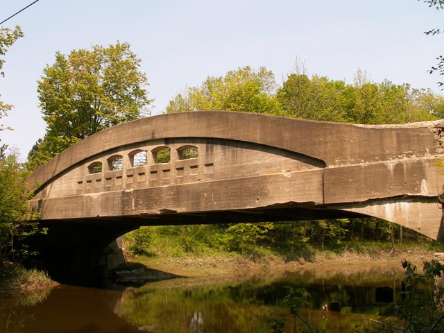
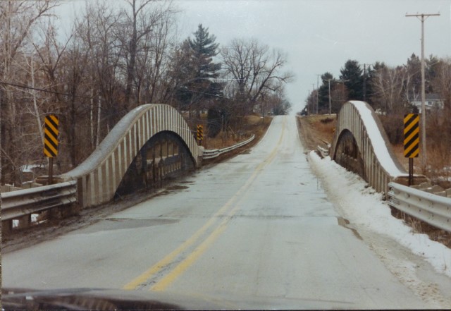
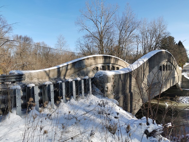
This bridge is in a small valley and you do not see it until you are on top of it, and it is a welcome surprise. It is an example of Michigan's unique curved-chord through girder bridge. Built to the 90 foot plan style, this bridge has the characteristic taller girder than shorter plans. The curved portion of the girders have vertical stripes painted on them all the way across. The reasoning for these stripes is unclear, perhaps it is decorative, or it could be some sort of old reflecting paint that has long since faded. The bridge deck appears to have been resurfaced, perhaps when the rest of this section of Griswold Road was redone. The girders of the bridge are a sad sight, however. The concrete is spalling severely in several spots. This is still an interesting bridge, and it is be one tough bridge, because there is no weight limit posted despite this deterioration! The repair of the deck was a nice gesture, but without repairing the beautiful girders, which give the bridge both historic and aesthetic value, there is not much point. Even with these repairs, the bridge continues to deteriorate visually. The bridge should have been restored like the 7 Mile Road Bridge, which included adding concrete to spalled areas, paying attention to the original shape and design of the girder, and also applying a protective paint on the girders.
The Griswold Road Bridge appears to have replaced a metal truss bridge. The remains of steel caissons still sit under the bridge today. In 1925, when this bridge was built, the truss bridge would have been considered anything but historic at that time. There also was another metal truss bridge on Griswold Road west of this bridge, but it was demolished and replaced in 1990.
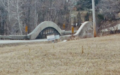
The below two photos of the bridge are special because they were taken in March, 1991 with a film camera twelve years before this website was created. Note that the vertical stripes were still on the bridge, and were much more visible.
View Archived National Bridge Inventory Report - Has Additional Details and Evaluation
Learn about Michigan's Unique Concrete Camelback Bridges
This bridge is tagged with the following special condition(s): Unorganized Photos
![]()
Photo Galleries and Videos: Griswold Road Bridge
Bridge Photo-Documentation
A collection of overview and detail photos. This photo gallery contains a combination of Original Size photos and Mobile Optimized photos in a touch-friendly popup viewer.Alternatively, Browse Without Using Viewer
![]()
2019 Additional Unorganized Photos
Original / Full Size PhotosA supplemental collection of photos that are from additional visit(s) to the bridge and have not been organized or captioned. This gallery offers photos in the highest available resolution and file size in a touch-friendly popup viewer.
Alternatively, Browse Without Using Viewer
![]()
2019 Additional Unorganized Photos
Mobile Optimized PhotosA supplemental collection of photos that are from additional visit(s) to the bridge and have not been organized or captioned. This gallery features data-friendly, fast-loading photos in a touch-friendly popup viewer.
Alternatively, Browse Without Using Viewer
![]()
Maps and Links: Griswold Road Bridge
Coordinates (Latitude, Longitude):
Search For Additional Bridge Listings:
Bridgehunter.com: View listed bridges within 0.5 miles (0.8 kilometers) of this bridge.
Bridgehunter.com: View listed bridges within 10 miles (16 kilometers) of this bridge.
Additional Maps:
Google Streetview (If Available)
GeoHack (Additional Links and Coordinates)
Apple Maps (Via DuckDuckGo Search)
Apple Maps (Apple devices only)
Android: Open Location In Your Map or GPS App
Flickr Gallery (Find Nearby Photos)
Wikimedia Commons (Find Nearby Photos)
Directions Via Sygic For Android
Directions Via Sygic For iOS and Android Dolphin Browser
USGS National Map (United States Only)
Historical USGS Topo Maps (United States Only)
Historic Aerials (United States Only)
CalTopo Maps (United States Only)


