

View Information About HSR Ratings
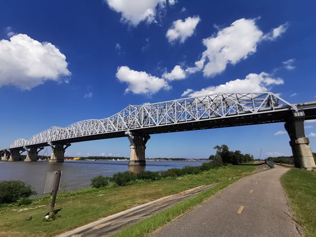
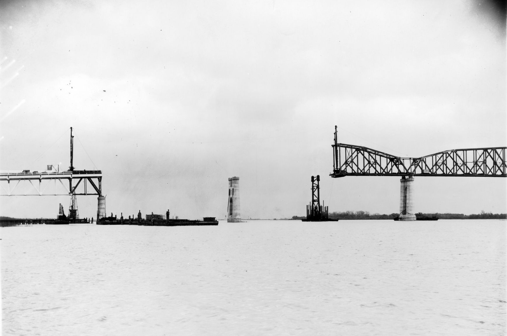
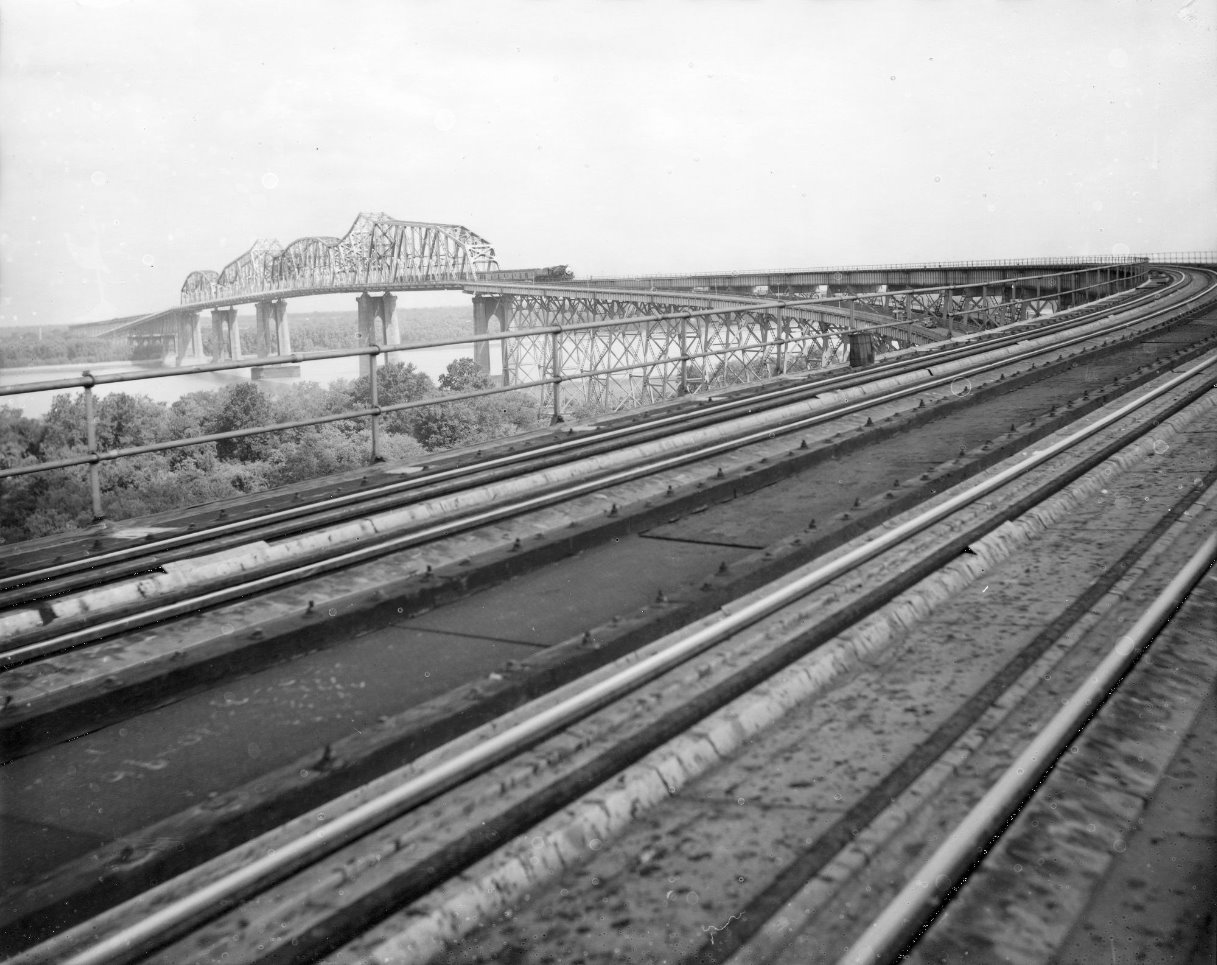
This immense bridge is a unique structure that is only more unique following a major widening project completed in 2013. As originally designed, the three span cantilever bridge consisted of two 529 foot anchor arms, a 790 foot navigation span consisting of two 145 foot cantilever arms and one 500 foot suspended span, which has a Pennsylvania truss configuration. An additional 528 foot simple through truss span, also a Pennsylvania truss, was present immediately to the north of the cantilever truss spans. This simple span was constructed by the cantilever method, using a temporary tie to the cantilever unit. American Bridge Company fabricated and erected the 1,850 foot cantilever truss unit in only 10 months. McClintic Marshall constructed the approach spans. As originally designed, railroad traffic flowed between the two truss lines of the through truss, while highway traffic flowed on cantilevered decks on either side of the truss. A long, curving approach system of deck plate girders and deck trusses (for the railroad approach) were also present. Because trains require a much more shallow grade than highway traffic, the railroad approach soared over the approach ramps for the highway deck, with the railroad approach extending far beyond before touching down to ground level. The widening project for this bridge was unique. A truss line was added to each side of the original truss to eliminate the cantilevered deck, and instead create two highway decks, each supported by one new truss line and one of the original truss lines. In short, what was originally a bridge with two truss lines is now a bridge with four truss lines. The new trusses replicate the shape and truss configuration of the historic trusses, however as modern trusses, they lack rivets and lattice found in the original trusses. Modjeski and Masters, who designed the original bridge, also designed the widening of the bridge.
The railroad approach for this bridge includes Warren deck truss spans (in addition to many deck plate girder spans). The deck truss spans have riveted connections for the top chord, and pin connections for the bottom chord. The original truss lines of the main spans of the bridge are rivet connected, except where eyebars were used near the towers and the ends of the suspended span. The new trusses have modern bolted connections.

Above: Historical photo of bridge construction.

Above: Historical photo of bridge construction.

Above: Historical photo of bridge construction.
Above: Historical photo of bridge construction.

Above: Historical photo of bridge.

Above: Historical photo of bridge.
Above: Historical photo of bridge.

Above: Historical photo of bridge.

Above: Historical photo of bridge.

Historical photo from the US Navy showing the bridge in 2007, prior to widening.

Above: Governor Huey P. Long.
![]()
![]()
![]()
Coordinates (Latitude, Longitude):
Search For Additional Bridge Listings:
Bridgehunter.com: View listed bridges within 0.5 miles (0.8 kilometers) of this bridge.
Bridgehunter.com: View listed bridges within 10 miles (16 kilometers) of this bridge.
Additional Maps:
Google Streetview (If Available)
GeoHack (Additional Links and Coordinates)
Apple Maps (Via DuckDuckGo Search)
Apple Maps (Apple devices only)
Android: Open Location In Your Map or GPS App
Flickr Gallery (Find Nearby Photos)
Wikimedia Commons (Find Nearby Photos)
Directions Via Sygic For Android
Directions Via Sygic For iOS and Android Dolphin Browser
USGS National Map (United States Only)
Historical USGS Topo Maps (United States Only)
Historic Aerials (United States Only)
CalTopo Maps (United States Only)

© Copyright 2003-2024, HistoricBridges.org. All Rights Reserved. Disclaimer: HistoricBridges.org is a volunteer group of private citizens. HistoricBridges.org is NOT a government agency, does not represent or work with any governmental agencies, nor is it in any way associated with any government agency or any non-profit organization. While we strive for accuracy in our factual content, HistoricBridges.org offers no guarantee of accuracy. Information is provided "as is" without warranty of any kind, either expressed or implied. Information could include technical inaccuracies or errors of omission. Opinions and commentary are the opinions of the respective HistoricBridges.org member who made them and do not necessarily represent the views of anyone else, including any outside photographers whose images may appear on the page in which the commentary appears. HistoricBridges.org does not bear any responsibility for any consequences resulting from the use of this or any other HistoricBridges.org information. Owners and users of bridges have the responsibility of correctly following all applicable laws, rules, and regulations, regardless of any HistoricBridges.org information.
![]()