

View Information About HSR Ratings
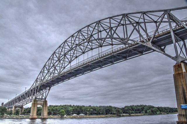
This is one of two similar bridges of very beautiful design over this canal. Unlike the nearby Sagamore Bridge, this bridge was built in a flatter area that required some deck truss approach spans in additional to the main spans. Also of note, original riveted light fixtures remain on this bridge, albeit with modern light equipment attached. Due to time and weather constraints, HistoricBridges.org only performed a walkover of the Sagamore Bridge's identical main through truss structure, so please visit that bridge's page for additional on-bridge detail photos of structural details matching those of this bridge. This bridge won a Class A Prize Bridge award from the AISC for its beauty when it was completed.
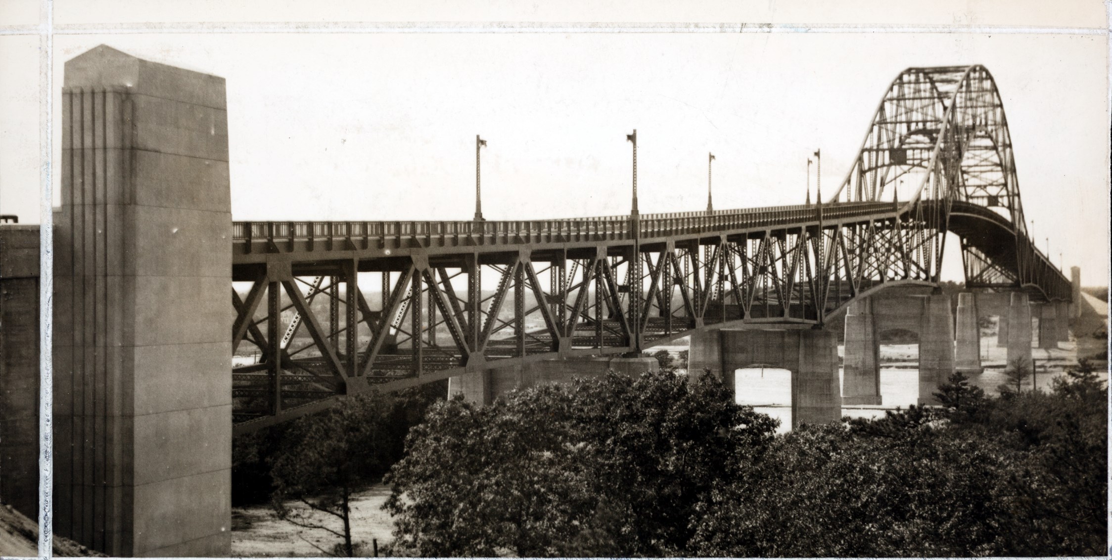
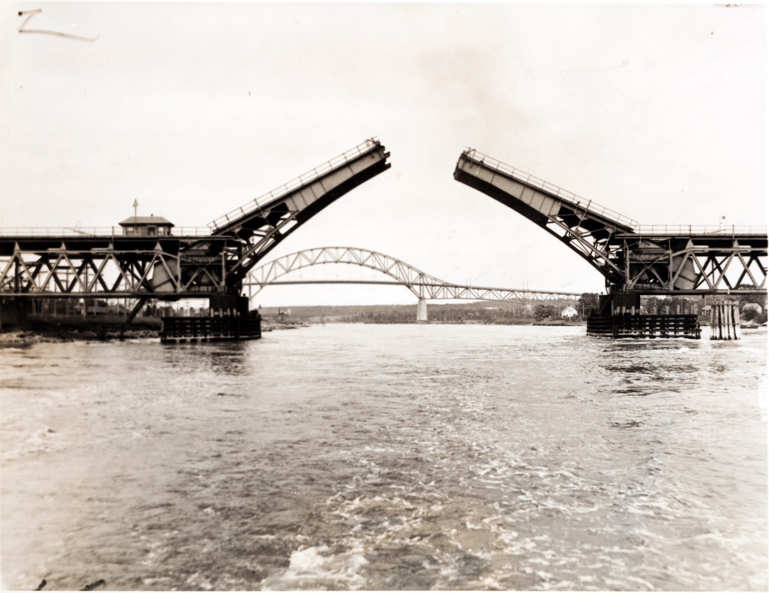
Historical photos below are from the Nina Heald Webber Cape Cod Canal collection.
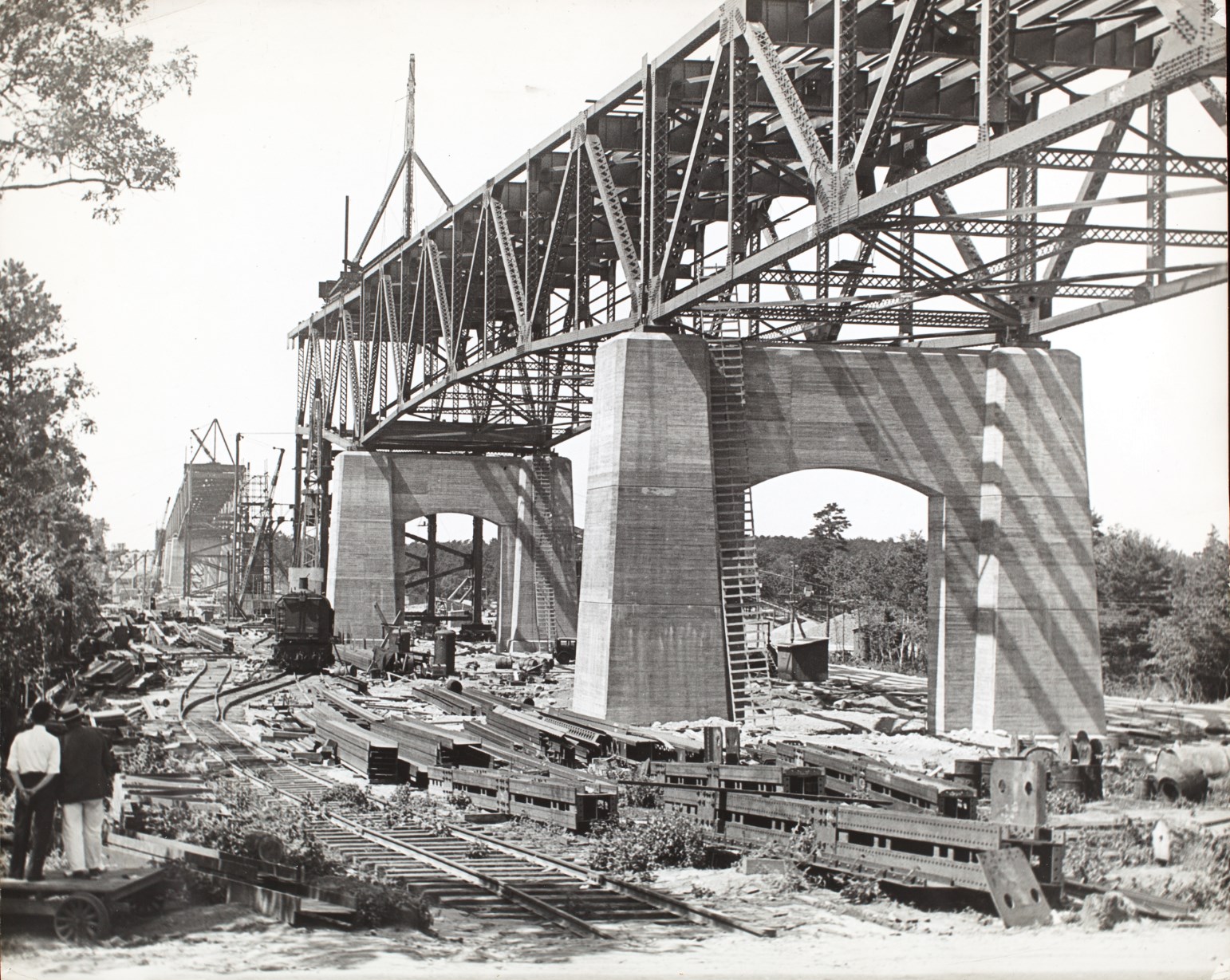
Above: Historical photo showing bridge construction.

Above: Historical photo showing bridge construction.

Above: Historical photo showing newly completed bridge.
Above: Historical photo showing newly completed bridge.

Above: Historical photo showing construction of one of the two similar previous bascule bridges that were located at Sagamore and Bourne.

Above: Historical photo showing previous bascule bridge at location.
Above: Historical photo showing previous bascule bridge at location.
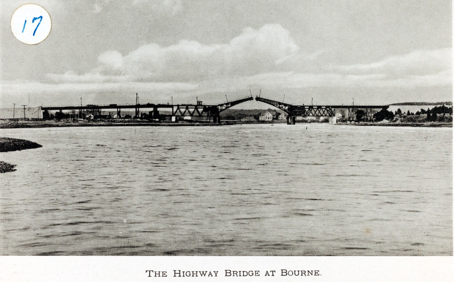
Above: Historical photo showing previous bascule bridge at location.
![]()
![]()
![]()
Coordinates (Latitude, Longitude):
Search For Additional Bridge Listings:
Bridgehunter.com: View listed bridges within 0.5 miles (0.8 kilometers) of this bridge.
Bridgehunter.com: View listed bridges within 10 miles (16 kilometers) of this bridge.
Additional Maps:
Google Streetview (If Available)
GeoHack (Additional Links and Coordinates)
Apple Maps (Via DuckDuckGo Search)
Apple Maps (Apple devices only)
Android: Open Location In Your Map or GPS App
Flickr Gallery (Find Nearby Photos)
Wikimedia Commons (Find Nearby Photos)
Directions Via Sygic For Android
Directions Via Sygic For iOS and Android Dolphin Browser
USGS National Map (United States Only)
Historical USGS Topo Maps (United States Only)
Historic Aerials (United States Only)
CalTopo Maps (United States Only)

© Copyright 2003-2024, HistoricBridges.org. All Rights Reserved. Disclaimer: HistoricBridges.org is a volunteer group of private citizens. HistoricBridges.org is NOT a government agency, does not represent or work with any governmental agencies, nor is it in any way associated with any government agency or any non-profit organization. While we strive for accuracy in our factual content, HistoricBridges.org offers no guarantee of accuracy. Information is provided "as is" without warranty of any kind, either expressed or implied. Information could include technical inaccuracies or errors of omission. Opinions and commentary are the opinions of the respective HistoricBridges.org member who made them and do not necessarily represent the views of anyone else, including any outside photographers whose images may appear on the page in which the commentary appears. HistoricBridges.org does not bear any responsibility for any consequences resulting from the use of this or any other HistoricBridges.org information. Owners and users of bridges have the responsibility of correctly following all applicable laws, rules, and regulations, regardless of any HistoricBridges.org information.
![]()