

View Information About HSR Ratings

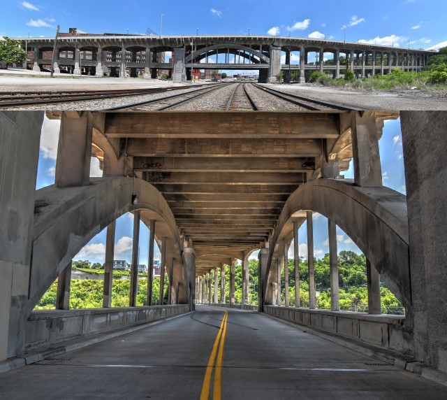
This bridge is historically significant on several levels. It was an early example of a large-scale concrete bridge. While smaller concrete bridges were being built in substantial numbers at the time this bridge was built, it was rare for a large viaduct like this to be constructed of concrete. The bridge is notable for its design by the prestigious engineering firm Waddell and Harrington. Lastly, the bridge's double deck design adds to the significant design of the bridge. In particular, the bridge's main span over the railroad tracks, which is a concrete arch, is very unique on account of the double-deck design, with the lower deck passing through the arch.

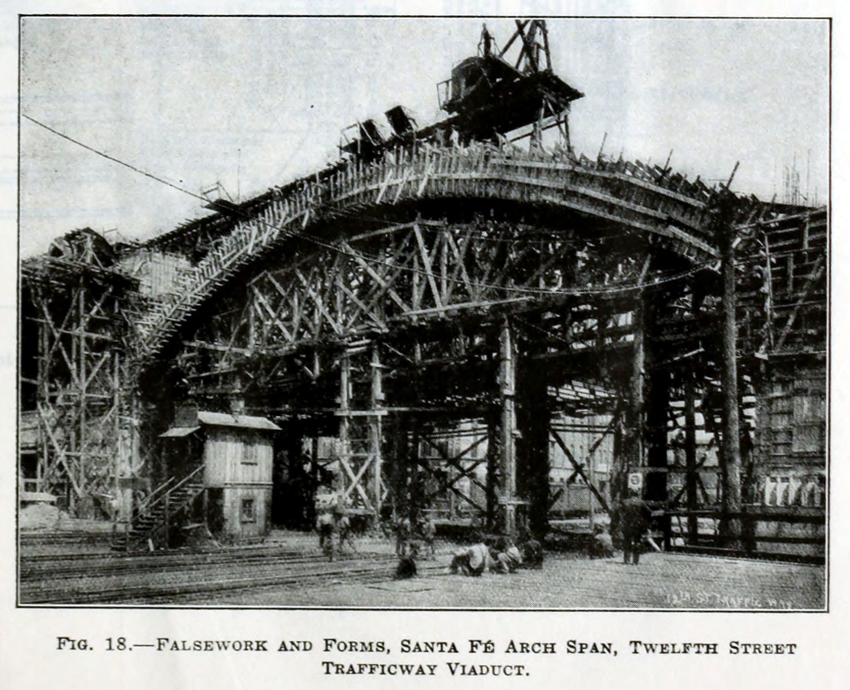
Above: This drawing from the Transactions of the American Society of Civil Engineers shows the way the falsework for the arch span was set up so as to not disrupt the trains below.

Above: Historical photos showing bridge construction.
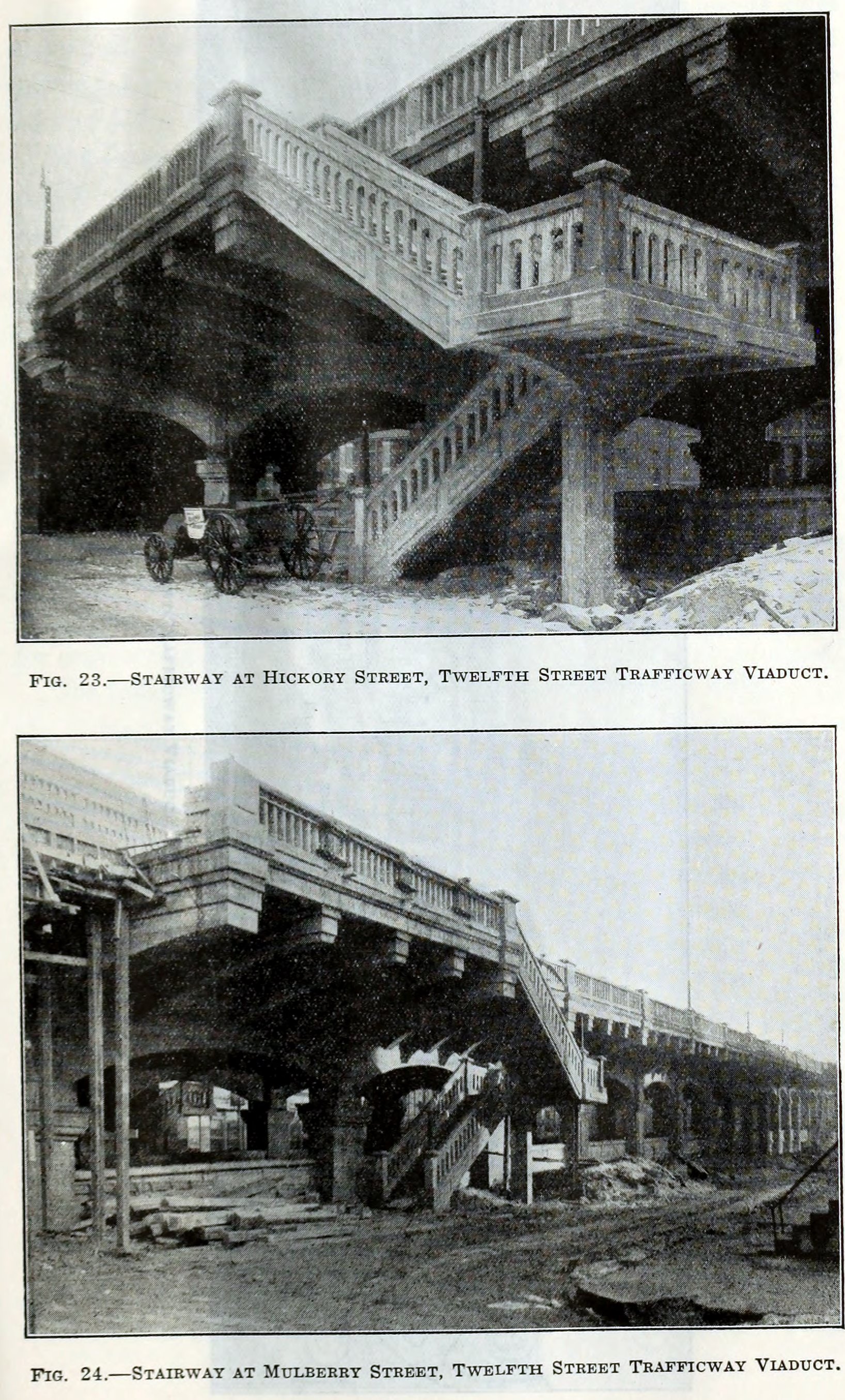
Above: These photos show the stairway which no longer exists today.

This bridge is tagged with the following special condition(s): Double-Deck
![]()
![]()
![]()
Coordinates (Latitude, Longitude):
Search For Additional Bridge Listings:
Bridgehunter.com: View listed bridges within 0.5 miles (0.8 kilometers) of this bridge.
Bridgehunter.com: View listed bridges within 10 miles (16 kilometers) of this bridge.
Additional Maps:
Google Streetview (If Available)
GeoHack (Additional Links and Coordinates)
Apple Maps (Via DuckDuckGo Search)
Apple Maps (Apple devices only)
Android: Open Location In Your Map or GPS App
Flickr Gallery (Find Nearby Photos)
Wikimedia Commons (Find Nearby Photos)
Directions Via Sygic For Android
Directions Via Sygic For iOS and Android Dolphin Browser
USGS National Map (United States Only)
Historical USGS Topo Maps (United States Only)
Historic Aerials (United States Only)
CalTopo Maps (United States Only)

© Copyright 2003-2024, HistoricBridges.org. All Rights Reserved. Disclaimer: HistoricBridges.org is a volunteer group of private citizens. HistoricBridges.org is NOT a government agency, does not represent or work with any governmental agencies, nor is it in any way associated with any government agency or any non-profit organization. While we strive for accuracy in our factual content, HistoricBridges.org offers no guarantee of accuracy. Information is provided "as is" without warranty of any kind, either expressed or implied. Information could include technical inaccuracies or errors of omission. Opinions and commentary are the opinions of the respective HistoricBridges.org member who made them and do not necessarily represent the views of anyone else, including any outside photographers whose images may appear on the page in which the commentary appears. HistoricBridges.org does not bear any responsibility for any consequences resulting from the use of this or any other HistoricBridges.org information. Owners and users of bridges have the responsibility of correctly following all applicable laws, rules, and regulations, regardless of any HistoricBridges.org information.
![]()