

View Information About HSR Ratings
This bridge was built by a notable bridge builder and also had an attractive abutment railing design.
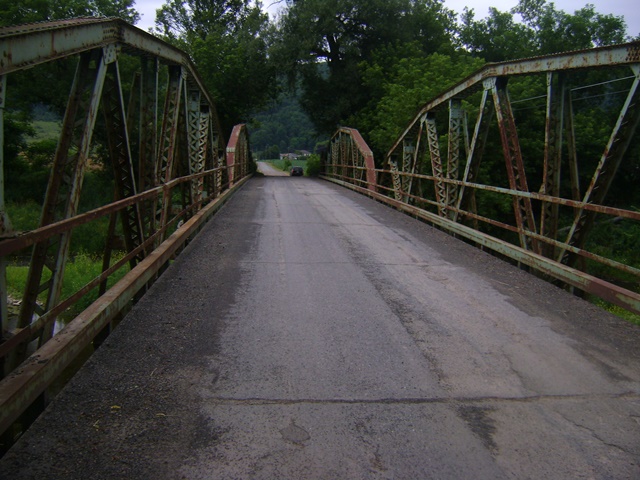
Information and Findings From Pennsylvania's Historic Bridge InventoryDiscussion of Bridge The 2-span, 175' long, riveted Warren with verticals and polygonal upper chords pony truss bridge was fabricated in 1917. It is supported on an ashlar cutwater pier and abutments with flared wingwalls, and the wingwalls are topped with reticulated-pattern balustrades. The trusses are traditionally composed and have no innovative or distinctive features. The outriggers are original. The bridge is complete, but it is not an early example of its type/design, which was common throughout the state by 1910. Neither the bridge nor its setting are historically or technologically significant. Discussion of Surrounding Area The bridge carries one lane of a township road over a stream in a sparsely developed, forested and agricultural setting that also has scattered modern houses. There are tilled fields in the flood plain on both sides of the river. Bridge Considered Historic By Survey: No, But Later Found Eligible |
This bridge is tagged with the following special condition(s): Unorganized Photos
![]()
![]()
![]()
This historic bridge has been demolished. This map is shown for reference purposes only.
Coordinates (Latitude, Longitude):
Search For Additional Bridge Listings:
Bridgehunter.com: View listed bridges within 0.5 miles (0.8 kilometers) of this bridge.
Bridgehunter.com: View listed bridges within 10 miles (16 kilometers) of this bridge.
Additional Maps:
Google Streetview (If Available)
GeoHack (Additional Links and Coordinates)
Apple Maps (Via DuckDuckGo Search)
Apple Maps (Apple devices only)
Android: Open Location In Your Map or GPS App
Flickr Gallery (Find Nearby Photos)
Wikimedia Commons (Find Nearby Photos)
Directions Via Sygic For Android
Directions Via Sygic For iOS and Android Dolphin Browser
USGS National Map (United States Only)
Historical USGS Topo Maps (United States Only)
Historic Aerials (United States Only)
CalTopo Maps (United States Only)

© Copyright 2003-2024, HistoricBridges.org. All Rights Reserved. Disclaimer: HistoricBridges.org is a volunteer group of private citizens. HistoricBridges.org is NOT a government agency, does not represent or work with any governmental agencies, nor is it in any way associated with any government agency or any non-profit organization. While we strive for accuracy in our factual content, HistoricBridges.org offers no guarantee of accuracy. Information is provided "as is" without warranty of any kind, either expressed or implied. Information could include technical inaccuracies or errors of omission. Opinions and commentary are the opinions of the respective HistoricBridges.org member who made them and do not necessarily represent the views of anyone else, including any outside photographers whose images may appear on the page in which the commentary appears. HistoricBridges.org does not bear any responsibility for any consequences resulting from the use of this or any other HistoricBridges.org information. Owners and users of bridges have the responsibility of correctly following all applicable laws, rules, and regulations, regardless of any HistoricBridges.org information.
![]()