
View Information About HSR Ratings
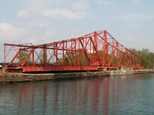
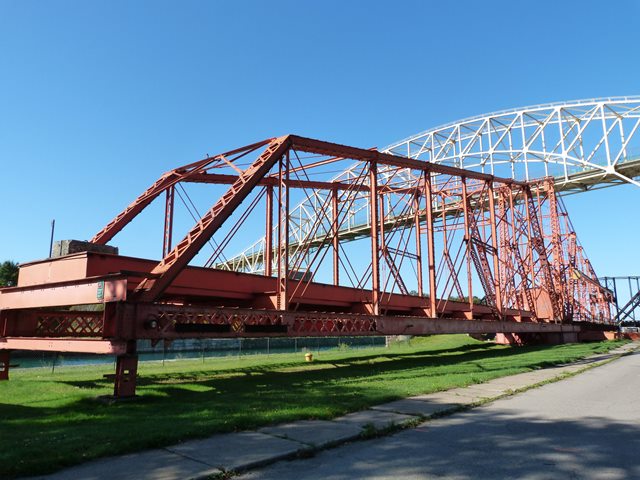
This Emergency Swing Dam has global significance as the last remaining structure of its kind in the world, a bridge-like dam that can swing out over the water, and lower wickets and shutters down into the water to reduce the flow of water. Although this bridge has only been called into service once, the bridge proved that one time to be a valuable asset. If a boat breaks the locks and releases torrents of water, this dam allows for a temporary slowing of that water flow so that the locks can be repaired and closed once again.
This is not a bridge in the sense that it was not built to facilitate the crossing of something. However, that is where the dissociation with the word "bridge" ends. This structure is in terms of design a swing truss bridge, and for that reason it appears on this website as one of the finest and most unusual bridge structures in Canada. It was built in 1896 by the Dominion Bridge Company, which was based in Lachine, which is part of Montreal, Quebec. This company also built the nearby fixed spans of the International Railroad Bridge, according to builder plaques on that structure.
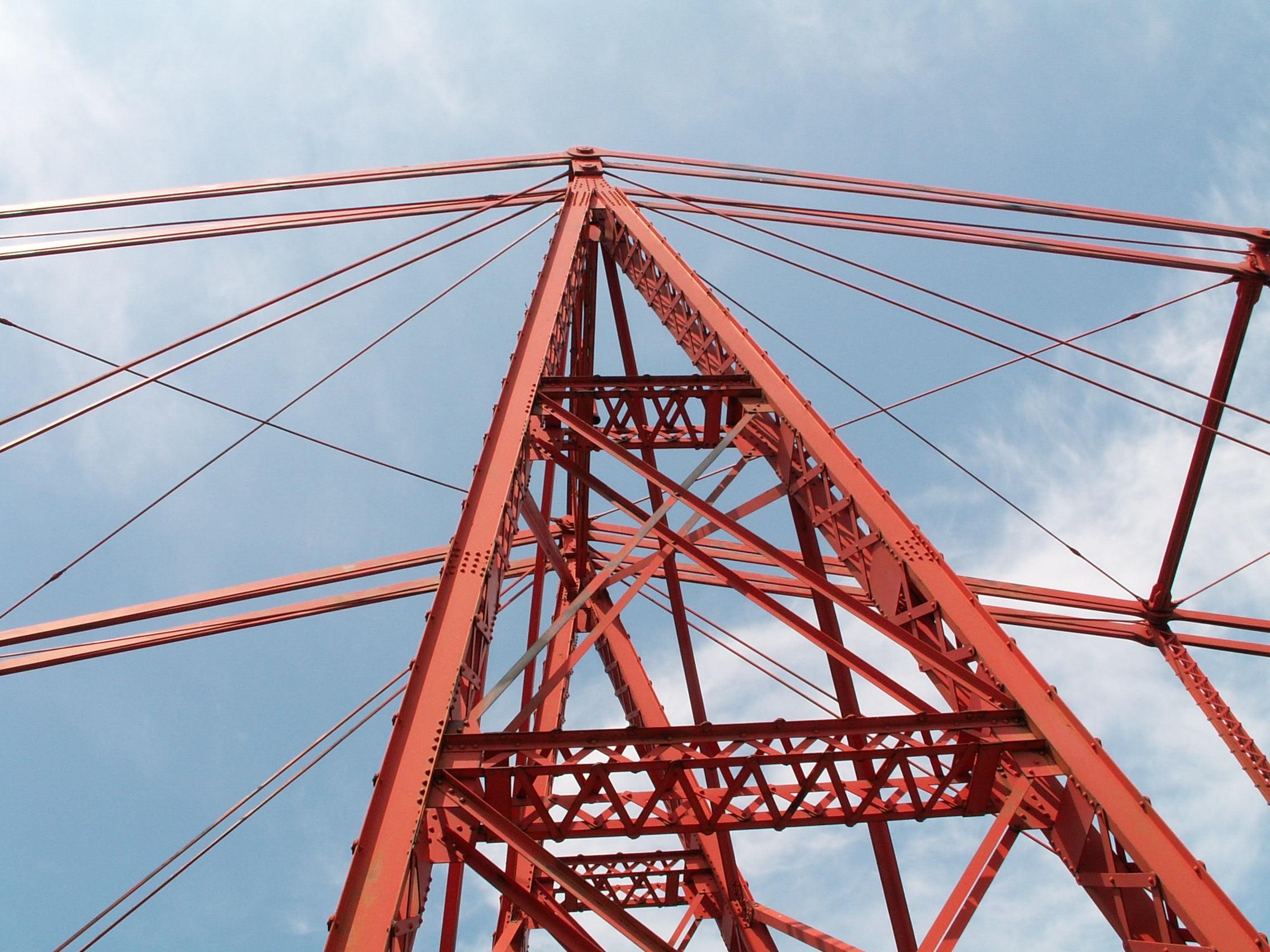
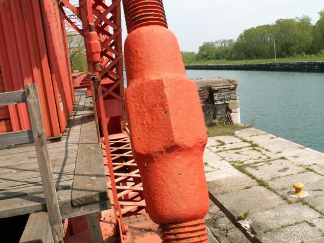
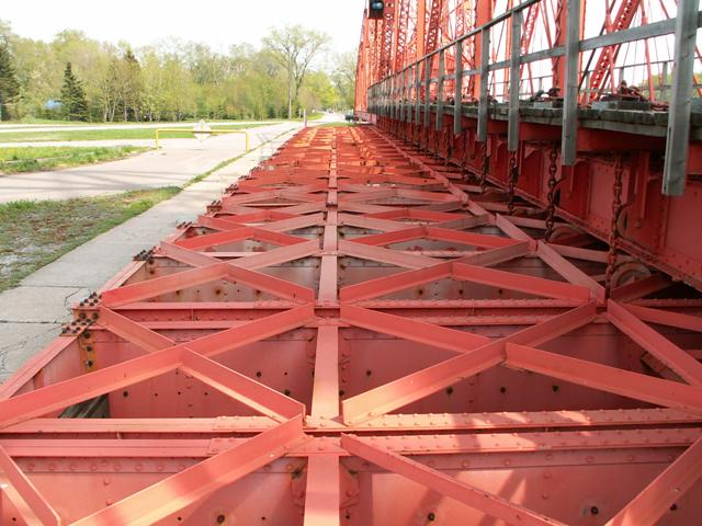
The Emergency Swing Dam features a Baltimore style truss configuration. Most connections are pinned, although some are riveted. Compression members on the bridge are built-up with substantial v-lacing and lattice used. There are an unusually large number of different steel mill stamps on this bridge including some from the U.K. There are Carnegie stamps, Burbach stamps, Consett stamps, and finally a mark reading "A.H.A.V. 1891" to me. The 1891 might refer to some sort of patent date, or when the iron was actually rolled at the mill. The bridge itself was erected in 1896.
The bridge retains a high degree of historic integrity, with some exceptions. The deck beams are huge on this bridge and are likely not original. Nor is machinery house, which houses the motor and other machinery. Also, some floor beams have steel welded to them and to some rollers below that handle the chain. This apparently was to strengthen the rollers. There is a weird i-beam that runs the length of the east side of the bridge and is attached to a weird arrangement of bracing in front of the portal bracing. All of this is riveted, but it does not look like it fits in although it appears to be original anyway. It is definitely old, and is visible in a 1909 historic photograph. The bridge has been maintained very well, and there is no major structural deterioration. It is good to see this wonderful structure being maintained for future generations. The informative sign near the bridge shows that Ontario is indeed recognizing the historic nature of it and wants to help educate the public about this bridges fascinating history and operation.
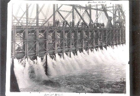
This bridge was only used once, way back in June 9, 1909.
The Accident at the Canadian Canal, Sault Ste. Marie, Ontario, 1909There was a major accident on June 9, 1909 at the
Sault Canal. Downbound from Lake Superior, the Canadian passenger vessel
Assiniboia was waiting in the lock at the Sault to be lowered to the
Lake Huron level of the St. Marys River. Behind the Assiniboia, the
Pittsburg Steamship Company's steamer Crescent City was just entering
the lock. Captain Frank Rice was asked to lock down with the Canadian
Pacific passenger vessel Assiniboia.
Above: View of the damage to the locks.
Above: View of the swing dam in operation. Excerpts taken from: |
This bridge is tagged with the following special condition(s): Unorganized Photos
![]()
![]()
![]()
![]()
![]()
![]()
![]()
Coordinates (Latitude, Longitude):
Search For Additional Bridge Listings:
Additional Maps:
Google Streetview (If Available)
GeoHack (Additional Links and Coordinates)
Apple Maps (Via DuckDuckGo Search)
Apple Maps (Apple devices only)
Android: Open Location In Your Map or GPS App
Flickr Gallery (Find Nearby Photos)
Wikimedia Commons (Find Nearby Photos)
Directions Via Sygic For Android
Directions Via Sygic For iOS and Android Dolphin Browser

© Copyright 2003-2024, HistoricBridges.org. All Rights Reserved. Disclaimer: HistoricBridges.org is a volunteer group of private citizens. HistoricBridges.org is NOT a government agency, does not represent or work with any governmental agencies, nor is it in any way associated with any government agency or any non-profit organization. While we strive for accuracy in our factual content, HistoricBridges.org offers no guarantee of accuracy. Information is provided "as is" without warranty of any kind, either expressed or implied. Information could include technical inaccuracies or errors of omission. Opinions and commentary are the opinions of the respective HistoricBridges.org member who made them and do not necessarily represent the views of anyone else, including any outside photographers whose images may appear on the page in which the commentary appears. HistoricBridges.org does not bear any responsibility for any consequences resulting from the use of this or any other HistoricBridges.org information. Owners and users of bridges have the responsibility of correctly following all applicable laws, rules, and regulations, regardless of any HistoricBridges.org information.
![]()