

View Information About HSR Ratings
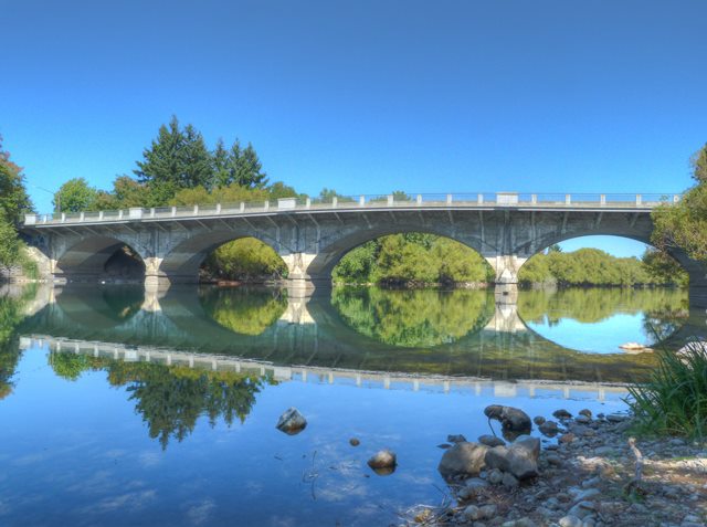
This is a concrete arch that was built in 1909. As such, it is an early surviving concrete arch bridge in Washington State that is further noted for its lack of alteration. The sidewalk is cantilevered out from the arches, and contains an unusual railing that has concrete posts and metal railing panels. Metal railings are somewhat uncommon to see on a concrete arch bridge. They are however original as shown in historical photos. The only alteration was the addition of a metal pipe to the top of the railings.
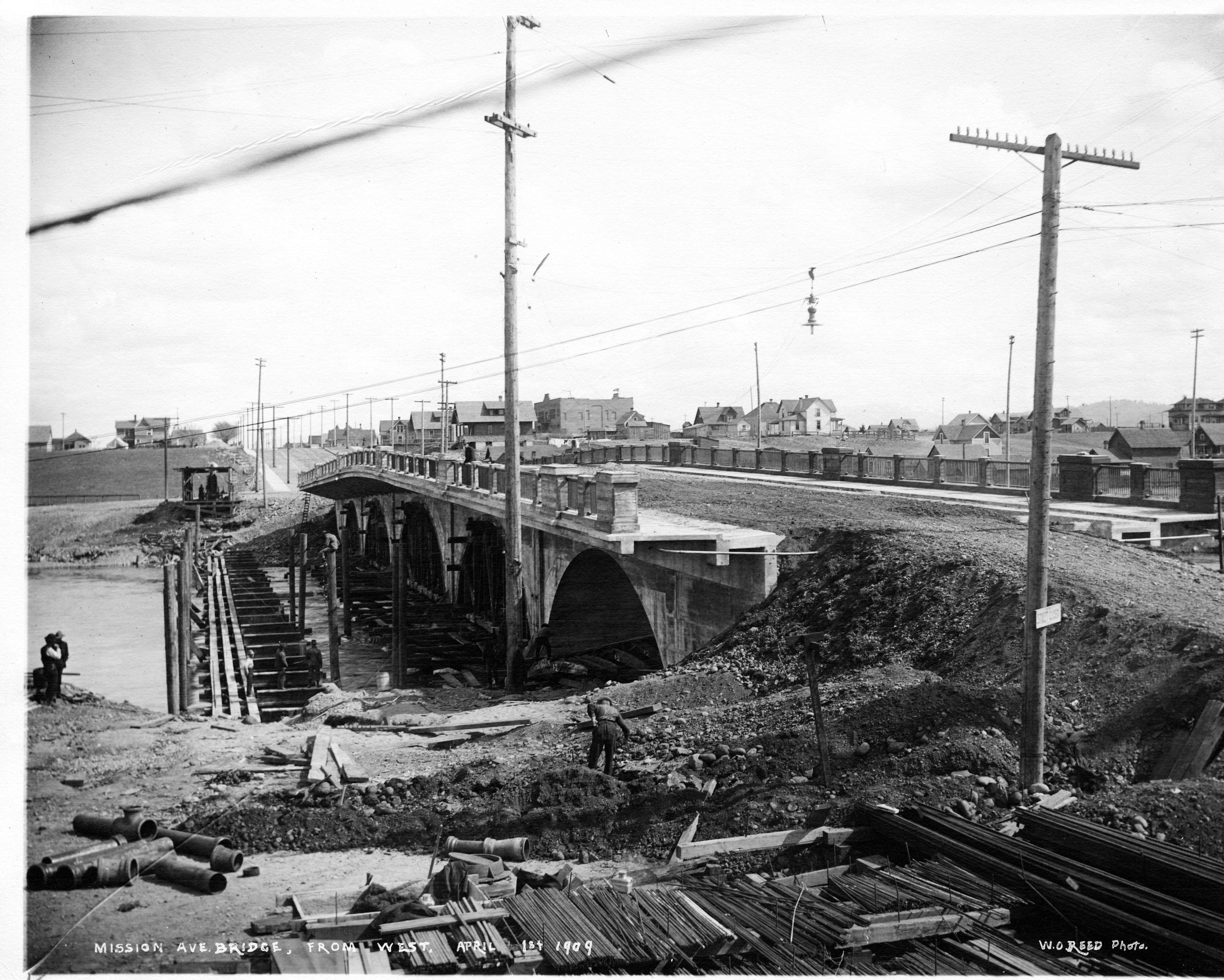
The construction of this bridge was extensively photographed, so in addition to the full collection of present-day photos by HistoricBridges.org in the photo gallery, some of the historical construction photos are shown and described below. Compared to modern bridge construction, these photos effectively convey the vastly different construction methods used to build concrete arch bridges.

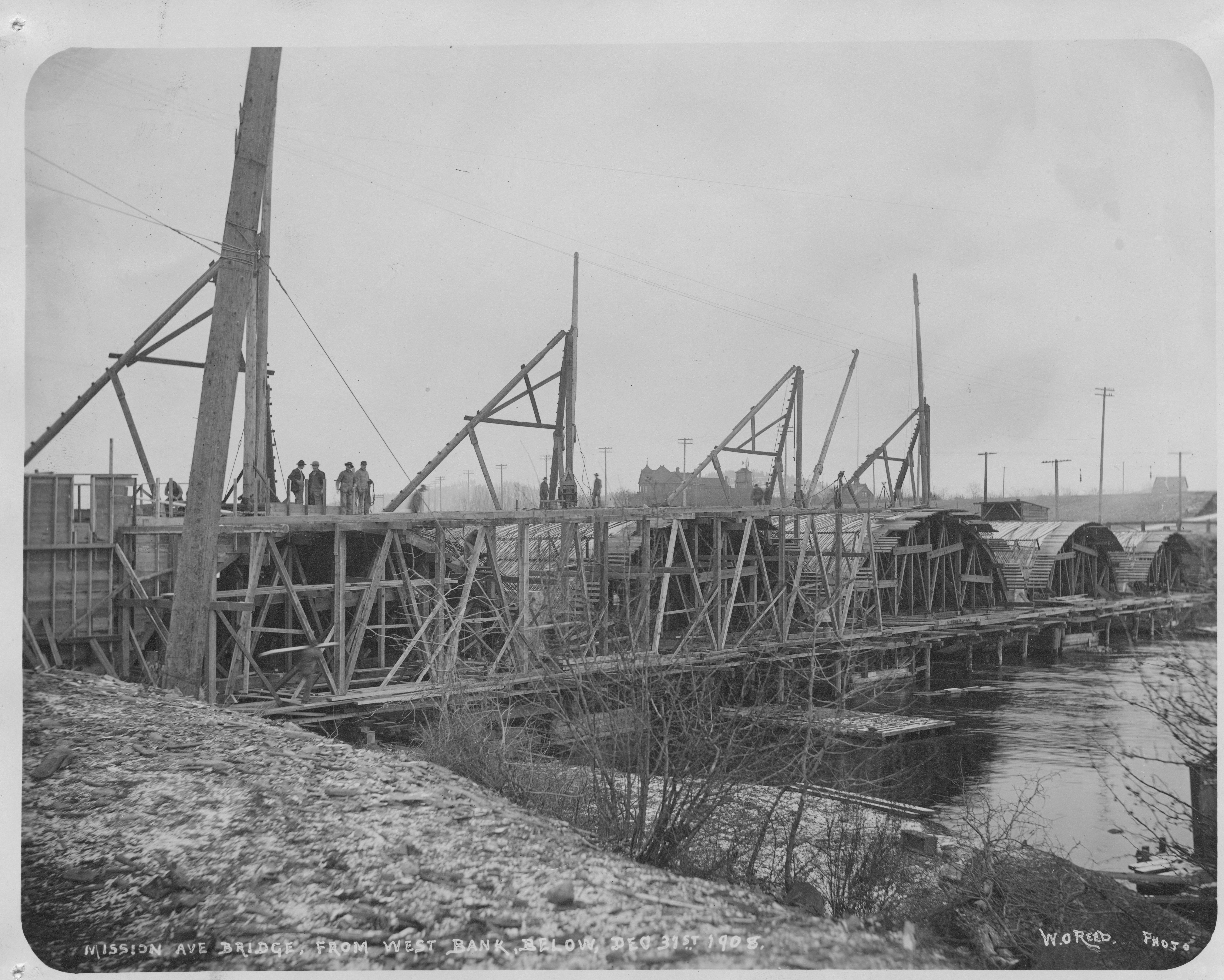
This photo shows initial construction with the previous bridge, which was a wooden through truss bridge visible.


The above photos show the initial construction of the bridge, with equipment used to facilitate construction being assembled and some initial falsework being erected.

The above photo shows the first of the wooden centering (which is the falsework used to erect arch bridges) being erected.

These two photos show the arch centering mostly completed.

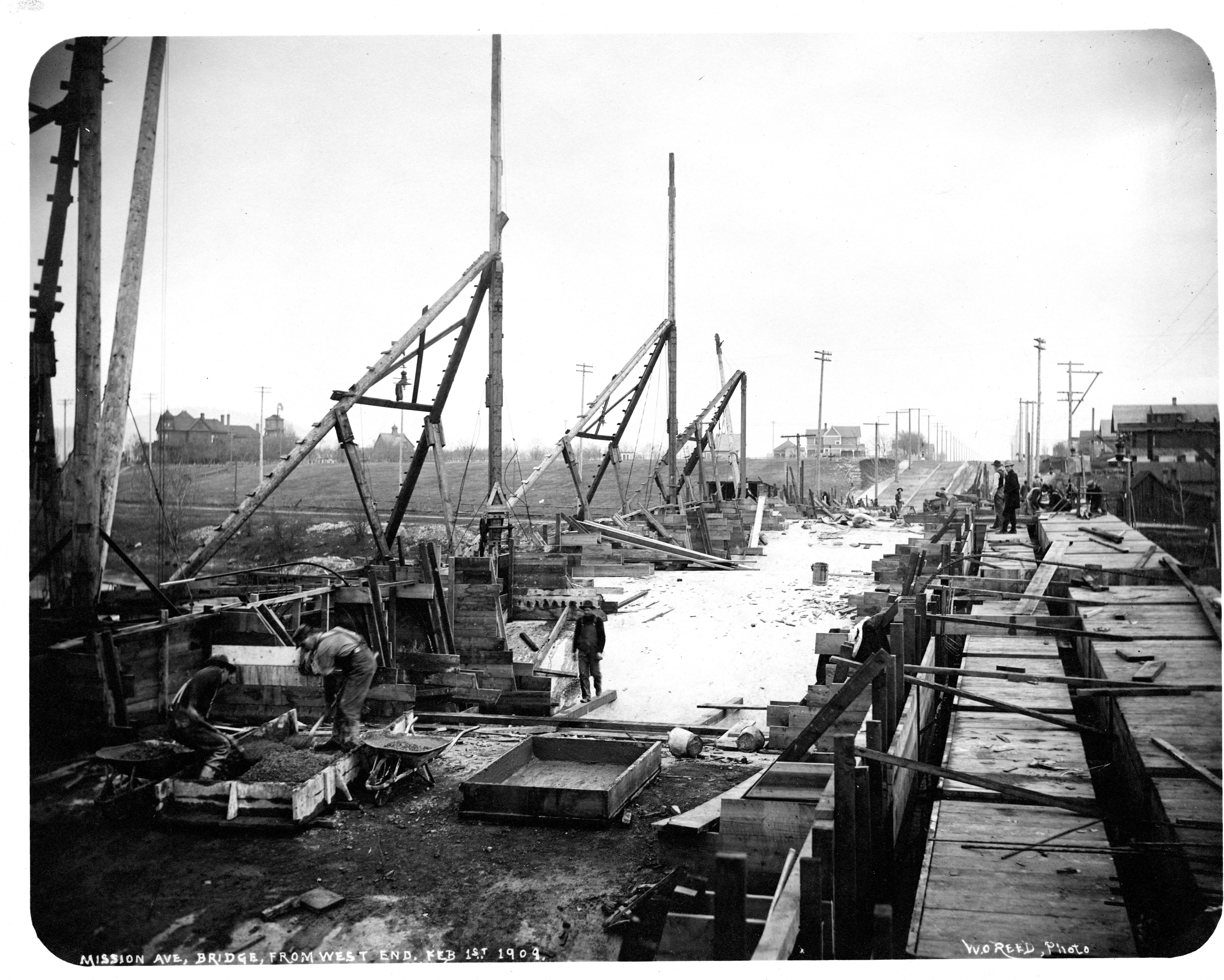
Here, concrete is being (or has been) poured on the centering to form the arches.
Here, the bridge is nearly complete. The earth fill is visible in the vehicular roadway. The concrete deck has yet to be poured.

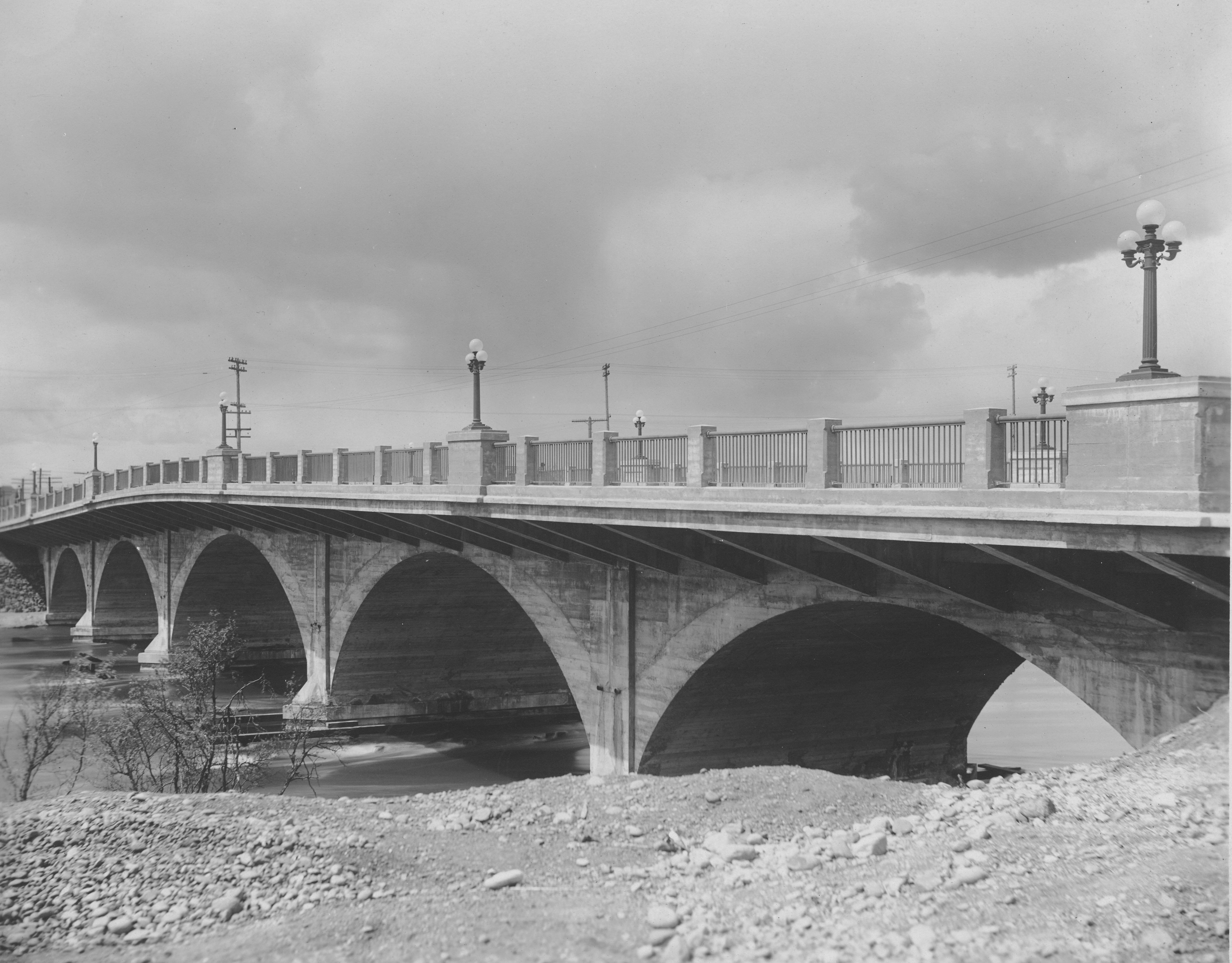
This photo shows the bridge newly completed.
![]()
![]()
![]()
Coordinates (Latitude, Longitude):
Search For Additional Bridge Listings:
Bridgehunter.com: View listed bridges within 0.5 miles (0.8 kilometers) of this bridge.
Bridgehunter.com: View listed bridges within 10 miles (16 kilometers) of this bridge.
Additional Maps:
Google Streetview (If Available)
GeoHack (Additional Links and Coordinates)
Apple Maps (Via DuckDuckGo Search)
Apple Maps (Apple devices only)
Android: Open Location In Your Map or GPS App
Flickr Gallery (Find Nearby Photos)
Wikimedia Commons (Find Nearby Photos)
Directions Via Sygic For Android
Directions Via Sygic For iOS and Android Dolphin Browser
USGS National Map (United States Only)
Historical USGS Topo Maps (United States Only)
Historic Aerials (United States Only)
CalTopo Maps (United States Only)

© Copyright 2003-2024, HistoricBridges.org. All Rights Reserved. Disclaimer: HistoricBridges.org is a volunteer group of private citizens. HistoricBridges.org is NOT a government agency, does not represent or work with any governmental agencies, nor is it in any way associated with any government agency or any non-profit organization. While we strive for accuracy in our factual content, HistoricBridges.org offers no guarantee of accuracy. Information is provided "as is" without warranty of any kind, either expressed or implied. Information could include technical inaccuracies or errors of omission. Opinions and commentary are the opinions of the respective HistoricBridges.org member who made them and do not necessarily represent the views of anyone else, including any outside photographers whose images may appear on the page in which the commentary appears. HistoricBridges.org does not bear any responsibility for any consequences resulting from the use of this or any other HistoricBridges.org information. Owners and users of bridges have the responsibility of correctly following all applicable laws, rules, and regulations, regardless of any HistoricBridges.org information.
![]()