

View Information About HSR Ratings
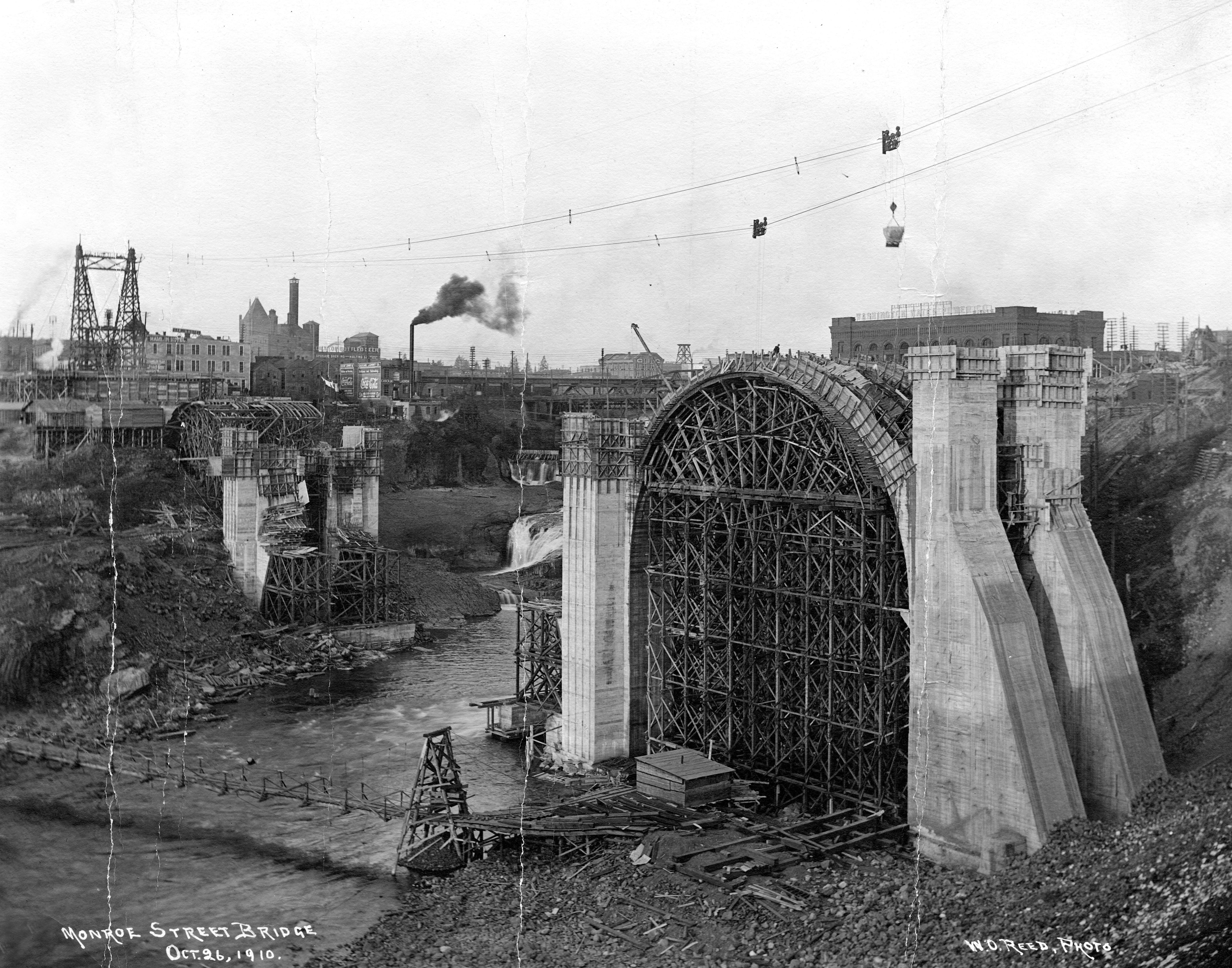
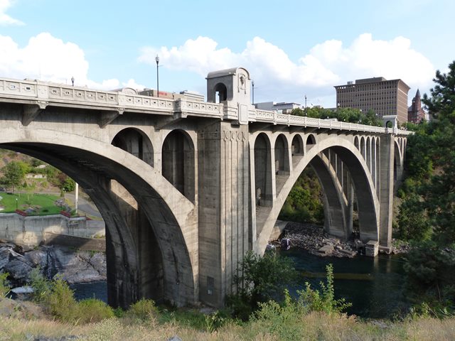
This bridge is along with the Sunset Boulevard Bridge the two largest and most impressive historic concrete arch bridges in Spokane. This bridge at Monroe Street however has, unlike Sunset Boulevard (as of 2014), been heavily altered and suffers from the removal and replacement of large volumes of original bridge material with new material. The only major portions of the bridge that are original are the arch ribs and piers. This is a contrast compared to the nearly unaltered Sunset Boulevard Bridge. That said, the portions of the Monroe Street Bridge that were replaced seem to have been replaced in a manner that attempts to respect the original design and appearance. Most notably, the attractive and unique pavilions over the sidewalk at the pier points of the center span have been carefully replicated including the unique Bison sculptures that give this bridge its one-of-a-kind appearance. Historically, this bridge was also significant for very briefly holding the record for largest concrete arch span in the United States.
Noted architects Cutter and Malmgren designed the aesthetic elements of the bridge. John C. Ralston and Morton McCartney were the main engineers for the bridge, but noted firm Waddell and Harrington also provided design consultation.

![]()
![]()
![]()
Coordinates (Latitude, Longitude):
Search For Additional Bridge Listings:
Bridgehunter.com: View listed bridges within 0.5 miles (0.8 kilometers) of this bridge.
Bridgehunter.com: View listed bridges within 10 miles (16 kilometers) of this bridge.
Additional Maps:
Google Streetview (If Available)
GeoHack (Additional Links and Coordinates)
Apple Maps (Via DuckDuckGo Search)
Apple Maps (Apple devices only)
Android: Open Location In Your Map or GPS App
Flickr Gallery (Find Nearby Photos)
Wikimedia Commons (Find Nearby Photos)
Directions Via Sygic For Android
Directions Via Sygic For iOS and Android Dolphin Browser
USGS National Map (United States Only)
Historical USGS Topo Maps (United States Only)
Historic Aerials (United States Only)
CalTopo Maps (United States Only)

© Copyright 2003-2024, HistoricBridges.org. All Rights Reserved. Disclaimer: HistoricBridges.org is a volunteer group of private citizens. HistoricBridges.org is NOT a government agency, does not represent or work with any governmental agencies, nor is it in any way associated with any government agency or any non-profit organization. While we strive for accuracy in our factual content, HistoricBridges.org offers no guarantee of accuracy. Information is provided "as is" without warranty of any kind, either expressed or implied. Information could include technical inaccuracies or errors of omission. Opinions and commentary are the opinions of the respective HistoricBridges.org member who made them and do not necessarily represent the views of anyone else, including any outside photographers whose images may appear on the page in which the commentary appears. HistoricBridges.org does not bear any responsibility for any consequences resulting from the use of this or any other HistoricBridges.org information. Owners and users of bridges have the responsibility of correctly following all applicable laws, rules, and regulations, regardless of any HistoricBridges.org information.
![]()