We Recommend:
Bach Steel - Experts at historic truss bridge restoration.
Kilburn Road Bridge

Primary Photographer(s): Nathan Holth
Bridge Documented: April 15, 2003 - June 23, 2005
Rural: St. Clair County, Michigan: United States
Not Available or Not Applicable
24.0 Feet (7.3 Meters)
27.0 Feet (8.2 Meters)
24 Feet (7.32 Meters)
1 Main Span(s)
77313H00020B010

View Information About HSR Ratings
Bridge Documentation
This bridge no longer exists!
Bridge Status: This bridge was demolished and replaced in 2011!View Archived National Bridge Inventory Report - Has Additional Details and Evaluation
View Original Plans For This Bridge
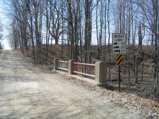
Although this is a small bridge, it appears to retain a great deal of integrity. Despite its small size, this bridge is in better physical condition than the other bridges built with this particular railing design, such as the Masters Road Bridge. The Kilburn Bridge is according to the bridge inventory, much older than Masters Road. The Kilburn Road Bridge was built in 1922, while the Masters Road Bridge was a depression-era construction effort.
The setting of this bridge in the small wooded valley cut by Plum Creek makes this an attractive bridge in a pretty place.
The St. Clair County Road Commission once stated that "trees kill people" as justification for excessive tree removal along road right-of-way. The author of this website having lived in St. Clair County for 18 years never encountered St. Clair County's Trees of Death, nor was an attack by a tree ever witnessed. However, St. Clair County Road Commission does seem to hate trees. Other counties have trees along the road, like Emmet County, which is home to the "tunnel of trees." The below photos showing this bridge's ugly replacement shows that the attractive old bridge was not the only casualty. The area is almost unrecognizable, the entire area immediately around the bridge completely devoid of so much as a shrub.


Photo Credit: St. Clair County Road Commission
This bridge is tagged with the following special condition(s): Unorganized Photos
![]()
Photo Galleries and Videos: Kilburn Road Bridge
Bridge Photo-Documentation
A collection of overview and detail photos. This photo gallery contains a combination of Original Size photos and Mobile Optimized photos in a touch-friendly popup viewer.Alternatively, Browse Without Using Viewer
![]()
Additional Unorganized Photos
Original / Full Size PhotosThis photo gallery features older ca. 2003-2006 photos taken when the website only included a few photos in original size on the website, and a smaller quantity of reduced size photos as well. This unorganized gallery may partially duplicate photos in other galleries on this bridge's page, however all photos here are available in the Original / Full Size. This gallery offers photos in the highest available resolution and file size in a touch-friendly popup viewer.
Alternatively, Browse Without Using Viewer
![]()
Additional Unorganized Photos
Mobile Optimized PhotosThis photo gallery features older ca. 2003-2006 photos taken when the website only included a few photos in original size on the website, and a smaller quantity of reduced size photos as well. This unorganized gallery may partially duplicate photos in other galleries on this bridge's page, however all photos here are available in the Original / Full Size. This gallery features data-friendly, fast-loading photos in a touch-friendly popup viewer.
Alternatively, Browse Without Using Viewer
![]()
Maps and Links: Kilburn Road Bridge
This historic bridge has been demolished. This map is shown for reference purposes only.
Coordinates (Latitude, Longitude):
Search For Additional Bridge Listings:
Bridgehunter.com: View listed bridges within 0.5 miles (0.8 kilometers) of this bridge.
Bridgehunter.com: View listed bridges within 10 miles (16 kilometers) of this bridge.
Additional Maps:
Google Streetview (If Available)
GeoHack (Additional Links and Coordinates)
Apple Maps (Via DuckDuckGo Search)
Apple Maps (Apple devices only)
Android: Open Location In Your Map or GPS App
Flickr Gallery (Find Nearby Photos)
Wikimedia Commons (Find Nearby Photos)
Directions Via Sygic For Android
Directions Via Sygic For iOS and Android Dolphin Browser
USGS National Map (United States Only)
Historical USGS Topo Maps (United States Only)
Historic Aerials (United States Only)
CalTopo Maps (United States Only)


