

View Information About HSR Ratings
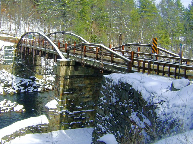
This is the only known surviving example of a half-through lenticular truss, and it also has a pony truss lenticular approach span. The bridge was closed to traffic in 1983, but in 2006 it was heavily retrofitted and rehabilitated and reopened to traffic. Load-bearing stringers were added in between truss lines. The trusses themselves are today decorative only. The loss of function and loss of all but the stubbed ends of the original built-up floorbeams represent significant losses to the historic integrity. However, the truss lines themselves retain good historic integrity and still visually convey the same general visual appearance and arrangement. Thus the project is an interesting compromise solution. Perhaps less alteration could have been achieved by restoration for pedestrian use only, but this solution allows the original experience of driving over the bridge to remain.
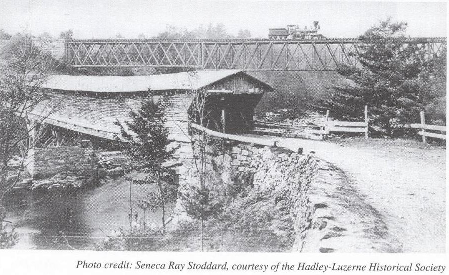
Above: The previous bridge at this location was an 1813 covered bridge.

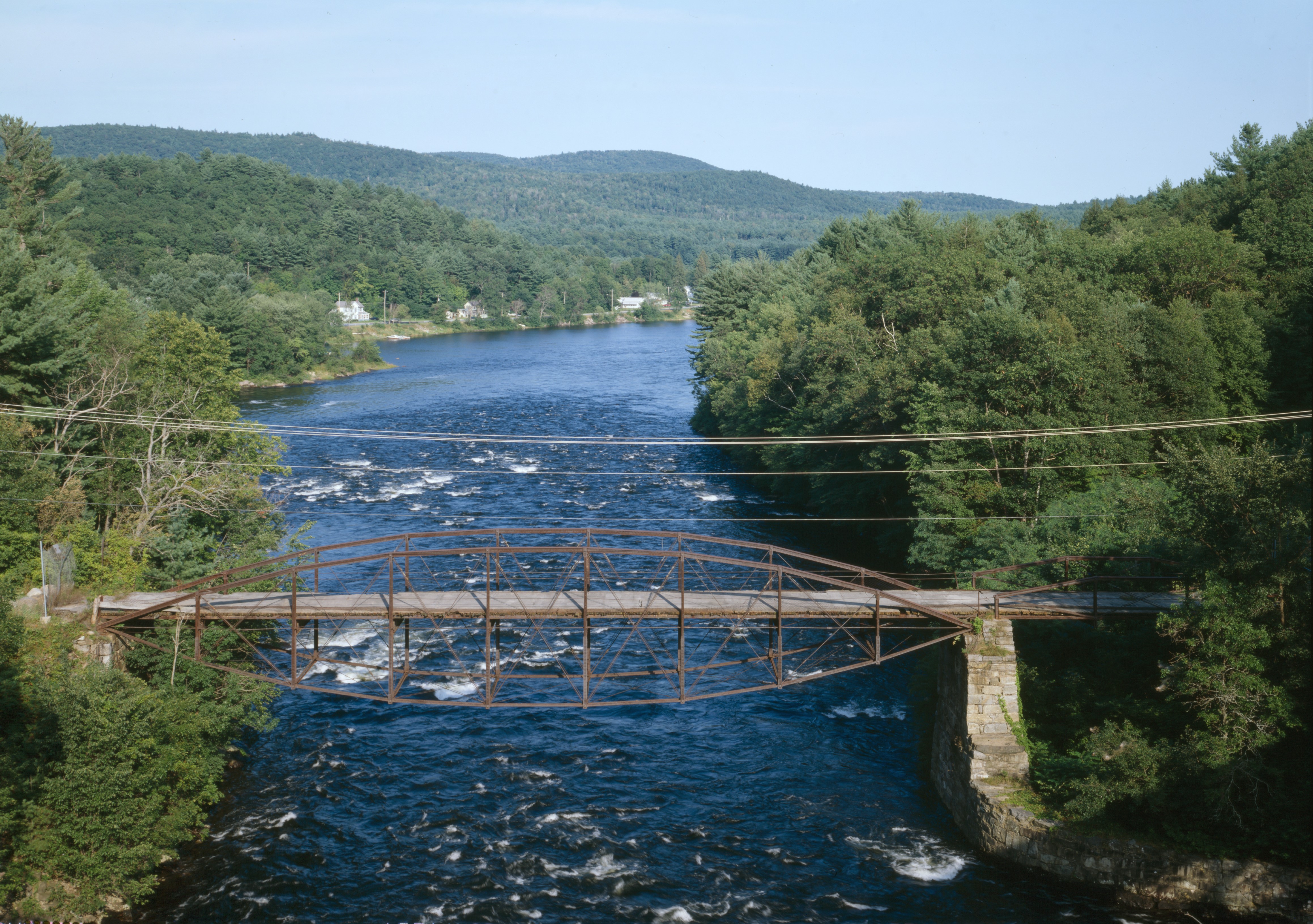
Above: These photos from the Historic American Engineering Record show the bridge prior to rehabilitation. Click/tap for enlargement.
This bridge is tagged with the following special condition(s): Trusses Converted To Decorative
![]()
![]()
![]()
Coordinates (Latitude, Longitude):
Search For Additional Bridge Listings:
Bridgehunter.com: View listed bridges within 0.5 miles (0.8 kilometers) of this bridge.
Bridgehunter.com: View listed bridges within 10 miles (16 kilometers) of this bridge.
Additional Maps:
Google Streetview (If Available)
GeoHack (Additional Links and Coordinates)
Apple Maps (Via DuckDuckGo Search)
Apple Maps (Apple devices only)
Android: Open Location In Your Map or GPS App
Flickr Gallery (Find Nearby Photos)
Wikimedia Commons (Find Nearby Photos)
Directions Via Sygic For Android
Directions Via Sygic For iOS and Android Dolphin Browser
USGS National Map (United States Only)
Historical USGS Topo Maps (United States Only)
Historic Aerials (United States Only)
CalTopo Maps (United States Only)

© Copyright 2003-2024, HistoricBridges.org. All Rights Reserved. Disclaimer: HistoricBridges.org is a volunteer group of private citizens. HistoricBridges.org is NOT a government agency, does not represent or work with any governmental agencies, nor is it in any way associated with any government agency or any non-profit organization. While we strive for accuracy in our factual content, HistoricBridges.org offers no guarantee of accuracy. Information is provided "as is" without warranty of any kind, either expressed or implied. Information could include technical inaccuracies or errors of omission. Opinions and commentary are the opinions of the respective HistoricBridges.org member who made them and do not necessarily represent the views of anyone else, including any outside photographers whose images may appear on the page in which the commentary appears. HistoricBridges.org does not bear any responsibility for any consequences resulting from the use of this or any other HistoricBridges.org information. Owners and users of bridges have the responsibility of correctly following all applicable laws, rules, and regulations, regardless of any HistoricBridges.org information.
![]()