
View Information About HSR Ratings
Although perhaps the most well-known and visible bridge in Sault Ste Marie, from a historical perspective, this is one of the younger historic bridges in the area, when compared to the International Railroad Bridge, and the Emergency Swing Span, and the Ashmun Street Bridge
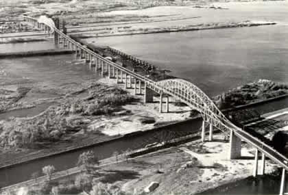
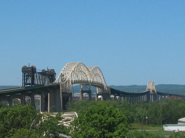
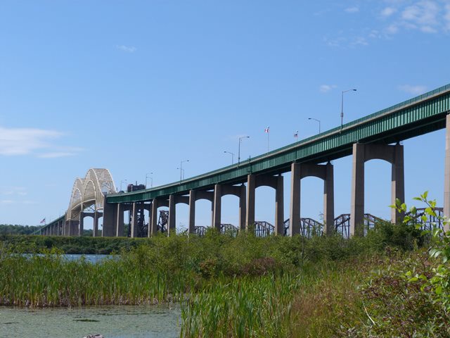
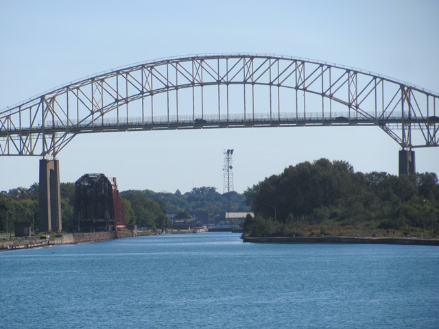
This bridge is a complex structure. The minor spans are all deck plate girder spans. There is a deck truss span over the Power Canal on the Michigan side. The continuous truss unit over the U.S. canals is a four span through truss with two arch-shaped spans featuring suspended deck, giving it an arch-like shape. This style of continuous truss unit usually only has a single arch-shaped suspended deck span, making this part of the bridge extremely rare. The span over the Ontario canal is another continuous truss unit with suspended deck, but this unit is of traditional arrangement with only a single arch-shaped suspended deck truss span. The bridge is noted for its sag in between these two through truss units, which was done because under-bridge clearance was not a concern at that part and so to reduce costs, the piers were built with a lower height there. The International Bridge lacks any v-lacing or lattice, and all connections are bolted. There are rivets on the built-up beams however. The concrete piers are tall and impressive, but feature minimal aesthetics, especially when compared to a bridge like the Blue Water Bridge.
Information and Findings From Michigan Historic Bridge InventoryNarrative Description
This is one of Michigan's five monumental bridges. The twin cities of Sault Ste. Marie in Michigan and Ontario were linked by a railroad bridge in 1887, but automobile traffic between the cities was carried by ferry until this bridge was opened in 1962. An International Bridge Authority was created by the Michigan State Legislature and passed before construction was begun. It was designed by the firm of Steinman, Boyton, Gronquist, and London of New York and cost twenty million dollars. This bridge was an ambitious project because it crossed two navigation canals and the St. Mary's River.Overall, the bridge is 2.76 miles long, including approaches, and provides a two lane roadway 28 feet wide. The Main spans had to be erected without the use of falsework so as not to obstruct traffic through the American and Canadian Locks. This was done through the balanced addition of steel structural members on the main spans. |
![]()
![]()
![]()
![]()
![]()
![]()
Coordinates (Latitude, Longitude):
Search For Additional Bridge Listings:
Additional Maps:
Google Streetview (If Available)
GeoHack (Additional Links and Coordinates)
Apple Maps (Via DuckDuckGo Search)
Apple Maps (Apple devices only)
Android: Open Location In Your Map or GPS App
Flickr Gallery (Find Nearby Photos)
Wikimedia Commons (Find Nearby Photos)
Directions Via Sygic For Android
Directions Via Sygic For iOS and Android Dolphin Browser

© Copyright 2003-2025, HistoricBridges.org. All Rights Reserved. Disclaimer: HistoricBridges.org is a volunteer group of private citizens. HistoricBridges.org is NOT a government agency, does not represent or work with any governmental agencies, nor is it in any way associated with any government agency or any non-profit organization. While we strive for accuracy in our factual content, HistoricBridges.org offers no guarantee of accuracy. Information is provided "as is" without warranty of any kind, either expressed or implied. Information could include technical inaccuracies or errors of omission. Opinions and commentary are the opinions of the respective HistoricBridges.org member who made them and do not necessarily represent the views of anyone else, including any outside photographers whose images may appear on the page in which the commentary appears. HistoricBridges.org does not bear any responsibility for any consequences resulting from the use of this or any other HistoricBridges.org information. Owners and users of bridges have the responsibility of correctly following all applicable laws, rules, and regulations, regardless of any HistoricBridges.org information.
![]()